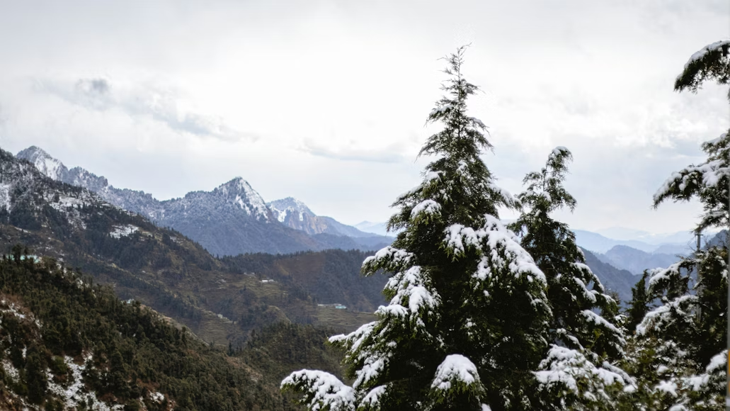
Photos of Snow in January Can Be Misleading – Here’s What They Don’t Show
Photos of snow in January often give the impression of wide, uninterrupted snow cover, but reality in India’s Himalayan hill stations is more complex. Many viral images capture brief snowfall events or high-altitude drifts, while lower towns may see intermittent snow, slush, fog, and closures that don’t show up in static photos.
In this Blog
Why Snow Photos in January Don’t Always Match Weather on the Ground
Static images can be misleading because they usually show snow at the peak of a snowfall event or from high-altitude viewpoints. Most visitors experience:
- Snow that melts quickly during daylight
- Slush rather than fresh snow by afternoon
- Road closures and traffic jams post-snowfall
- Fog or overcast skies that dampen snow views
These realities are often omitted from photos shared on social media and travel sites.
How Weather Systems Affect Snow in January Across Indian Hill Stations
India’s winter snow is driven by Western Disturbances—weather systems originating in the Mediterranean. These bring sporadic precipitation, not steady snow throughout January.
Rain or snow depends on:
- Altitude: Higher elevations see more persistent snow.
- Timing of disturbances: Snow often follows each system’s passage.
- Local temperature: Snow needs cold air + moisture.
Recent and Upcoming Snowfall Forecasts
Western Himalayan Forecast Highlights
The India Meteorological Department (IMD) and news agencies report multiple active systems affecting snow chances from late January into early February:
- Jan 22–26: Snow and rain from a Western Disturbance across Himachal and Uttarakhand, with snowfall peaking around Jan 23–25 in higher hills.
- Jan 26–28: Continued snow activity and cold conditions persisted, especially across higher elevations and passes around Manali and Uttarakhand.
- Jan 31 – Feb 2: A fresh Western Disturbance is forecast to bring additional snowfall in parts of Himachal and Uttarakhand.
Key takeaway: Rather than a long continuous snowy month, snowfall happens in bursts tied to these weather systems.
What the Forecast Means for Manali Snow in January
Manali typically sees more consistent snow above 2,500 m, such as in Solang Valley and Gulaba; lower town areas might get light snow or slush.
Predicted snowfall windows (2026):
- Jan 22–26: Notable snow events observed and forecasted
- Jan 31 – Feb 2: Another expected snow window from a Western Disturbance
Note: Fresh snow is not guaranteed every day; conditions vary with altitude and system strength.
Snow Conditions in Uttarakhand: Forecast and Reality
Uttarakhand’s higher Himalayan regions are prone to snow when Western Disturbances are active. Forecasts in late January pointed to rain and snow spells on Jan 27–28 due to a weather system affecting the region.
This means places like Nainital and higher Garhwal areas might see snow during these bursts, but lower towns may remain cold and mostly slush-free.
Mussoorie and Snow: What Recent Weather Shows
Mussoorie recorded the season’s first significant snowfall on Jan 24, with accumulations of 2–6 inches in higher areas like Lal Tibba.
Social reports from travellers also suggest potential snowfall around Jan 27–28. While this isn’t a guaranteed forecast, local patterns and models support that snow is more likely during active Western Disturbance windows.
What Snow Photos Fail to Show About January Weather
Most snow photos omit:
- Road closures and travel disruption after storms
- Melting patches and slush on frequent clear days
- Dense fog reducing visibility despite snow on peaks
- Crowds and limited access to higher snow zones
Unlike images, these factors shape the actual travel experience and conditions tourists encounter.
Snow & Weather Forecast – Late Jan to Feb 15, 2026
January 31 – February 3: Active Snow Windows
- Multiple Western Disturbances are forecast to affect the western Himalayan region including Himachal Pradesh and Uttarakhand.
- Light to moderate widespread snowfall is expected across higher elevations on Jan 31, Feb 1, and Feb 2, especially in the higher reaches of Manali, Lahaul-Spiti, Kinnaur, and Garhwal Himalaya. Dense fog and cold wave conditions will persist in nearby plains.
- These systems may produce isolated snowfall even in areas such as Solang Valley and parts of Nainital district on these dates as moisture interacts with cold temperatures.
February 5–7: Second Snow/Rain Burst
- A third Western Disturbance is likely to bring another round of scattered snow and rain across the western Himalayas.
- This means fresh snow is possible around February 5, 6, and 7 at higher elevations above ~2,000–2,500 m (e.g., upper Manali, Rohtang region, higher Uttarakhand passes).
February 8–15: Typical Mid-Winter Pattern
- After these active systems, mountain weather usually shifts to a cold, dry pattern with occasional isolated showers rather than widespread snow.
- Snowfall frequency tends to reduce, but residual snow cover remains at higher altitudes (e.g., Solang Valley rims, Auli slopes, Chopta–Tunganath areas) through mid-February.
- Lower elevations and townships (e.g., Mussoorie, lower Nainital, Kasauli) are less likely to see fresh snow during this window and may instead experience cold nights and frost.
Travel Signals
- Road closures and travel disruption remain possible during and immediately after snowfall events (e.g., Manali roads saw closures and stranded tourists recently).
- Dense fog and poor visibility will affect early morning travel across northern plains through early February.
- Cold wave conditions and sub-zero nights continue through mid-February at altitude
Road Closures & Safety Tips During Snow Season
Snowfall in the western Himalayas often leads to short-notice road closures and difficult driving conditions, especially between late January and mid-February.
Road-closure preparedness:
- Monitor district administration and local police updates, not just weather apps
- Expect temporary closures immediately after snowfall, even on main routes
- Keep buffer time in travel plans during active weather windows
- Avoid night driving on hill roads during or after snow
- Reconfirm hotel access roads before departure
Safety essentials in snowy conditions:
- Carry snow chains where advised; some stretches require them post-snowfall
- Use low gears on descents to reduce skidding risk
- Maintain extra braking distance on icy or slushy roads
- Carry power banks, offline maps, warm layers, and emergency supplies
- Prefer mid-morning to early-afternoon travel after snow clearance
FAQs
Is snow in January common in Manali?
Yes, especially at higher elevations like Solang Valley and Gulaba, but snow in Manali town is intermittent and tied to weather systems.
Will snow in Uttarakhand be consistent from 25 Jan to Feb?
No—snow occurs in bursts linked to Western Disturbances; multiple spells were reported around Jan 23–26 and forecast again around Jan 31–Feb 2.
Did Mussoorie get snow in late January?
Yes—Mussoorie recorded snowfall around Jan 24, with higher areas accumulating several inches.
Is snow in Nainital likely in late January?
Snow is possible during active disturbance spells, particularly in higher terrain; lower areas may not get consistent snow cover.
Does Kasauli get snow in January?
Snow in Kasauli remains rare; cold and frost are common, but measurable snow is uncommon compared with higher hills.
Does Manali still have snow in February?
Yes, especially in upper areas like Solang Valley and nearby high-altitude zones; snow in town areas may be patchy or melting.
Are roads usually open during snow events?
Sometimes roads close temporarily after heavy snow until clearing operations finish, especially in Himachal and Uttarakhand hill districts.
Understanding Snow Photos vs. Weather Reality
In India’s hills, snow in January should be understood as episodic and altitude-dependent. Viral photos show peak moments of snow, not the mixed conditions travellers frequently encounter between weather systems. Actual weather forecasts and local reports provide a clearer picture of when snow is most likely and when conditions revert to cold, partly cloudy, or slushy states.
Banner Image Credit: Chirag Vashist via Unsplash