
India’s First and Last Villages: Inside Mana, Chitkul and Turtuk at the Edge of the Map
India has dozens of villages that sit at the country’s physical borders, but three of them carry a particularly strong identity around that position. Mana in Uttarakhand is officially the first village of India according to the Border Roads Organisation, which placed a signboard here to mark the change. Chitkul in Himachal Pradesh holds the distinction of being the last village of India on the old Hindustan-Tibet trade route, the last point where any civilian can travel without a restricted area permit. Turtuk village in Ladakh was part of Pakistan until 1971 and only opened to tourists in 2010. Together, these three border villages of India sit at the outermost edges of the map, and each carries a story that goes well beyond its geographical position.
The first village of India is Mana, in Uttarakhand’s Chamoli district, 3 km from Badrinath at 3,200 metres, renamed from “last village” to “first village” in 2022 by the Indian government. The last village of India on the Hindustan-Tibet trade route is Chitkul in Kinnaur, Himachal Pradesh, at 3,450 metres. Turtuk village in Ladakh is a border village of India on the Line of Control, transferred from Pakistan in 1971.
In this Blog
Mana: The First Village of India at the Tibet Border
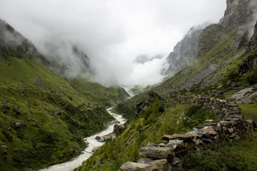
Mana sits at 3,200 metres in the Chamoli district of Uttarakhand, 3 km beyond the Badrinath temple, and is the last inhabited settlement before the Mana Pass that leads to Tibet. For most of modern history, it was called the last village of India, and the signboards at the tea stalls here still display both identities: one side reads “Bharat Ki Antim Chai Ki Dukaan” (India’s Last Tea Shop) and the other reads “Bharat Ki Pratham Chai Ki Dukaan” (India’s First Tea Shop). In 2022, the Border Roads Organisation placed an official signboard renaming it the first village of India, a deliberate reframing by the government to shift the sense of the border from an ending to a beginning.
The residents of Mana are not Garhwali in the conventional sense. They are the Marchha, an Indo-Tibetan community also known as the Bhotia, whose ancestors were traders who crossed the Mana Pass annually to barter salt and wool from Tibet for grain and cloth from the plains. That trade route was closed permanently after the 1962 Sino-Indian War, and the community turned to wool weaving, herb collection, and the pilgrim economy of Badrinath. The shawls, gloves, and socks sold from the roadside stalls in Mana are made on handlooms in village households and are among the most affordable authentic woollens in Uttarakhand.
The mythological layer of Mana is as dense as any place in the Garhwal Himalayas. According to tradition, the Pandavas passed through here on their final journey to heaven in the Mahabharata. The Vyas Gufa is a natural cave where Sage Vyas is believed to have composed the Mahabharata, and the Ganesh Gufa nearby is where Lord Ganesha is said to have written it down. Bhim Pul is a natural rock bridge over the Saraswati River, credited by tradition to Bhima, who placed the stone so Draupadi could cross. The Saraswati River, one of Hinduism’s most sacred rivers, is visible here at its point of origin before it disappears underground and is said to re-emerge at Prayagraj hundreds of kilometres away. This is the only place in India where the Saraswati can be seen above the ground.
Places to visit in Mana within a single walking loop of about 1 km include Vyas Gufa, Ganesh Gufa, Bhim Pul, and the Saraswati Udgam, the source point of the river. The Vasudhara Falls, a 145-metre waterfall attributed to the Pandavas’ departure for heaven, requires a 5-km trek from the village and is best attempted in June and September when the trail is clear.
The best time to visit Mana is May to June and September to October, when the Badrinath temple is open and the road is accessible. The village closes entirely in winter. How to reach Mana: the nearest railhead is Haridwar or Rishikesh, with onward road travel to Badrinath, roughly 300 km and seven to eight hours from Rishikesh. From Badrinath, Mana is 3 km by road or a pleasant walk. As of 2026, Char Dham Yatra biometric registration is mandatory for all visitors to Badrinath, and Mana is accessed through this registration, which is free and available online through the Tourist Care Uttarakhand portal.
Chitkul: The Last Village of India on the Hindustan-Tibet Road
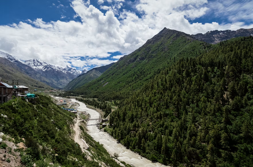
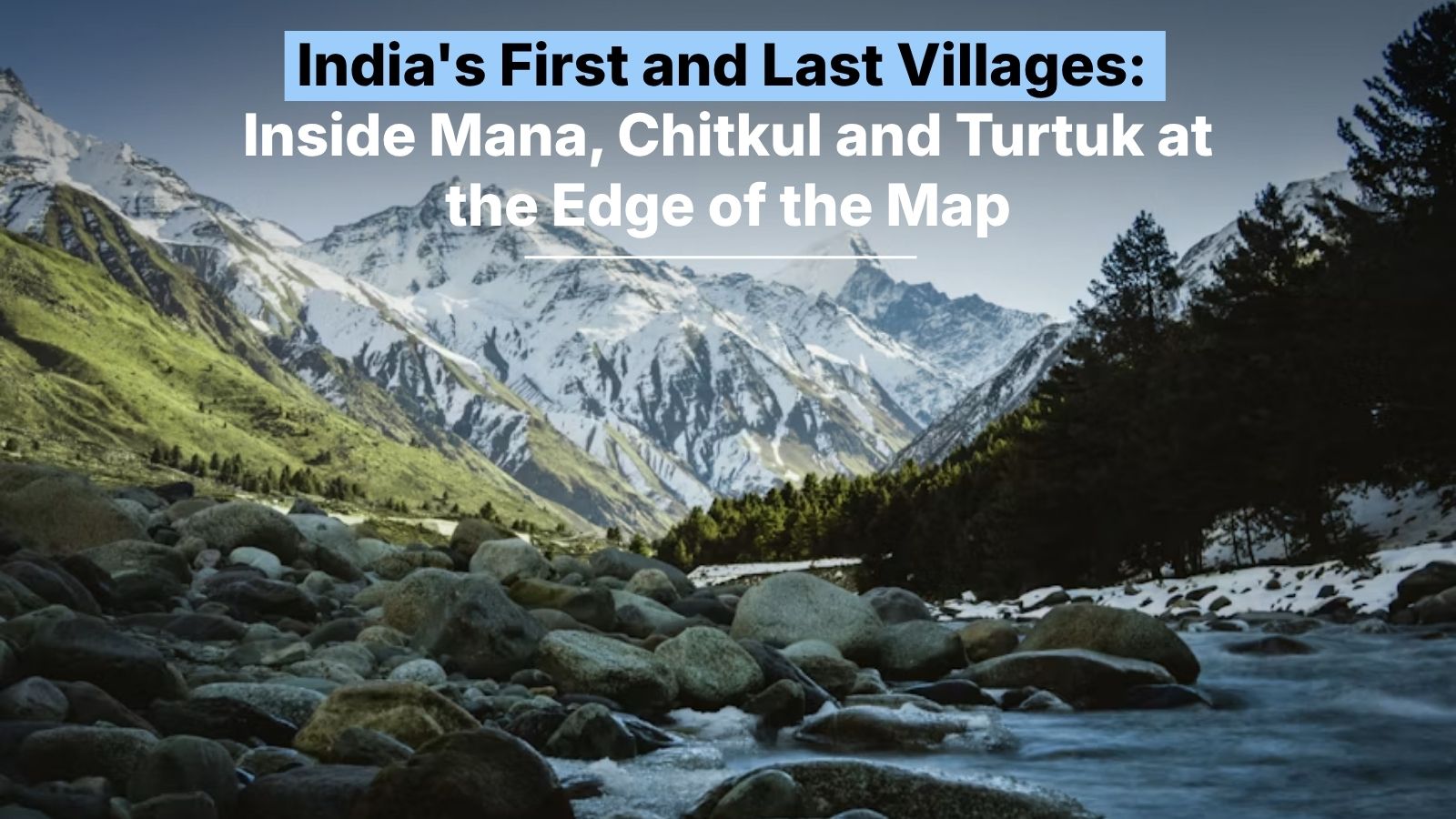
Chitkul sits at 3,450 metres on the right bank of the Baspa River in the Kinnaur district of Himachal Pradesh and is the last village of India on the old Hindustan-Tibet trade route. Beyond it, beyond the ITBP checkpost about 4 km away, there are no permanent settlements, no motorable roads, and no civilian access. The Tibet border is roughly 90 km further north. Chitkul is also, as confirmed by a study from the Centre of Atmospheric Sciences at IIT Delhi, the place with the cleanest air in India, a consequence of having no industry, minimal traffic, and a community of under 900 people whose primary activities are farming and grazing.
The Himalayan village character of Chitkul is visible in every part of its built environment. The houses use Kath Kuni construction, a wood-and-stone technique specific to the Kinnaur region, with slate roofs, carved wooden balconies, and facades that face the Baspa River. Hinduism and Buddhism both have a visible presence here, which reflects the Kinnaur district’s history as a zone where the two traditions have coexisted and overlapped for centuries. The Mathi Devi Temple, believed to be around 500 years old, holds a wooden palanquin with a yak-tail tuft that is central to the village’s ritual calendar. The Kagyupa Buddhist temple holds a rare image of Shakyamuni Buddha. In Chitkul, it is common for families to pay respects at both the Hindu temple and the Buddhist gompa on the same morning.
The Baspa Valley, also called the Sangla Valley, was described by the English explorer Captain Alexander Gerard in the 19th century as the most spectacular of the Himalayan valleys. The Baspa River originates from high-altitude glaciers and flows clear enough that the riverbed is visible from the bank. Chitkul is also the endpoint of the multi-day Kinnaur Kailash Parikrama trek, which circles the Kinner Kailash massif from Thangi village via the Charang La pass at 5,242 metres, and it is the last point where trekkers on that route can arrange onward transport.
The Kinnauri people of Chitkul speak a Tibeto-Burman dialect called Chitkuli Kinnauri, wear distinctive green pahadi caps, and were historically referred to in ancient texts as Kinnaras, beings described as halfway between humans and gods. The belief that Kinnaur is the land between heaven and earth is still referenced in the way the valley’s residents speak about their home.
Places to visit in Chitkul include the Mathi Devi Temple, the Kagyupa Buddhist temple, the Baspa riverbank walk, and the viewpoint above the village that gives a clear sightline to the Kinner Kailash range. The “Last Dhaba of India,” a small eatery near the road’s end, serves rajma chawal that regulars describe as worth the journey on its own.
The best time to visit Chitkul is April to June and September to October. Heavy snowfall closes the village for much of November to March, and the permanent residents move to lower altitudes for winter. How to reach Chitkul: from Shimla, drive to Karcham on NH5 (about 220 km), then turn onto the Baspa Valley road through Sangla and Rakcham to Chitkul, a further 40 km. No permit is required to visit Chitkul itself; it is the last point in India accessible to civilians without a restricted area permit.
Turtuk Village: The Border Village India Gained in 1971
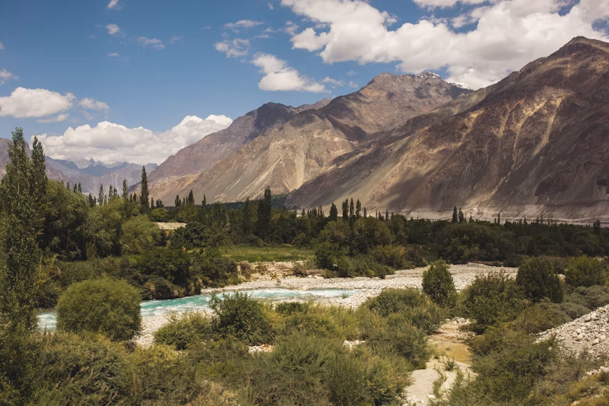
Turtuk village in Ladakh’s Nubra Valley is unlike either Mana or Chitkul in one important respect: it was not always India. Until the Bangladesh Liberation War of 1971, Turtuk was part of the Pakistani administrative territory of Baltistan. When Indian forces secured the Nubra Valley in that conflict, Turtuk and the surrounding settlements came under Indian administration. It remained off-limits to tourists until 2010, and the community here had lived in near-complete isolation from the Indian mainstream for nearly four decades.
The Balti culture of Turtuk is distinct from the Ladakhi culture of most of the surrounding region. The language spoken here is Balti, a Tibetan-derived language written in the Nastaliq script and more closely related to classical Tibetan than the Ladakhi spoken in Leh. The food, the wooden mosque in the lower village, the polo grounds on the valley flats, and the architectural style of the homes are all Balti in origin and have no direct equivalent elsewhere in India. The Yabgo dynasty, the former royal family of Turtuk, once governed this stretch of the Shyok River valley. Their archive, including historical documents and ceremonial objects, is now maintained in a small museum inside the old fort, which makes Turtuk village one of the only places in India where the tangible record of a pre-1947 border kingdom is still accessible to visitors.
The apricot orchards that line the village paths produce the harvest in July that covers the flat stone rooftops in drying fruit, turning them orange against the grey rock walls of the valley. The Shyok River runs below the village, cold and fast-moving from its glacial source. The surrounding mountains on both sides of the Line of Control are bare rock, which makes the green of the village orchards and gardens particularly striking by contrast. At the far edge of Turtuk, a short walk from the main settlement, is the point where the road ends and the restricted zone begins. Beyond that point, the Line of Control marks the boundary with Pakistan-administered Kashmir.
Places to visit in Turtuk include the Yabgo dynasty museum in the old fort, the wooden Balti mosque in the lower village, the apricot orchards along the main path, and the Shyok River viewpoint at the edge of the settlement. The upper village, called Youl, is a short walk above the main bazaar and has older homes and quieter lanes than the busier lower settlement.
The best time to visit Turtuk village is June to September, the only window when the Nubra Valley road from Leh is reliably passable. The road from Leh crosses the Khardung La pass at 5,359 metres before descending into the Nubra Valley, after which Turtuk is a further 90 km from Diskit. How to reach Turtuk: Leh to Turtuk is approximately 205 km by road, a journey of six to seven hours. A Protected Area Permit is required for Turtuk and can be obtained from the Deputy Commissioner’s office in Leh or through a registered travel agent; it is issued free of charge to Indian nationals and for a fee to foreign nationals.
Three Villages, Three Border Stories
What connects Mana, Chitkul, and Turtuk is not just their position at the edge of the country. Each of them is a border village of India that has had its identity shaped by the specific border it sits against. Mana’s Marchha community lost their Tibet trade route in 1962 and rebuilt their economy around the Badrinath pilgrimage circuit. Chitkul’s Kinnauri residents maintained their distinct language, religion, and architecture through centuries of being at the edge of multiple kingdoms and modern states.
Turtuk village absorbed a complete administrative change in 1971 and has held its Balti cultural identity intact through decades of restricted access. Visiting any one of these three places requires genuine planning and, in some cases, permits, but the communities at each of them have been shaped by forces so specific to their locations that no other place in India can quite replicate what they have to show.
Where to Stay
FAQs
The last village of India on the Hindustan-Tibet trade route is Chitkul, in the Kinnaur district of Himachal Pradesh, at an altitude of 3,450 metres. It sits on the banks of the Baspa River and is the final point any civilian can reach in that direction without a restricted area permit. The ITBP checkpost about 4 km beyond Chitkul marks the boundary of civilian access.
The first village of India is Mana, in the Chamoli district of Uttarakhand, 3 km from the Badrinath temple at an altitude of 3,200 metres. It was previously known as the last village of India and was officially redesignated the first village by the Border Roads Organisation in 2022, with a signboard placed to mark the change. It sits 26 km from the India-Tibet border.
Yes, all three are open to tourists. Mana is freely accessible to anyone visiting Badrinath, subject to the Char Dham Yatra biometric registration required as of 2026. Chitkul requires no permit and is the last point in India accessible without one in that region. Turtuk village requires a Protected Area Permit, which is free for Indian nationals and issued by the Deputy Commissioner’s office in Leh.
It depends on the village. Mana requires only the standard Char Dham biometric registration, which is free. Chitkul requires no permit at all. Turtuk village requires a Protected Area Permit because it falls within Ladakh’s restricted border zone. For Turtuk village, Indian nationals can obtain the permit for free from the Leh DC office; foreign nationals pay a fee and must travel in a group of at least two with a registered local agent.
The best time to visit Mana is May to June and September to October, aligned with the Badrinath temple’s open season. The best time to visit Chitkul is April to June and September to October, when the Baspa Valley road is clear. The best time to visit Turtuk village is June to September, when the Nubra Valley road from Leh is reliably open.
Turtuk village is the most logistically demanding because it requires crossing the Khardung La at 5,359 metres and then driving a further 90 km into the Nubra Valley, totalling about six to seven hours from Leh. Chitkul’s road from Sangla is narrow and steep but manageable. Mana is the easiest to reach, being just 3 km from Badrinath on an accessible road.
The Himalayan village of Chitkul is known for its Kath Kuni wood-and-stone architecture, the 500-year-old Mathi Devi Temple, the Kagyupa Buddhist temple with a rare Shakyamuni image, and a community that practices both Hinduism and Buddhism in daily life. It is also the endpoint of the Kinnaur Kailash Parikrama trek and, according to an IIT Delhi Centre of Atmospheric Sciences study, has the cleanest air in India.
Turtuk village is fully part of India. It came under Indian administration during the 1971 Bangladesh Liberation War when Indian forces secured the Nubra Valley. Before 1971, Turtuk was governed as part of Pakistani Baltistan. It was opened to Indian tourists for the first time in 2010, nearly four decades after the transfer of administration.