
Kannur to Wayanad Distance: 115 km, ~3 Hours & the Complete Airport-Transfer Guide

TL;DR: The Kannur to Wayanad distance is roughly 108–115 km by road, and most travellers complete the drive in about 3 hours. Kannur International Airport (CNN) is the most convenient entry point for northern Wayanad — Mananthavady, Thirunelli and Kuruva Island — with prepaid taxis from about ₹2,700, self-drive rentals and regular KSRTC buses. For Kalpetta, Vythiri and Sulthan Bathery, Kozhikode Airport remains marginally closer.
In this Blog
Quick Info: Kannur to Wayanad at a Glance
| Field | Details |
|---|---|
| Kannur to Wayanad distance | ~108–115 km (Kannur town to Kalpetta); ~85 km to Mananthavady |
| Travel time | About 3 hours (add 30–45 minutes in monsoon) |
| Nearest airport for north Wayanad | Kannur International Airport (CNN), Mattannur — ~65–70 km from Mananthavady |
| Nearest airport for central/south Wayanad | Kozhikode International Airport (CCJ) — ~95–100 km from Kalpetta |
| Nearest railway station | Kannur (CAN) and Kozhikode (CLT) — Wayanad has no railway line |
| Best time to travel | October–February (clear roads); June–September for monsoon greenery |
| Ideal trip duration | 2–3 days in Wayanad |
The Kannur to Wayanad distance question doesn’t have one single answer — and that’s exactly where most guides get it wrong. Wayanad is a district, not a town, so your real distance depends on whether you’re headed to Mananthavady in the north, Kalpetta in the centre, or Sulthan Bathery in the east. This guide breaks down every route, transfer option and fare, plus the stops worth slowing down for.
What Is the Kannur to Wayanad Distance by Road?
The Kannur to Wayanad distance is approximately 108–115 km if you measure from Kannur town to Kalpetta, the district headquarters. Mananthavady is closer at roughly 85 km, while Sulthan Bathery sits farthest at around 135–140 km. Most drives take about 3 hours.
Here’s the town-by-town breakdown travellers actually need:
| From → To | Distance (approx.) | Drive time |
|---|---|---|
| Kannur town → Mananthavady | ~85 km | 2.5 hrs |
| Kannur town → Kalpetta | ~113–115 km | 3 hrs |
| Kannur town → Sulthan Bathery | ~135–140 km | 3.5–4 hrs |
| Kannur Airport (Mattannur) → Mananthavady | ~65–70 km | ~2 hrs |
| Kannur Airport (Mattannur) → Kalpetta | ~100–108 km | ~3 hrs |
| Kozhikode Airport (Karipur) → Kalpetta | ~95–100 km | 2.5–3 hrs |
(Distances rounded from Google Maps; verify against your exact pickup point before booking. Aerial distance is only ~86 km, which is why some websites quote confusingly low figures.)
Why do published figures range from 108 km to 150 km? Because different sites measure to different corners of the district. Once you know your destination town, the numbers above are the ones that matter.
During the monsoon (June–September), add 30–45 minutes for reduced visibility on the ghat sections. Compared with the famous Thamarassery Churam on the Kozhikode side — with its 9 hairpin bends — the Kannur-side climbs are gentler and friendlier for travellers prone to motion sickness.
Which Is the Nearest Airport to Wayanad: Kannur or Kozhikode?
Kozhikode International Airport (CCJ) is the closest airport for central and southern Wayanad (Kalpetta, Vythiri, Meppadi, Sulthan Bathery), while Kannur International Airport (CNN) is the smarter choice for northern Wayanad (Mananthavady, Thirunelli, Padinjarathara). Wayanad itself has no airport — or railway station — of its own.
| Factor | Kannur Airport (CNN) | Kozhikode Airport (CCJ) |
|---|---|---|
| Location | Mattannur, Kannur district | Karipur, Malappuram district |
| Opened | December 2018 (Kerala’s fourth international airport) | 1988 |
| Best for | Mananthavady, Thirunelli, Kuruva Island, Banasura/Padinjarathara | Kalpetta, Vythiri, Lakkidi, Meppadi, Sulthan Bathery |
| Distance to its side of Wayanad | ~65–70 km to Mananthavady | ~95–100 km to Kalpetta |
| Ghat road | Palchuram or Periya ghats — gentler gradients | Thamarassery Churam — 9 hairpin bends |
| Crowds | Newer, noticeably less crowded | Busier, heavy Gulf-sector traffic |
Here’s the practical rule we share with guests: if your stay is north of Kalpetta, fly into Kannur; if it’s Kalpetta or south, fly into Kozhikode. If fares differ sharply on your dates, Kannur’s quicker kerb-to-car exit often cancels out the extra few kilometres.
For flight schedules, check the official Kannur International Airport website.
Kannur to Wayanad Route Options: Two Ghat Roads, Not One
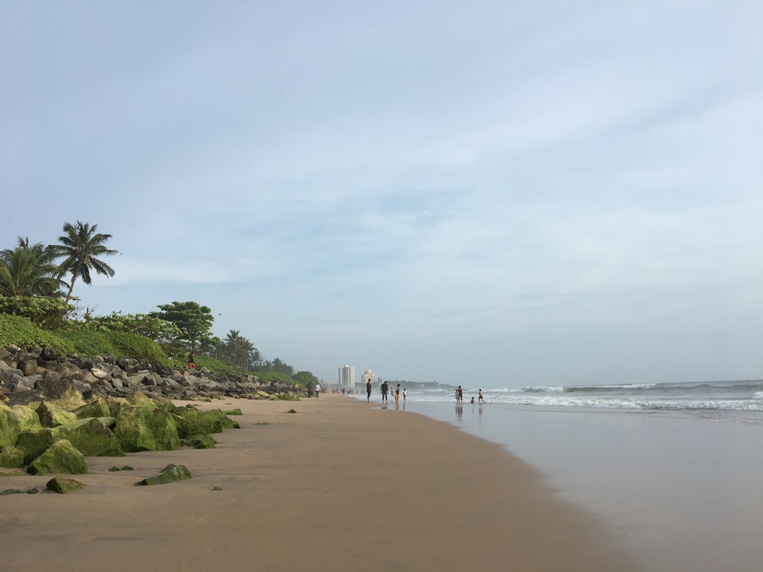
There are two distinct ghat routes from Kannur to Mananthavady — the Nedumpoil–Periya road via Kuthuparamba, and the Palchuram–Boys Town road via Iritty and Kottiyoor. Many blogs mash these into a single route; they are separate roads on opposite sides of the Kottiyoor forests, and your stops depend entirely on which one you take.
Route 1: Kannur → Kuthuparamba → Nedumpoil → Periya → Mananthavady
The workhorse route, used by most KSRTC buses and taxis from Kannur town. It climbs the Nedumpoil–Periya ghat through Kannavam forest stretches, with wide curves and a steady gradient. Best if you’re starting from Kannur town, Thalassery or the beaches.
Route 2: Kannur Airport → Iritty → Kottiyoor → Palchuram → Boys Town → Mananthavady
The scenic route — and usually the quicker one from the airport, since Mattannur sits on the Iritty side. The Kottiyoor–Palchuram–Boys Town ghat passes waterfalls and mist-prone viewpoints. As of July 2026, this road is fully motorable, though it narrows on the upper stretch; confirm conditions locally during peak monsoon. [VERIFY: current Palchuram ghat road condition]
| Route 1 (Nedumpoil) | Route 2 (Palchuram) | |
|---|---|---|
| Best starting point | Kannur town / Thalassery | Kannur Airport / Iritty |
| Character | Wider, steadier, more traffic | Narrower, quieter, more scenic |
| Key stops | Kuthuparamba, Nedumpoil | Kottiyoor temples, Palchuram waterfalls, Boys Town |
| Bus availability | Frequent KSRTC services | KSRTC services via Iritty at regular intervals |
Both routes converge at Mananthavady, the gateway town of northern Wayanad. Driving to Kalpetta or Sulthan Bathery? Continue on NH766/SH roads from Mananthavady, or ask your driver about the Thamarassery alignment if you started closer to Kozhikode.
How to Reach Wayanad from Kannur Airport
You can reach Wayanad from Kannur International Airport by prepaid taxi (₹2,700–₹5,500, ~2–3 hours), self-drive rental car, or KSRTC bus via Kannur town or Iritty. Taxis are the fastest door-to-door option; buses are the cheapest.
Prepaid Taxi — Easiest Door-to-Door
Authorised taxi counters operate right outside the arrivals hall.
- Time required: ~2 hours to Mananthavady; ~3 hours to Kalpetta
- Ideal for: Families with elders or children, travellers with luggage
- Pro tip: Book a round trip if you’re staying 2–3 days — outstation round-trip rates per km are usually kinder than two one-way bookings, and Wayanad’s attractions are spread out enough that you’ll want the car.
Self-Drive Car — Best for Multi-Day Exploring
Rental desks at the airport hand over cars within the hour. Roads are well surfaced, gradients are moderate, and navigation is straightforward — genuinely manageable even if this is your first Kerala drive.
- Ideal for: Couples and small groups planning to move around the district
- Pro tip: Fuel up at Iritty or Mattannur before the ghat section; pumps thin out until Mananthavady.
KSRTC Bus — Cheapest Option
Budget travellers can take a bus or taxi from the airport to Kannur town or Iritty, then board KSRTC services towards Mananthavady, Kalpetta or Sulthan Bathery. Buses run at regular intervals through the day on both ghat routes, and the Kannur–Mananthavady fare stays under ₹200. [VERIFY: current KSRTC fare]
- Time required: 4–5 hours total including the change
- Ideal for: Solo travellers, backpackers
- Pro tip: Check live timings on KSRTC’s schedule search or kbuses.in before you land; evening services onto the ghat roads taper off after 8 pm.
Arriving by Train Instead?
Kannur Railway Station (CAN) is a major stop on the Konkan–Malabar line with direct trains from Mumbai, Bengaluru, Kochi and Thiruvananthapuram. From the station, the same two road routes apply. Since Wayanad has no rail line, Kannur and Kozhikode stations are its practical railheads.
Best Stops on the Kannur to Wayanad Drive
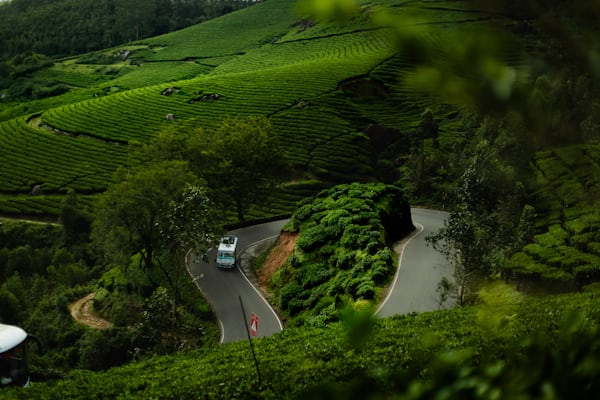
The right stops depend on your route — here’s what’s actually on each road, with the details you need.
Kuthuparamba (Route 1)
A busy junction town 25 km from Kannur, and the traditional breakfast halt before the hills.
| Detail | Info |
|---|---|
| Best time | Morning, before the ghat climb |
| How to reach | 25 km from Kannur town on the Mananthavady road |
| Time required | 30–45 minutes |
| Ideal for | Food stops, quick market browsing |
| Pro tip | Order a Malabar breakfast — puttu with kadala curry — and pick up banana chips for the drive. |
Nedumpoil (Route 1)
A quiet green village where the climb properly begins, with roadside tea stalls brewing spice-laced chai.
| Detail | Info |
|---|---|
| Best time | Early morning for mist |
| How to reach | ~55 km from Kannur, between Kuthuparamba and the Periya ghat |
| Time required | 20–30 minutes |
| Ideal for | Tea break, photography, leg-stretch walks |
| Pro tip | The stretch just after Nedumpoil runs through Kannavam forest — drive slow at dawn and dusk; deer crossings are common. |
Palchuram Waterfalls & Viewpoint (Route 2)
The highlight of the Iritty–Boys Town road: seasonal falls beside the tarmac and valley views that open up after light rain. Most tourists racing to Wayanad miss it entirely.
| Detail | Info |
|---|---|
| Best time | June–November, when the falls are alive |
| How to reach | On the Kottiyoor–Boys Town ghat, ~45 km from Kannur Airport |
| Time required | 20–30 minutes |
| Ideal for | Photography, birdwatching, waterfall stops |
| Pro tip | Park only in the marked lay-bys — the road narrows here, and mist can drop visibility within minutes. |
Mananthavady — Your Arrival Town (Both Routes)
Both ghat roads land you in Mananthavady, northern Wayanad’s hub and the base for Thirunelli, Kuruva Island and the Tholpetty forest range.
| Detail | Info |
|---|---|
| Best time | Year-round |
| How to reach | ~85 km from Kannur town; ~65–70 km from Kannur Airport |
| Time required | Half a day, or use it as your base |
| Ideal for | Families, pilgrims, first-time Wayanad visitors |
| Pro tip | Stock up on spices here rather than at tourist-priced stalls near the attractions — the Sunday market is the locals’ pick. |
Places to Visit in Wayanad After the Drive
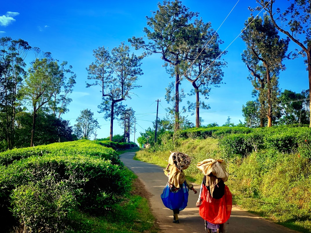
The transfer is short enough that most guests start sightseeing the same afternoon. These five anchor any northern-Wayanad itinerary.
Edakkal Caves
Edakkal’s rock shelters on Ambukuthi Hill hold Neolithic petroglyphs estimated at 6,000+ years old — among the finest prehistoric carvings in South India, first documented by Fred Fawcett in the 1890s.
| Detail | Info |
|---|---|
| Entry fee | ~₹50 adults, ~₹30 children [VERIFY: current fee] |
| Timings | ~9 am–4 pm ticket counter; closed Mondays [VERIFY: current timings] |
| Best time | October–February; go before 10 am to beat queues |
| How to reach | Near Ambalavayal, ~12 km from Sulthan Bathery, ~25 km from Kalpetta |
| Time required | 2–3 hours including the 45-minute uphill walk |
| Ideal for | History lovers, active families (moderate fitness needed) |
| Pro tip | Wear proper shoes — the final stretch is a steep rock scramble with railings. Carry water; there’s little shade. |
Pookode Lake
A freshwater lake ringed by evergreen forest at about 770 m altitude near Vythiri — Wayanad’s easiest, most family-friendly outing.
| Detail | Info |
|---|---|
| Best time | Mornings; monsoon months for the greenest frames |
| How to reach | ~2 km off NH766 near Lakkidi, 15 km from Kalpetta |
| Time required | 1.5–2 hours |
| Ideal for | Families, couples |
| Pro tip | Pair it with the Lakkidi viewpoint 3 km away — the mist rolls through Lakkidi by late afternoon. |
Read more: Pookode Lake, Wayanad 2026: ₹40 Entry, Boat Charges from ₹300 & Timings
Banasura Sagar Dam
Banasura Sagar near Padinjarathara is the largest earthen dam in India, its reservoir dotted with islands that surface and vanish with the seasons.
| Detail | Info |
|---|---|
| Best time | Just after monsoon (September–December) when the reservoir is full |
| How to reach | ~21 km from Kalpetta, ~25 km from Mananthavady via Padinjarathara |
| Ideal for | All ages; boating enthusiasts |
| Time required | 2–3 hours |
| Pro tip | The 15-minute walk up the dam bund rewards you with the best panorama — most visitors stop at the boating point and miss it. |
Thirunelli Temple
An ancient Maha Vishnu temple in the Brahmagiri foothills, ringed by forest — and meaningfully easier to reach from the Kannur side than from Kozhikode.
| Detail | Info |
|---|---|
| Best time | Early morning for rituals at the Papanasini stream |
| How to reach | ~30 km north of Mananthavady through Tholpetty forest roads |
| Time required | Half a day with the drive |
| Ideal for | Pilgrims, heritage and forest lovers |
| Pro tip | The forest road from Mananthavady closes to traffic after dusk — plan to return by 6 pm. Dress code applies inside the temple. |
Kuruva Island (Kuruvadweep)
A 950-acre cluster of uninhabited river islands on the Kabani, explored on bamboo rafts and forest trails.
| Detail | Info |
|---|---|
| Best time | October–May |
| How to reach | ~17 km east of Mananthavady |
| Time required | 2–3 hours |
| Ideal for | Nature walks, families, birdwatchers |
| Pro tip | Entry counts are capped daily by the forest department — reach before 11 am in December–January. |
[IMAGE SLOT 2 — alt: “Banasura Sagar Dam reservoir with islands, Wayanad, Kerala”]
Best Time to Travel from Kannur to Wayanad
October to February is the best window for the Kannur to Wayanad journey — dry ghat roads, 15–25°C weather in the hills, and every attraction open. June to September trades convenience for drama: waterfalls at full throttle, but slower ghat driving.
| Season | Months | What to expect |
|---|---|---|
| Post-monsoon & winter | Oct–Feb | Peak season; clear roads, cool evenings, Kuruva open |
| Summer | Mar–May | Warm on the coast, pleasantly cooler in Wayanad; light crowds |
| Monsoon | Jun–Sep | Lush and misty; add 30–45 min drive time; Kuruva closed |
Travelling in monsoon anyway? You’re in for the best version of Palchuram’s waterfalls — just start the ghat climb before 4 pm, when mist thickens fast.
Road Conditions and Driving Tips (as of July 2026)
The Kannur–Wayanad roads are well maintained, with gentler gradients than the Thamarassery Churam’s 9 hairpins on the Kozhikode side — which is exactly why many repeat visitors now prefer entering Wayanad from Kannur.
Our practical checklist:
- Start early; ghat traffic and afternoon mist both build after 3 pm.
- Fuel up at Mattannur, Iritty or Kuthuparamba — pumps are sparse on the climbs.
- Use lower gears downhill instead of riding the brakes.
- Watch for wildlife on the Kannavam and Tholpetty forest stretches, especially at dawn and dusk.
- In heavy rain, pull into a lay-by and wait out the worst 10 minutes rather than crawling blind.
- Mobile network drops on parts of both ghats; download offline maps before leaving the airport.
Suggested Itineraries After Your Kannur to Wayanad Transfer
Same-day arrival plan (half day): Land at Kannur Airport → Route 2 with a Palchuram stop → check in at Mananthavady by 1 pm → Kuruva Island (Oct–May) or Banasura Sagar in the afternoon.
Weekend (2 days): Day 1 — arrival drive, Pookode Lake and Lakkidi viewpoint en route to your stay near Kalpetta. Day 2 — Edakkal Caves early, Banasura Sagar after lunch, sunset at the dam bund.
Extended (3+ days): Add Thirunelli Temple and the Tholpetty wildlife safari on day 3, plus a slow plantation morning — this is where staying in one comfortable base pays off.
Where to Stay in Wayanad?
Wayanad rewards travellers who stay put in one well-located home rather than hopping hotels — the attractions radiate 20–30 minutes in every direction. StayVista’s private villas and homestays across the district come with staff, home-cooked Kerala meals and space for multi-generation groups. Five picks, with nightly rates as of July 2026:
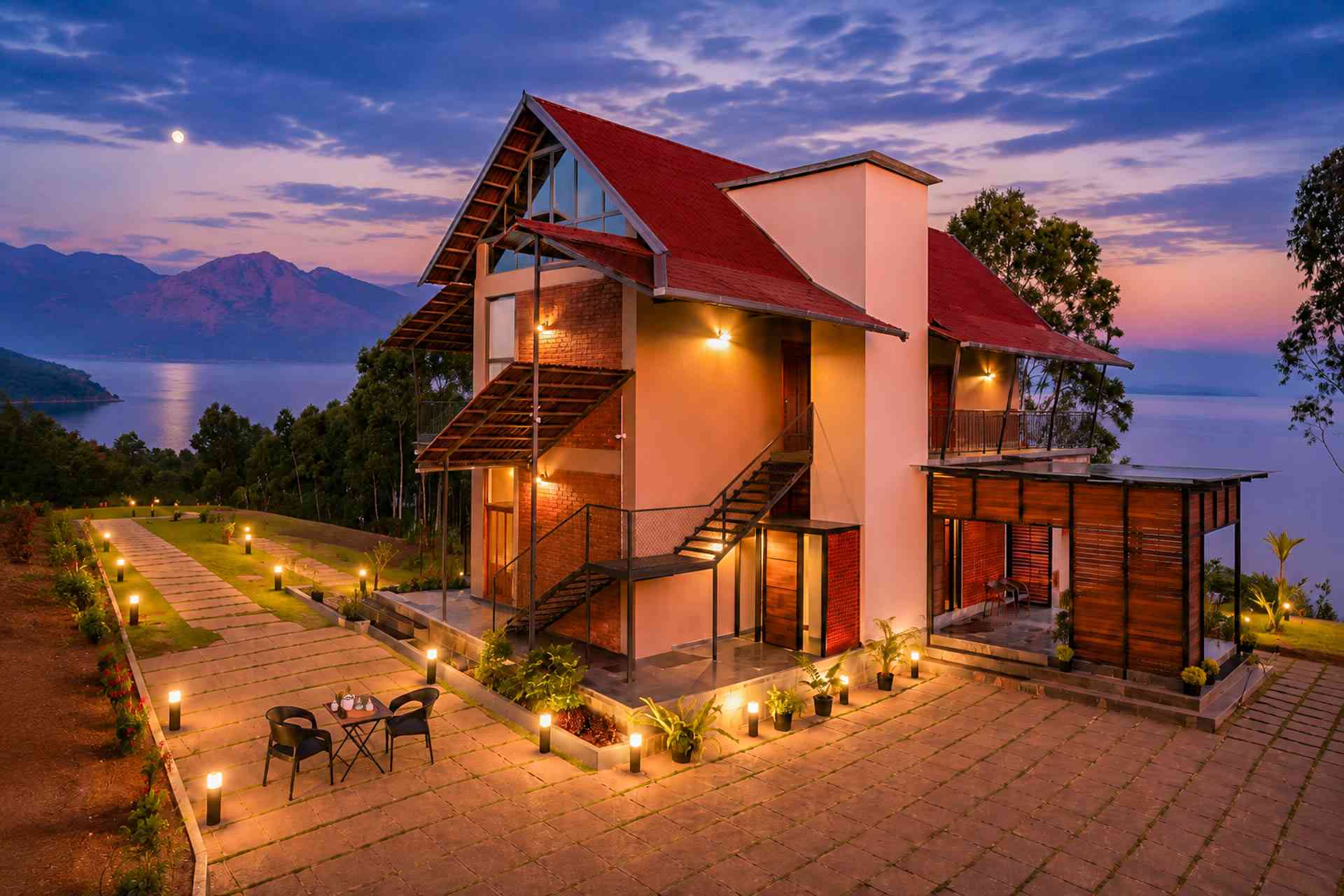
Novera Villa, Wayanad
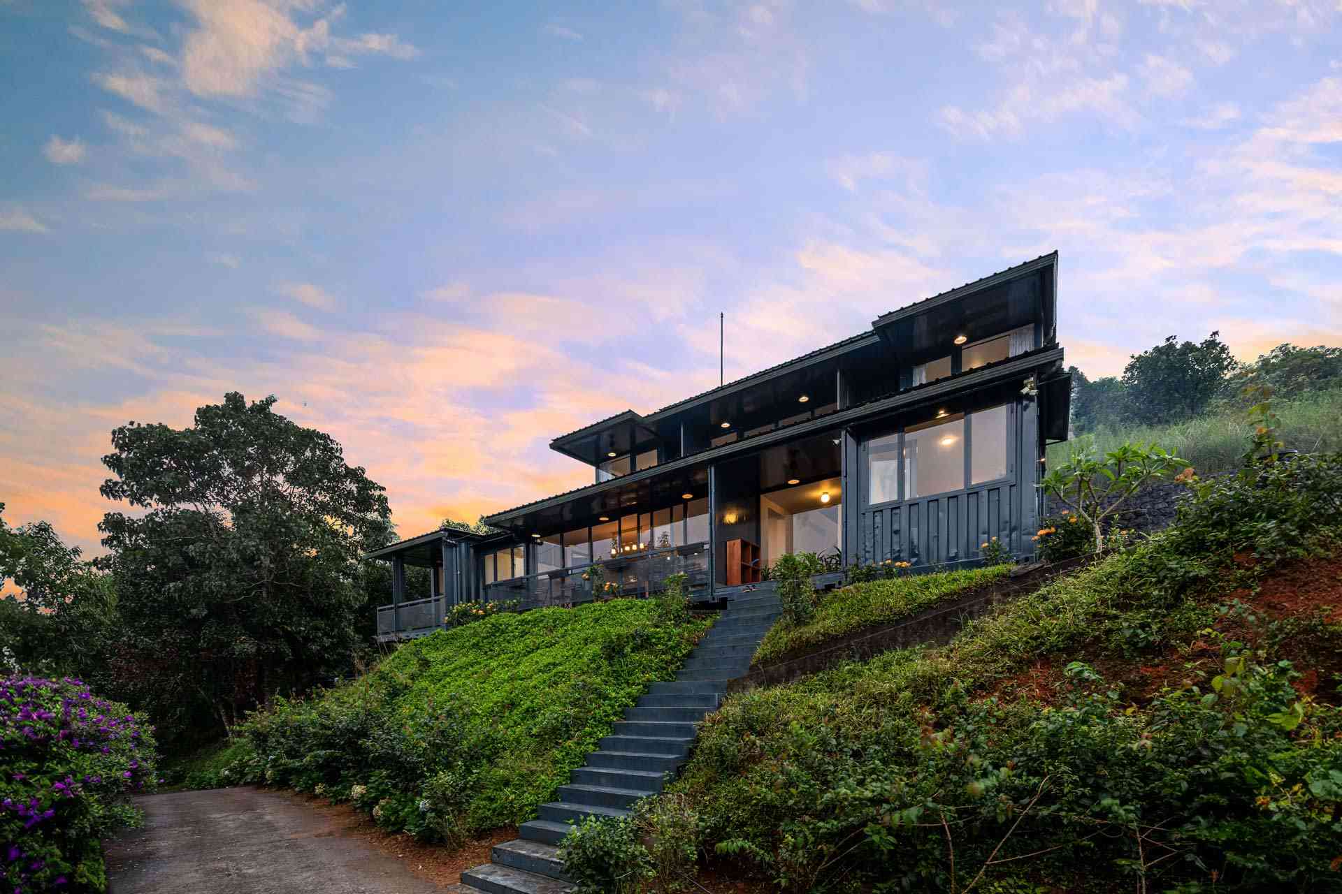
Veda @ Griha Sankalapa Villa
FAQs: Kannur to Wayanad Distance & Transfers
Kozhikode International Airport (CCJ) is closest for central and southern Wayanad, including Kalpetta, Vythiri and Sulthan Bathery. Kannur International Airport (CNN) is more convenient for northern Wayanad — Mananthavady, Thirunelli and Padinjarathara — about 80 km from Mananthavady.
The Kannur to Wayanad distance is about 113–115 km from Kannur town to Kalpetta, 80–82 km to Mananthavady, and 135–140 km to Sulthan Bathery. From Kannur International Airport at Mattannur, Mananthavady is about 80 km.
About 2–2.5 hours to Mananthavady and around 3 hours to Kalpetta, depending on traffic and weather. Add 30–45 minutes during the June–September monsoon for mist and slower ghat driving.
As of July 2026, one-way taxi fares run roughly ₹2,700–₹3,800 for a sedan and up to ₹5,500 for an SUV. Ebix-run prepaid counters operate at the arrivals exit, and round-trip outstation rates work out cheaper for 2–3 day stays.
Yes. KSRTC runs regular services from Kannur to Mananthavady via the Nedumpoil–Periya ghat, and via Iritty–Palchuram on the second route, with connections onward to Kalpetta and Sulthan Bathery. The Kannur–Mananthavady fare is about ₹140, and the run takes roughly 2.5 hours.
No. Wayanad has neither an airport nor a railway line. The nearest airports are Kozhikode (CCJ) and Kannur (CNN), and the nearest major railway stations are Kozhikode and Kannur, both on well-connected trunk lines.
Take the Nedumpoil–Periya route from Kannur town for a wider, steadier road with more bus options. Take the Iritty–Palchuram–Boys Town route from Kannur Airport for shorter distance to Mananthavady and better scenery, accepting a narrower upper stretch.
Yes, with sensible precautions. Both ghat roads stay open in the rains; expect mist, occasional waterfalls over the tarmac near Palchuram, and 30–45 minutes of extra driving time. Start climbs before late afternoon and avoid overtaking on blind curves.
Conclusion
The Kannur to Wayanad distance — 108–115 km, about 3 hours — makes this one of Kerala’s easiest hill transfers, and Kannur International Airport has quietly become the smartest gateway to northern Wayanad. Pick the Palchuram route from the airport for scenery, the Nedumpoil route from town for simplicity, and keep a morning free for Edakkal or Kuruva once you arrive. When you’re ready to lock in the trip, StayVista’s Wayanad villas and homestays make a single comfortable base for all of it — start with the Wayanad collection.