12 Weekend Escapes Under 2 Hours From Bangalore: Quick Monsoon Getaways 2026

In this Blog
The Best Weekend Getaways From Bangalore in Monsoon 2026
Quick Answer: The best weekend getaways from Bangalore in the 2026 monsoon are split across three drive-time tiers — under 2 hours (Nandi Hills, Anthargange, Bheemeshwari), 2 to 4 hours (Shivanasamudra, BR Hills, Yercaud, Sakleshpur) and 4 to 6 hours (Coorg, Chikmagalur, Kemmangundi, Wayanad, Kabini). India’s domestic tourist footfall hit 2,948 million visits in 2024, a 17.5% year-on-year jump (Ministry of Tourism, India Tourism Data Compendium 2025) — and weekend trips from Bangalore are a big part of that surge. This guide ranks every short break by verified drive time, monsoon-specific safety, and what you can actually do once the rain hits.
Weekend Getaways From Bangalore (Monsoon 2026): The southwest monsoon entered Karnataka on June 8, 2026 (IMD onset tracker), turning the Western Ghats into a 1,600 km green corridor of waterfalls, mist and coffee plantations. Of the 12 monsoon weekend getaways from Bangalore below, only three are truly drivable in under 2 hours — Nandi Hills, Anthargange and Bheemeshwari. The remaining nine sit in the 2–6 hour band, which is realistic for a Friday-night-out, Sunday-night-back weekend. Best monsoon picks for 2026: Coorg (mist + Abbey Falls), Chikmagalur (Mullayanagiri + Hebbe Falls) and Sakleshpur (Bisle Ghat viewpoint).
Why Monsoon Is Peak Season for Weekend Getaways From Bangalore

Monsoon turns Karnataka’s hill country into arguably the best place to visit in India in monsoon. Coastal Karnataka receives 2,000–3,000 mm of rainfall annually, with most of it falling June through September (IMD Bengaluru agromet forecast). Karnataka’s domestic visitor arrivals jumped from 182.41 million in 2022 to 284.12 million in 2023 (CEIC / Ministry of Tourism data) — a 56% leap that has weekend getaways from Bangalore booked out by Wednesday in monsoon months.
IMD has issued red alerts for Coorg, coastal Karnataka and Gokarna in early June 2026 (Native Planet citing IMD). That changes how you should plan — particularly which ghat roads to drive at what times. We have flagged advisory zones for every destination below.
Why Bangalore Is Uniquely Placed
Bangalore sits at 920 m elevation on the Deccan plateau, with the Western Ghats arc running west and south. That geography means a 90-minute drive can swap you from city smog into a 25°C cloud layer — a kind of vertical climate teleport few Indian metros offer. It’s why the bangalore weekend outing market has exploded: rail-distance hill stations and waterfalls are within a single tank of fuel.
How We Picked These 12 Weekend Getaways From Bangalore
We started with 18 candidates from the Karnataka, Kerala and Tamil Nadu tourism boards, then filtered against five criteria:
- Drive time: Door-to-door in 6 hours or less from Bangalore city centre, verified via Google Maps and official tourism resources. Friday-evening departures add 30–60 minutes.
- Monsoon viability: Open and meaningfully enjoyable June–September. Destinations where boating bans, road closures or trek shutdowns gut the experience were demoted.
- Safety in 2026: Cross-checked against IMD advisories, the NDMA landslide portal and the Karnataka State Disaster Management Authority. We have called out red-flag zones explicitly.
- Weekend-able: Doable in 1N/2D or 2N/3D without backbreaking driving.
- Sourcing standard: Every distance, rainfall and visitor-arrival statistic in this guide is cited from a Tier 1 source — IMD, Ministry of Tourism India, Karnataka Tourism, Kerala Tourism, NDMA or CEIC’s mirror of official tourism data.
We also rejected five popular but unsuitable destinations: Skandagiri (Karnataka Forest Department restricts trek permits in monsoon — see Karnataka Tourism), Hogenakkal (boating suspended in spate), Jog Falls (380 km exceeds the weekend threshold), Ooty (270 km but ghat slowdowns push it past 7 hours) and Agumbe (7,000+ mm rainfall, road impassability).
This guide will be updated whenever IMD issues fresh advisories. Last updated: June 10, 2026.
Drive Times for All 12 Weekend Getaways From Bangalore (Visual)
Tier 1 — True Sub-2-Hour Weekend Trips From Bangalore
These three are the only short getaways from Bangalore you can genuinely reach in under two hours during the monsoon, traffic and rain factored in — the truly quick getaways around Bangalore when you have a single morning to spare.
1. Nandi Hills — Best Sunrise Cloud-Inversion Day Trip
Distance: 60 km · Drive time: 1.5–2 hrs · Best for: Day trip or 1N/2D · Budget: Rs 1,500–3,000 per person · Status: Open, entry timing staggered

Nandi Hills is a 1,478 m granite fort hill north of Bangalore, fortified since the Ganga dynasty and now Karnataka Tourism’s most-visited sunrise spot. It is the closest of the weekend getaways from Bangalore where you can stand above a literal sea of clouds — and in July and August, the inversion layer below Tipu’s Drop is so thick it looks like an ocean.
Why to visit Nandi Hills in monsoon
The cloud inversion phenomenon peaks between June and September, when warm plains air gets capped under cool hilltop temperatures. You get a 40-minute window between 5:45 and 6:30 AM when the clouds are physically below the summit. The hill greens up briefly after the first showers, and the surrounding grape and rose orchards are at their photogenic best. It is also one of the few cloud-sea spots in South India accessible by a sedan with no special permits.
Best time to visit Nandi Hills
The standout window is late June through early September, when monsoon moisture creates daily cloud inversions. For sunrise viewing specifically, target weekdays — weekend mornings draw vehicle queues that extend back toward Devanahalli well before sunrise. October through February also delivers crisp views without rain. Avoid late afternoons in heavy-rain windows; visibility collapses to under 50 metres.
Weather of Nandi Hills in June, July and August
Nandi Hills sits in a rain-shadow pocket compared to the Western Ghats, but the southwest monsoon still delivers steady moisture between June and September. June starts dry and warm with daytime highs around 26–28°C and intermittent showers; July is the wettest month with frequent drizzle, daytime temperatures of 20–24°C, and morning fog that creates the cloud sea; August stays similarly cool with overcast skies and short heavy bursts. Nights in all three months hover around 16–19°C. Carry a light fleece even at noon.
How to reach Nandi Hills
The standard route from Bangalore is NH-44 (Bellary Road) via Yelahanka and Devanahalli, exiting onto the Nandi Hills approach road just before Chickballapur (60 km, 1.5–2 hrs). A second route runs via Hebbal flyover and Hennur, useful from east Bangalore. Cabs charge around Rs 2,500–3,500 for a round trip. KSRTC runs morning buses from Majestic to Chickballapur, but the final climb still needs a local taxi or auto. The drive up the hill has 40 hairpin bends — slow down in fog.
Things to do in Nandi Hills in monsoon
- Catch the cloud-inversion sunrise at Tipu’s Drop or near the parachute landing zone
- Walk the Tipu Sultan summer palace ruins and the 9th-century Yoga Nandeeshwara Temple
- Picnic at Amrita Sarovar (the hilltop pond) when rain pauses
- Stop at Nandi Upachar Garden for breakfast (operated by Karnataka Tourism)
- Combine with a visit to the Skandagiri base village for paragliding viewing (the trek itself is restricted in monsoon)
Places to visit in Nandi Hills in monsoon
- Tipu’s Drop — the principal sunrise vista, cliff edge
- Yoga Nandeeshwara Temple — Chola-era temple at the summit
- Tipu Sultan’s Summer Palace — basalt-stone fort ruin
- Amrita Sarovar — natural pond believed to be the source of five rivers
- Brahmashram Cave — small meditation cave behind the temple complex
- Bhoga Nandeeshwara Temple — at the base village, 9th-century Ganga-era architecture
2. Anthargange — Best Cave Trek for a Day-Long Bangalore Weekend Outing
Distance: 67 km · Drive time: ~2 hrs · Best for: Day trip · Budget: Rs 1,000–2,000 per person · Status: Open, avoid in active rain

Anthargange is a volcanic boulder hill near Kolar that hides a network of caves carved into rock formations. The name means “underground Ganga” — a perennial spring trickles into a small temple tank year-round. After light rain, the surrounding scrubland transforms into a green-carpeted boulder field, making it one of the most photogenic short getaways from Bangalore in monsoon.
Why to visit Anthargange in monsoon
The volcanic boulder landscape is dry and uninspiring most of the year, but post-shower it carpets in moss, springs activate, and the surrounding fields fluoresce. Trekking grade is easy-moderate, and the cave network sits on top — accessible by a 30–45 minute climb. The night-camping crowd treats Anthargange as a starter trek, but day visits in monsoon offer better light. Kolar district receives lighter rainfall than the Western Ghats, so windows of clear weather are common.
Best time to visit Anthargange
The sweet spot is late June through early September, immediately after the first heavy showers transform the boulder field. Pick clear mornings; the cave descent is slippery during active rain. Sunrise treks are popular (start the drive from Bangalore at 3:30–4:00 AM). October to February is also pleasant, but lacks the post-rain green. Avoid solo treks in heavy-rain forecasts.
Weather of Anthargange in June, July and August
Anthargange sits in the drier Kolar plateau, receiving roughly 600–800 mm of rainfall annually with most of it concentrated in the southwest and northeast monsoon windows. June delivers occasional thunderstorms with daytime highs of 28–32°C and humid afternoons; July sees more consistent rain in short bursts, daytime temperatures around 25–28°C and overcast skies; August stays similar with cooler mornings of 20–22°C and higher humidity. Nights in all three months stay around 19–22°C. Carry a poncho and grippy footwear.
How to reach Anthargange
The drive is straightforward — NH-75 (Bangalore–Kolar highway) east, then a short detour north from Kolar town to the Anthargange base. Total 67 km, around 2 hours including weekend traffic past Hoskote. KSRTC buses run Bangalore–Kolar frequently (Rs 100–150 one way); local autos from Kolar town to the base cost Rs 200–300. There is no parking fee at the base. The trail to the caves is unmarked — hire a local guide at the village for Rs 300–500 if it is your first time.
Things to do in Anthargange in monsoon
- Trek the 30–45 minute climb to the cave network
- Explore the boulder caves with a torch (mobile reception drops inside)
- Watch sunset from the temple plateau on top
- Camp overnight at the base village (multiple outfits offer Rs 1,200–1,800 packages)
- Photograph the moss-covered boulder field after rain
Places to visit in Anthargange in monsoon
- Kashi Vishweshwara Temple — small temple at the base with the perennial spring
- Cave system on the summit — three to four traversable caves connected by passages
- Anthargange peak viewpoint — Eastern Ghats panorama, best at sunset
- Kolar Gold Fields — 30 km detour for industrial-heritage interest
- Avalabetta — a quieter 70 km detour to a cliff-side temple known for cloud views
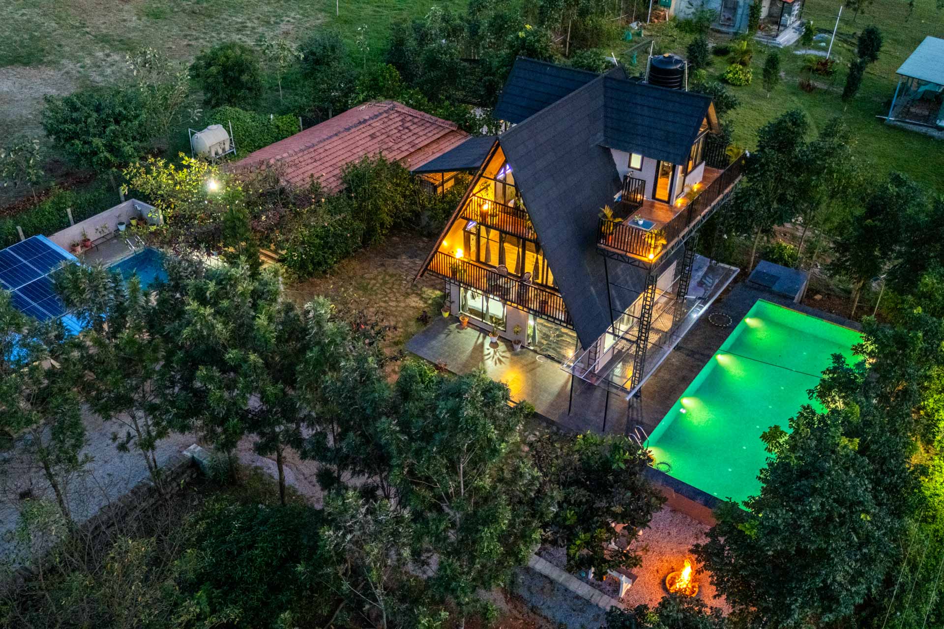
3. Bheemeshwari — Best River-Camp Weekend Trip Around Bangalore
Distance: ~100 km · Drive time: 2–2.5 hrs · Best for: 1N/2D · Budget: Rs 4,000–7,000 per person · Status: Open

Bheemeshwari is a stretch of the Cauvery river bordering the Cauvery Wildlife Sanctuary, with a riverside eco-camp operated by Jungle Lodges & Resorts — a Karnataka government undertaking. During monsoon, the river runs fat and copper-coloured through a deciduous canyon. It is the closest authentic wilderness camp to Bangalore and the only weekend trip around Bangalore where you can do coracle rides and riverside cottage stays in a 2.5-hour drive.
Why to visit Bheemeshwari in monsoon
River volume peaks July to September, transforming the calm summer Cauvery into a roaring waterway. The sound of moving water becomes a constant soundtrack from the cottages. Birding picks up — the mahseer-rich stretch attracts herons, kingfishers and ospreys. Active fishing (catch-and-release mahseer angling) is suspended in monsoon for breeding, but coracle rides on quieter pools continue. JLR’s monsoon pricing typically runs 10–15% lower than peak winter rates.
Best time to visit Bheemeshwari
The river is at its visual best between July and September. For active angling, October through February is the prime window (but rates are higher). The transition months — late September and early October — offer the best balance of high water, lower humidity and resumed fishing. Avoid the peak rain weeks in late July if you want guaranteed coracle outings.
Weather of Bheemeshwari in June, July and August
Bheemeshwari sits in the Mandya–Cauvery valley, receiving moderate southwest monsoon rainfall in the 700–900 mm annual range. June is humid and warm with daytime highs of 28–32°C and short evening showers; July gets steadier rainfall, daytime temperatures of 25–28°C, and overcast skies that keep humidity high; August is cooler at 24–27°C with frequent cloud cover and occasional thunder. Nights across all three months range 22–25°C. River mist is common at dawn — pack a light layer for early-morning coracle outings.
How to reach Bheemeshwari
Take the Bangalore–Kanakapura Road (SH-3) southwest through Kanakapura town, then continue toward Halagur and follow the JLR signposts to the Bheemeshwari camp (around 100 km, 2–2.5 hrs). The road is two-lane and well-maintained through Kanakapura, then narrower forest road for the last 20 km. JLR provides shuttle service from select Bangalore points on request. KSRTC buses run to Halagur; the final 12 km needs a local auto or pre-booked taxi.
Things to do in Bheemeshwari in monsoon
- Stay at the JLR Bheemeshwari Adventure & Nature Camp (cottages or log huts)
- Take a coracle ride on a quieter Cauvery pool (peak-rain windows excepted)
- Walk the short forest trails inside the property with a naturalist
- Birdwatch at dawn for kingfishers, herons, ospreys and river terns
- Cross to Galibore (sister JLR camp) for a more remote forest stay
Places to visit in Bheemeshwari in monsoon
- JLR Bheemeshwari Camp — the primary base, riverside cottages
- Galibore Fishing Camp — 15 km onward, deeper inside the sanctuary
- Mekedatu and Sangama — confluence of Cauvery and Arkavathy (visit warily in monsoon, swimming banned)
- Doddamakali — another JLR property upstream, lighter footprint
- Muthathi — Cauvery riverside pilgrim spot 45 km away, popular but crowded
Tier 2 — Short Weekend Breaks From Bangalore (2–4 Hours). These four are practical weekend breaks from Bangalore for a Friday-night-out, Sunday-night-back trip — strong picks when you want a real change of scenery without spending the entire Saturday in the car.
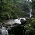
4. Shivanasamudra Falls — Best Waterfall Spectacle
Distance: ~135 km · Drive time: ~3 hrs · Best for: Day trip or 1N/2D · Budget: Rs 2,000–4,000 per person · Status: Viewpoints open, swimming/boating suspended

Shivanasamudra is the segmented island town where the Kaveri river splits into two parallel waterfalls — Gaganachukki on the western branch and Barachukki on the eastern. During peak monsoon, both falls bloom into full curtains at 75 and 98 metres respectively. The site also hosts one of Asia’s oldest hydroelectric stations, commissioned in 1902.
Why to visit Shivanasamudra in monsoon
The falls are reduced to a pencil-thin trickle in summer; only the monsoon delivers the full-curtain experience. According to Holidify’s Shivanasamudra guide, the best viewing window is July to October when river discharge is highest. Spray reaches the viewing platforms on humid days, and a rainbow forms between 10 AM and noon on cloud-broken days. The viewing decks themselves are sturdy concrete; you can drive to within 200 metres of both falls.
Best time to visit Shivanasamudra
The peak viewing window is late July through October, when upstream KRS reservoir releases peak water. Day-trip timing should target 9 AM–1 PM for the best light; avoid late evenings as the road back is dark and forest-edged. Visit Gaganachukki first (less crowded) and Barachukki after lunch. Weekends from August onward see large crowds — go on a weekday if possible.
Weather of Shivanasamudra in June, July and August
Shivanasamudra sits in the Mandya region with moderate annual rainfall of 700–900 mm. June is hot and humid with daytime highs of 28–32°C and brief afternoon showers; July gets consistent rainfall and cooler daytime temperatures of 25–28°C with overcast skies; August stays similar at 24–27°C, though the falls are at their visual peak in late August and September when upstream discharge intensifies. Nights stay warm at 22–25°C across all three months. Carry waterproof cases for cameras and phones — spray near the falls is unavoidable.
How to reach Shivanasamudra
Take the Bangalore–Mysuru Expressway (NH-275), exit at Maddur and head south via Malavalli town to Shivanasamudra (around 135 km, 3 hrs). The expressway has dramatically shortened this drive — it used to be 4 hours. KSRTC operates direct buses from Bangalore to Shivanasamudra; private taxis charge Rs 4,000–5,000 round trip. There is no rail connectivity to the falls themselves — Mandya is the closest railhead, 60 km away.
Things to do in Shivanasamudra in monsoon
- View Gaganachukki Falls from the main observation deck
- Cross to Barachukki Falls (4 km away) for the double-cascade view
- Visit the Shivanasamudra Hydroelectric Power Station — one of Asia’s oldest operational stations
- Combine with a stop at Talakad — a sand-buried temple complex 20 km away
- Visit Somnathpur (Hoysala-era Keshava Temple) — 50 km extension toward Mysuru
Places to visit in Shivanasamudra in monsoon
- Gaganachukki Falls viewpoint — the iconic twin-cascade view
- Barachukki Falls viewpoint — broader, more diffused fall
- Shivanasamudra Power Station — operational hydroelectric heritage site
- Talakad — Hoysala-era temple town buried in shifting sand
- Mudukuthore Mallikarjuna Temple — hilltop temple with valley views, 15 km detour
5. BR Hills (Biligiri Ranganatha Temple) — Best Biosphere Reserve Stay
Distance: 180 km · Drive time: 4–5 hrs · Best for: 1N/2D · Budget: Rs 5,000–9,000 per person · Status: Open, safari schedules subject to forest department

BR Hills, or Biligiri Ranganatha Swamy Temple Wildlife Sanctuary, is a tiger reserve and biosphere where the Eastern Ghats meet the Western Ghats. The K. Gudi Wilderness Camp — a Jungle Lodges property — is the only authorised stay inside the reserve, and the temple itself sits on a 5,091 ft cliff with valley views in all directions.
Why to visit BR Hills in monsoon
Monsoon turns the open grasslands rich green, the canopy hits full saturation, and wildlife congregates at salt-licks and waterholes. Visibility on safari can actually be higher than in dry summer because animals stay closer to known water sources. Cooler temperatures (18–22°C), low tourist density and active bird life make this one of the best weekend destinations around Bangalore for naturalists. The reserve is part of UNESCO’s Western Ghats biosphere recognition.
Best time to visit BR Hills
The reserve is open year-round, but July through September offers the best green-season experience. October through March delivers easier wildlife sighting in drier scrub. Avoid peak summer (April–May) when temperatures rise and visibility drops in dry haze. Safari permits are limited; book through Karnataka Forest Department’s official portal or JLR’s reservations, not aggregators.
Weather of BR Hills in June, July and August
BR Hills sits at 1,500–1,800 m elevation, receiving roughly 1,000–1,500 mm of annual rainfall. June brings the first monsoon showers with cool daytime temperatures of 20–24°C and frequent mist; July is the wettest month with persistent drizzle, daytime temperatures of 18–22°C and saturated forest canopies; August stays similar at 19–23°C with periodic clear windows. Nights drop to 15–18°C across all three months. Warm layers, leech socks and waterproof footwear are essential.
How to reach BR Hills
Drive via NH-948 from Bangalore through Kanakapura, Malavalli and Kollegal, then climb the BR Hills ghat road to the reserve (180 km, 4–5 hrs). The last 25 km is forest road with strict speed limits and no overtaking past sunset. KSRTC runs buses from Bangalore to Yelandur; the final climb requires a local taxi. Closest railhead is Chamarajanagar, 60 km away. JLR provides shuttle pickup from Chamarajanagar.
Things to do in BR Hills in monsoon
- Stay at K. Gudi Wilderness Camp (JLR) — tented cottages inside the reserve
- Take morning and evening jeep safaris (book through the camp)
- Visit the Biligiri Ranganatha Swamy Temple on the cliff edge
- Walk the short nature trails with a Soliga tribal guide
- Birdwatch — the reserve has 270+ recorded species including the Nilgiri wood pigeon
Places to visit in BR Hills in monsoon
- K. Gudi Wilderness Camp — the central JLR base
- Biligiri Ranganatha Swamy Temple — 5,091 ft cliff-top shrine
- Doddasampige tree — a 2,000-year-old champak tree sacred to the Soliga tribe
- Vibhuthi Falls — short, monsoon-fed cascade 12 km from the temple
- Bilikal Rangaswamy Betta — an extension trek (subject to forest dept approval)
6. Yercaud — Best Tamil Nadu Hill Station for a Bangalore Weekend Outing
Distance: 215 km · Drive time: ~4.5 hrs · Best for: 2N/3D · Budget: Rs 5,000–8,000 per person · Status: Open

Yercaud sits in the Shevaroy Hills of Tamil Nadu at 1,515 m elevation, a coffee-and-orange hill town with a central lake. It is the underrated alternative to Ooty for a bangalore weekend outing — shorter ghats, thinner crowds and a lake-and-coffee aesthetic that mirrors Coorg without the Western Ghats rainfall extremes.
Why to visit Yercaud in monsoon
Yercaud receives less rain than Coorg or Chikmagalur, so you get the cool hill weather without the constant downpour. Coffee estates open for guided tours, the central lake is at its photogenic best, and the orange and silver oak plantations turn lush. The Salem–Yercaud ghat road is well-maintained year-round and less landslide-prone than the Sakleshpur or Madikeri ghats. Crowds drop sharply in monsoon — homestay rates fall 15–25%.
Best time to visit Yercaud
The most pleasant stretch is June through September for greenery without saturation, and October through February for clearer skies. Avoid May (when the hills are dry and dusty) and the post-Diwali tourist surge. For coffee estate tours, target late August through September — coffee bean ripening is visible.
Weather of Yercaud in June, July and August
Yercaud’s annual rainfall ranges 1,500–1,800 mm, lower than the Western Ghats. June is mild and pleasant with daytime highs of 22–26°C and afternoon showers; July sees more consistent rainfall, daytime temperatures of 20–24°C and overcast mornings; August stays cool at 19–23°C with mist on most mornings. Nights drop to 14–18°C across all three months. The lake area can be windy in late evenings — carry a light jacket.
How to reach Yercaud
Drive south via NH-44 through Hosur, Krishnagiri and Salem, then climb the 20-bend ghat road to Yercaud (215 km, around 4.5 hrs). The Salem ghat road is one of the smoother climbs in South India. The closest railhead is Salem Junction (35 km from Yercaud); regular trains from Bangalore (Cantt or Yeshwantpur) take 3–4 hours, followed by a 45-minute cab. Yercaud has no airport — Salem and Coimbatore are the nearest options.
Things to do in Yercaud in monsoon
- Boating on Yercaud Lake (operates in light rain)
- Coffee estate walks at Lady’s Seat or 32nd Mile estates
- Hike to Pagoda Point for valley views (short, drivable)
- Visit the Yercaud Botanical Garden and rose garden
- Explore the orange orchards (peak fruiting late September onward)
Places to visit in Yercaud in monsoon
- Yercaud Lake — central artificial lake with boating
- Pagoda Point — Shevaroy Hills viewpoint at sunset
- Lady’s Seat and Gent’s Seat — twin cliff-edge viewpoints
- Killiyur Falls — 300 ft monsoon-fed cascade, short trek
- Shevaroyan Temple — hilltop temple at the summit (1,623 m)
- Anna Park — central park near the lake with manicured gardens
7. Sakleshpur — Best Coffee-Estate Weekend Destination Around Bangalore
Distance: 220 km · Drive time: 4.5–6 hrs · Best for: 1N/2D · Budget: Rs 5,000–9,000 per person · Status: Open; Shiradi Ghat and Bisle Ghat status varies

Sakleshpur is a small town in Hassan district that has quietly become Karnataka’s premier coffee-estate-stay destination. The town itself is modest; the appeal is the homestays in the surrounding ridges, plus the spectacular Bisle Ghat viewpoint overlooking Pushpagiri Wildlife Sanctuary.
Why to visit Sakleshpur in monsoon
Sakleshpur’s ridges turn emerald-green between June and September — arguably the prettiest of any monsoon weekend destinations around Bangalore. Coffee estates open guest cottages, pepper vines flower, and Bisle Ghat reveals three valleys meeting under cloud cover. The Green Route rail trek (Sakleshpur to Kukke Subramanya) is closed in monsoon for safety, but road-based attractions like Bisle Ghat, Manjarabad Fort and several waterfalls remain accessible.
Best time to visit Sakleshpur
The peak window is July through September for monsoon greenery, or December for the pepper-pluck and coffee-blossom seasons. November and February also offer clear views and pleasant weather. Avoid late October to early November if the northeast monsoon is active — Hassan district occasionally sees secondary rainfall windows that close the ghats.
Weather of Sakleshpur in June, July and August
Sakleshpur sits at the edge of the Western Ghats and receives heavy southwest monsoon rainfall in the 2,500–3,000 mm annual range. June starts with intense pre-monsoon showers and daytime temperatures around 22–26°C; July is the wettest month with persistent rain, daytime temperatures of 19–23°C and frequent mist; August continues wet at 20–24°C with occasional clearer afternoons. Nights drop to 16–19°C across all three months. Expect leeches on plantation trails — carry leech socks or wear long pants tucked into socks.
How to reach Sakleshpur
The standard route is NH-75 (Bangalore–Mangaluru Highway) via Hassan town to Sakleshpur (220 km, 4.5–6 hrs depending on rain). The road is mostly four-lane until Hassan, then two-lane onward. Shiradi Ghat begins after Sakleshpur — do not cross into the ghat in monsoon without checking the NDMA landslide portal and Karnataka PWD advisories. KSRTC buses run frequent services; Sakleshpur has its own small railway station with limited Bangalore connectivity (the Yeshwantpur–Mangaluru route).
Things to do in Sakleshpur in monsoon
- Stay at a coffee-estate homestay (popular options around Hanbal, Mookanahalli and Heggadde)
- View sunrise at Bisle Ghat viewpoint
- Visit Manjarabad Fort — Tipu Sultan’s star-shaped fort with cannon embrasures
- Walk Abbi Falls or Mookanamane Falls (short monsoon-fed cascades nearby)
- Take a coffee plantation tour with the homestay host
Places to visit in Sakleshpur in monsoon
- Bisle Ghat viewpoint — three-valley vista, monsoon-iconic
- Manjarabad Fort — 18th-century star-shaped fort
- Sakleshwara Temple — old Shiva temple at the town centre
- Mookanamane Falls — short monsoon waterfall en route
- Magajahalli Falls (Abbi Falls) — 80 ft cascade, accessible after a short walk
- Hadlu (rice fields) — terraced fields between coffee estates, photogenic
Tier 3 — Long Weekend Getaways From Bangalore (4–6 Hours). These five are best done as 2N/3D trips. They are the most spectacular monsoon tourist places in India within reach of Bangalore, but they demand longer driving and stricter safety planning.
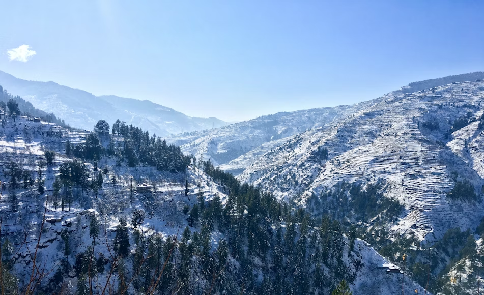
8. Coorg (Madikeri) — Best Overall Monsoon Weekend Getaway From Bangalore
Distance: ~260 km · Drive time: 5–6 hrs · Best for: 2N/3D · Budget: Rs 7,000–12,000 per person · Status: Open with IMD red-alert windows

Coorg, officially Kodagu district, is Karnataka’s premier coffee-growing region — a 4,102 sq km plateau of plantations, ridges and Kaveri tributaries. Madikeri is the district headquarters and the standard tourist base. It is the flagship monsoon weekend getaway from Bangalore, but it is also the destination most affected by 2026’s monsoon advisories.
Why to visit Coorg in monsoon
Coorg gets 3,000+ mm of annual rainfall, most of it June through September — and the visual transformation is extreme. Plantations hit peak green, Abbey Falls roars at full volume, Mandalpatti’s cloud-soaked viewpoint becomes otherworldly, and Talakaveri (the source of the Kaveri) overflows ceremonially in October. Coffee homestays drop rates by 10–20% in monsoon, and the crowds at Raja’s Seat and Madikeri Fort thin out dramatically.
Best time to visit Coorg
For the iconic monsoon look, target July through September — but with strict attention to IMD red-alert windows. For drier, clearer conditions, mid-October through February is the prime tourist season. The shoulder window of late September and early October offers the best green-with-clear-skies combination, plus the Talakaveri Tula Sankramana festival. Avoid Coorg during active red alerts; rebook through homestays.
Weather of Coorg in June, July and August
Coorg sits in the Western Ghats and is among the highest-rainfall regions in peninsular India. June brings the monsoon onset with daytime highs of 22–25°C and heavy initial showers; July is the wettest month with persistent rain, daytime temperatures of 19–23°C, and dense mist that can reduce visibility to 10–20 metres; August stays nearly as wet at 20–24°C with occasional clear afternoons. Nights drop to 16–19°C across all three months. Carry waterproof footwear, full rain gear and leech socks for plantation trails.
How to reach Coorg
The standard route is NH-275 (Bangalore–Mysuru Expressway) to Mysuru, then SH-88 via Hunsur and Kushalnagar to Madikeri (260 km, 5–6 hrs). The expressway cut nearly an hour off the older route. Avoid the Sampaje Ghat and the Madikeri–Mangaluru road in monsoon — both are landslide-prone. KSRTC runs daily Volvo services; the closest railhead is Mysuru (120 km from Madikeri), with frequent Bangalore trains. There is no airport in Coorg; Mangaluru (135 km) and Mysuru are the closest options.
Things to do in Coorg in monsoon
- Stay at a coffee plantation homestay (Tata Coffee Estate, Old Kent Estates, or smaller bungalows)
- View Abbey Falls at peak volume (parking near the falls, 200 m walk)
- Drive up to Mandalpatti viewpoint in a 4×4 jeep (mandatory in monsoon)
- Visit Talakaveri — the source of the Kaveri river
- Walk through Dubare Elephant Camp (boating across the Kaveri may be suspended)
Places to visit in Coorg in monsoon
- Abbey Falls — 70 ft cascade through coffee and cardamom estates
- Mandalpatti viewpoint — 4×4-only route to a misty 1,600 m vista
- Talakaveri — Kaveri origin shrine on Brahmagiri Hill
- Raja’s Seat — Madikeri sunset viewpoint
- Madikeri Fort — 17th-century fort with a small museum
- Omkareshwara Temple — Kodava-style temple with central courtyard
- Namdroling Monastery (Golden Temple, Bylakuppe) — Tibetan settlement 35 km from Madikeri
- Dubare Elephant Camp — Karnataka Forest Department’s elephant interaction camp
9. Chikmagalur — Best Hill-and-Trek Weekend Destinations Around Bangalore
Distance: ~245 km · Drive time: 4–5 hrs · Best for: 2N/3D · Budget: Rs 6,000–11,000 per person · Status: Open; some treks restricted

Chikmagalur is where Indian coffee was first cultivated in the 1670s, when Baba Budan smuggled seven coffee beans into the Bababudangiri Hills. It is now one of the strongest non-Coorg picks for weekend trips from Bangalore — vertical greenery, the state’s highest peak at Mullayanagiri (1,930 m), and Hebbe Falls plunging 168 m through dense forest.
Why to visit Chikmagalur in monsoon
The hills flush to their annual peak green between July and September. Mullayanagiri’s road approach stays accessible (drive up the ghat; the final trail is a short, manageable climb). Coffee blossoms recede by June, but plantation foliage saturates. Hebbe Falls is at full volume, and the Kemmangundi–Z Point region is misty almost daily. Chikmagalur has more drive-up viewpoints than Coorg, making it a better pick for travellers who want hill scenery without a heavy hike.
Best time to visit Chikmagalur
The greenest window is July through September. October through February offers clearer trekking weather. March showcases coffee blossoms (the entire region smells like jasmine for two weeks). Avoid peak summer (April–May) when daytime heat rises and the hills look brown.
Weather of Chikmagalur in June, July and August
Chikmagalur receives 2,000–3,000 mm of annual rainfall, concentrated in the southwest monsoon. June brings sustained rainfall with daytime highs of 22–25°C and heavy mornings; July is the wettest month at 19–23°C with persistent rain and dense mist on the higher hills; August continues wet at 20–24°C with brief sunny windows. Nights drop to 15–18°C across the three months. Mullayanagiri’s summit can be 4–6°C cooler than the town, so layered clothing is essential.
How to reach Chikmagalur
Drive via NH-75 to Hassan, then SH-57 via Belur to Chikmagalur (245 km, 4–5 hrs). The road is mostly four-lane until Hassan. Karnataka State Transport runs hourly Volvo and semi-sleeper services from Majestic. Closest railhead is Kadur (40 km); some trains run direct to Chikmagalur station from Yeshwantpur. There is no airport — Mangaluru (160 km) is the closest.
Things to do in Chikmagalur in monsoon
- Drive to Mullayanagiri summit for sunrise (last 500 m on foot)
- Visit Hebbe Falls via 4×4 jeep from Kemmangundi (jeeps are mandatory in monsoon)
- Walk the short trails at Bababudangiri shrine and Mannikyadhara Falls
- Take a coffee plantation tour with the homestay host
- Spend an afternoon at Hirekolale Lake — quiet, photogenic
Places to visit in Chikmagalur in monsoon
- Mullayanagiri Peak — Karnataka’s highest point
- Bababudangiri — shrine sacred to both Hindus and Muslims
- Hebbe Falls — 168 m two-stage waterfall
- Mannikyadhara Falls — short cascade near Bababudangiri
- Coffee Museum (Chikmagalur) — Karnataka Coffee Board’s heritage exhibit
- Belur and Halebid — Hoysala temple cluster, 30–40 km detour
- Kemmangundi (Z Point) — sister hill station, can be combined as a day trip
10. Kabini — Best Wildlife Weekend Trip From Bangalore
Distance: 211 km · Drive time: 4.5–5 hrs · Best for: 1N/2D · Budget: Rs 8,000–15,000 per person · Status: Open; specific zones may have restricted safaris

Kabini is the backwater stretch of the Kabini reservoir bordering Nagarhole Tiger Reserve. The reservoir was created in 1974 by damming the Kabini river, and the receding shoreline in late monsoon concentrates wildlife along a narrow strip — making Kabini one of the few places in India where wildlife photography improves during monsoon.
Why to visit Kabini in monsoon
Late monsoon (August through October) brings shoreline wildlife concentration as water recedes — elephants, gaur and the elusive black panther congregate near the water. Crowds thin out, and JLR Kabini River Lodge rates soften by 10–20% versus December. The forest itself is at peak green. Bandipur and Nagarhole are part of the larger Nilgiri Biosphere Reserve, so the wildlife corridor extends across multiple sanctuaries.
Best time to visit Kabini
The two prime windows are March to May (for tigers and panthers in dry forest) and August to October (for shoreline wildlife and lush greenery). November to February is also pleasant but more crowded and pricier. Peak monsoon weeks in July can see safari schedules reduced by the forest department — check with JLR or the official reservations portal.
Weather of Kabini in June, July and August
Kabini sits at the Nagarhole edge with moderate annual rainfall of 1,000–1,500 mm. June brings the monsoon onset with daytime temperatures of 26–30°C and heavy initial showers; July is the wettest with daytime temperatures of 24–27°C, persistent rain, and dense forest canopies; August begins to ease with 25–28°C daytime temperatures and clearer afternoons. Nights drop to 21–24°C across all three months. Open-top jeep safaris run in light rain but may pause during heavy bursts.
How to reach Kabini
Drive via the Bangalore–Mysuru Expressway, then south through Mysuru, Hunsur and Bidarahalli to Kabini (211 km, 4.5–5 hrs). The expressway makes this the easiest of the wildlife-camp drives. KSRTC runs Volvo services to Hunsur or Mysuru; the final 40–50 km needs a taxi. Closest railhead is Mysuru (80 km from Kabini); JLR provides shuttle pickup from Mysuru on request. The Bandipur night-driving ban (9 PM–6 AM on NH-766) applies if approaching from Mysuru via Gundlupet.
Things to do in Kabini in monsoon
- Stay at JLR Kabini River Lodge or Orange County Kabini (premium options)
- Take morning and evening jeep safaris into Nagarhole’s tourism zone
- Boat safari on the Kabini backwaters at sunset
- Visit a tribal village with a naturalist guide (Jenu Kuruba and Betta Kuruba settlements)
- Birdwatching along the reservoir at dawn
Places to visit in Kabini in monsoon
- JLR Kabini River Lodge — flagship wildlife camp, premium tents
- Nagarhole National Park — adjacent tiger reserve and core safari zone
- Kabini reservoir backwaters — sunset boat safari starts here
- Bandipur Tiger Reserve — 50 km onward, often combined as a 2-park itinerary
- Brahmagiri foothills — Coorg’s southern edge, an extension drive
- Tholpetty range (Wayanad) — across the Kerala border, 60 km onward
11. Kemmangundi — Best Budget Monsoon Hill Stay
Distance: ~255 km · Drive time: 5–6 hrs · Best for: 1N/2D · Budget: Rs 4,000–7,000 per person · Status: Open

Kemmangundi is the quieter, cheaper sibling of Chikmagalur — same Mullayanagiri-Bababudangiri range, fraction of the tourist load, and the Karnataka Horticulture Department’s Kemmangundi Hill Resort is one of the most affordable hill stays in the state. Z Point sunset and Hebbe Falls are both within a short drive.
Why to visit Kemmangundi in monsoon
Kemmangundi shares the same Western Ghats microclimate as Chikmagalur — green, cool, misty — but with mid-week-low occupancy even on weekends. The Horticulture Department’s hilltop property offers government-rate rooms (often Rs 1,800–3,500 per night), and the surrounding Bababudangiri range becomes a continuous green canvas. It is one of the few weekend breaks from Bangalore where you can do a full hill-station stay for under Rs 5,000 per person all-in.
Best time to visit Kemmangundi
The hills are most spectacular July through September, but October through February also delivers cool, clear weather. Avoid late April and May — the rose garden withers and the heat rises. Hebbe Falls is at peak in August and September.
Weather of Kemmangundi in June, July and August
Kemmangundi sits at 1,434 m, receiving 2,500–3,500 mm of annual rainfall. June brings the monsoon onset with daytime highs of 18–22°C and frequent showers; July is the wettest with persistent rain, daytime temperatures of 16–20°C and mornings often below 10 m visibility; August stays cool at 17–21°C with periodic clear afternoons. Nights drop to 12–16°C across all three months — among the coolest of any weekend getaway from Bangalore. Pack a fleece even in July.
How to reach Kemmangundi
The drive runs via NH-75 to Hassan, then SH-57 via Belur and Chikmagalur to Kemmangundi (255 km, 5–6 hrs). The last 30 km past Tarikere is narrow ghat road — drive in daylight only. KSRTC services run Bangalore–Chikmagalur; the final 55 km to Kemmangundi needs a taxi. Closest railhead is Tarikere (35 km), with limited connectivity to Bangalore.
Things to do in Kemmangundi in monsoon
- Stay at the Horticulture Department Hill Resort (book direct on their portal)
- Catch sunset at Z Point — the cliff-edge viewpoint
- Visit Hebbe Falls via the shared 4×4 jeep from Kemmangundi village
- Walk the rose garden and the Raj Bhavan grounds
- Drive the short loop to Shanti Falls for a quieter waterfall experience
Places to visit in Kemmangundi in monsoon
- Z Point — sunset cliff viewpoint with 180-degree valley vista
- Hebbe Falls — 168 m two-stage cascade (jeep mandatory)
- Shanti Falls — short hike near the main resort
- Raj Bhavan rose garden — manicured Horticulture Department grounds
- Kalhatti Falls — 30 km detour, monsoon-fed
- Bhadra Wildlife Sanctuary — 50 km extension for a safari add-on
12. Wayanad — Best Cross-Border Long-Weekend Pick
Distance: ~283 km · Drive time: 6–7 hrs · Best for: 2N/3D · Budget: Rs 7,000–12,000 per person · Status: Open

Wayanad is the Kerala extension of the Western Ghats — a 2,131 sq km district of rainforest, tea estates and Banasura Sagar Dam (India’s largest earth dam). It is the most rainforest-like of the weekend getaways from Bangalore, and Kerala’s tourism arrivals hit a record 22.2 million in 2024 (Kerala Tourism Statistics) with Wayanad a major contributor.
Why to visit Wayanad in monsoon
Wayanad’s waterfalls — Soochipara, Meenmutty, Kanthanpara — only reach full bloom between July and September. Tea estates around Vythiri turn photogenic, the Pookode and Banasura lakes fill to capacity, and the rainforest canopy at Edakkal Caves becomes its mossiest version. Wildlife at Tholpetty and Muthanga ranges of Wayanad Wildlife Sanctuary stays active. The cross-border drive itself is scenic — from Bandipur’s tropical dry forest into Kerala’s evergreen rainforest within 30 km.
Best time to visit Wayanad
For waterfalls and rainforest atmosphere, July through September is ideal. October through February offers clearer skies for trekking. Avoid the heaviest weeks in late July when ghat closures can disrupt the return journey. The Pulpally and Sulthan Bathery zones see lighter rainfall than the western Vythiri side.
Weather of Wayanad in June, July and August
Wayanad receives 2,500–3,500 mm of annual rainfall, concentrated June through October. June brings the monsoon onset with daytime highs of 22–26°C and heavy showers; July is the wettest with daytime temperatures of 20–24°C, persistent rain and dense mist; August stays similar at 21–25°C with brief clearer windows. Nights drop to 16–19°C across the three months. The Vythiri and Lakkidi areas receive higher rainfall than the eastern Sulthan Bathery side.
How to reach Wayanad
The standard route runs via the Bangalore–Mysuru Expressway, then NH-766 through Mysuru, Gundlupet and Bandipur Tiger Reserve into Kerala (283 km, 6–7 hrs). The Bandipur night-driving ban (9 PM–6 AM on NH-766) is strictly enforced — plan your Friday departure for an early afternoon start. The alternate route via Hunsur, Gonikoppal and Kutta avoids Bandipur but adds 40 km. Closest railhead is Kozhikode (95 km); the closest airports are Kozhikode (110 km) and Kannur (120 km).
Things to do in Wayanad in monsoon
- Stay at a tea estate resort around Vythiri or a homestay near Sulthan Bathery
- Visit Soochipara (Sentinel Rock) Falls — accessible after a short forest walk
- Explore the prehistoric Edakkal Caves with Neolithic petroglyphs
- Boat on Pookode Lake and visit Banasura Sagar Dam
- Wildlife safari at Tholpetty range of Wayanad Wildlife Sanctuary
Places to visit in Wayanad in monsoon
- Soochipara Falls (Sentinel Rock) — three-tier waterfall accessible by short trail
- Meenmutty Falls — Wayanad’s tallest, a longer trek (often restricted in heavy rain)
- Banasura Sagar Dam — India’s largest earth dam with reservoir activities
- Edakkal Caves — Neolithic petroglyphs dating 6,000+ years
- Pookode Lake — natural freshwater lake with boating
- Chembra Peak — heart-shaped lake trek (forest dept permits, restricted in monsoon)
- Thirunelli Temple — ancient Vishnu temple in the Brahmagiri foothills
- Tholpetty and Muthanga ranges — Wayanad Wildlife Sanctuary safari zones
Quick-Compare Table: Weekend Getaways From Bangalore (Monsoon 2026)
| # | Destination | Drive time | Distance | Best for | Budget/person | Monsoon flag |
|---|---|---|---|---|---|---|
| 1 | Nandi Hills | 1.5–2 hrs | 60 km | Sunrise day trip | Rs 1,500–3,000 | Slot booking |
| 2 | Anthargange | ~2 hrs | 67 km | Cave day trek | Rs 1,000–2,000 | Avoid heavy rain |
| 3 | Bheemeshwari | 2–2.5 hrs | 100 km | Riverside 1N | Rs 4,000–7,000 | Fishing suspended |
| 4 | Shivanasamudra | ~3 hrs | 135 km | Waterfall day | Rs 2,000–4,000 | No boating |
| 5 | BR Hills | 4–5 hrs | 180 km | Wildlife 1N | Rs 5,000–9,000 | Safari slots limited |
| 6 | Yercaud | ~4.5 hrs | 215 km | Lake hill 2N | Rs 5,000–8,000 | Mostly clear |
| 7 | Sakleshpur | 4.5–6 hrs | 220 km | Coffee homestay | Rs 5,000–9,000 | Ghat advisory |
| 8 | Coorg | 5–6 hrs | 260 km | Plantation 2N | Rs 7,000–12,000 | IMD red alert |
| 9 | Chikmagalur | 4–5 hrs | 245 km | Peak hike 2N | Rs 6,000–11,000 | Trek limits |
| 10 | Kabini | 4.5–5 hrs | 211 km | Safari 1N | Rs 8,000–15,000 | Night-ban applies |
Where to Stay in Bangalore in Monsoon

Monsoon Safety Advisory for Weekend Getaways From Bangalore (2026)
The southwest monsoon entered Karnataka on June 8, 2026 (IMD onset tracker). Three categories of risk apply this season:
Landslide-prone ghat roads (verify status 24–48 hours before departure):
- Shiradi Ghat (NH-75) — Bangalore–Mangaluru, recurring closures
- Charmadi Ghat (NH-73) — Chikmagalur–Mangaluru
- Bisle Ghat — Sakleshpur–Kukke Subramanya, narrow and slippery
- Sampaje Ghat — Madikeri–Mangaluru
- Live updates: NDMA landslide portal and the Karnataka State Disaster Management Authority bulletin.
Activities suspended in monsoon:
- Hogenakkal boating (Tamil Nadu) — Jun–Sep
- Skandagiri trek — Karnataka Forest Department restricts permits (Karnataka Tourism)
- Kudremukh, Kumara Parvatha, Tadiandamol peak treks — closed Jun–Sep
- Jog Falls viewing platforms — episodically closed during extreme spates
Routes with mandatory timing windows:
- Bandipur Tiger Reserve, NH-766 — night-driving ban 9 PM–6 AM year-round (relevant for Wayanad, Mudumalai, Ooty trips).
For trekking-focused weekend trips from Bangalore, the safest monsoon picks are Mullayanagiri (drive-up access), Z Point Kemmangundi and Tipu’s Drop at Nandi Hills — all have road access and short, well-trodden trails.