15 Best Places to Visit in India Without Rain in July & August 2026

The Quick Answer
If you want to dodge India’s southwest monsoon in July and August 2026, head to a rain-shadow region. The three driest destinations on this list are Dhanushkodi (~1 mm rainfall in July), Leh (~15 mm), and Spiti’s Kaza (~15 mm) — places that get less rain in two months than Mumbai gets on a single July afternoon.
The 15 destinations below sit in the Himalayan cold deserts (Ladakh, Spiti, Lahaul), Thar Desert (Jaisalmer), or the Western Ghats’ rain shadow (Dhanushkodi). All are open and accessible in July–August 2026, with road and permit specifics for each.
Top 3 picks for first-time monsoon-escape travelers: 1) Leh–Nubra–Pangong loop (Ladakh) 2) Spiti Valley circuit via Manali 3) Jaisalmer + Sam Dunes (lowest altitude, easiest access).
By mid-July, most of India is under monsoon. The southwest monsoon delivers around 75% of the country’s annual rainfall between June and September, and in 2025 it ended roughly 8% above the long-period average — with northwest India recording 121% and central India 123% of normal. Mumbai, Goa, Manali, and most of the Western Ghats turn into a wet, beautiful, but logistically tricky mess.
But India is enormous, and parts of it sit in the rain shadow of the Himalayas or the Western Ghats — geological pockets where the clouds simply do not arrive. Ladakh’s annual rainfall is between 50 and 70 mm — less than what Mumbai gets in a single heavy spell. Spiti, Lahaul, Jaisalmer, and Dhanushkodi share the same rain-shadow physics.
This guide pulls together 15 such destinations, with actual IMD (India Meteorological Department) rainfall numbers, altitudes, route status for July–August 2026, and a frank note on what climate change is doing to the “safety” of these regions. Skim the TL;DR, or jump to the destination you’re curious about via the comparison table.
In this Blog
Why these places stay dry in July & August
The southwest monsoon enters India through two arms — one over the Arabian Sea and one over the Bay of Bengal. Both arms drop most of their moisture before they cross natural barriers: the Western Ghats wring out the Arabian Sea arm, and the Himalayas block the Bay of Bengal arm.
What sits behind these barriers is a rain shadow. The big four rain-shadow zones relevant to your July–August travel plans:
- Trans-Himalayan cold deserts (Ladakh, Spiti, Lahaul, upper Kinnaur): The clouds dump their rain on the southern Himalayan slopes and arrive dry on the Tibetan-plateau side.
- Thar Desert (western Rajasthan, including Jaisalmer): Arid by climate — most years see fewer than 200 mm of total annual rainfall.
- Coromandel coast rain shadow (Dhanushkodi, parts of Rameswaram): The Western Ghats block the Arabian Sea monsoon; this strip of Tamil Nadu gets its rain in October–December from the northeast monsoon instead.
- Leeward Deccan plateau (southern interior): Less dramatic, but cities like Hyderabad and Bengaluru also see relatively moderate July–August rain.
| What’s new for July–August 2026• Atal Tunnel (Manali–Lahaul): Fully operational since October 2020 — cut Manali–Keylong from a 4–5 hour Rohtang Pass crawl to a 71 km, 2-hour drive. Single-day vehicle counts crossed 7,500–10,000 in peak 2025; expect crowds on weekends.• Zojila Tunnel (Srinagar–Kargil–Leh): 75% complete as of late 2025; targeted completion February 2028. When ready it will be Asia’s longest bidirectional road tunnel (13.1 km) and give all-weather access to Ladakh. For 2026, Zojila Pass is still the route — generally clears by late June.• Shinku La Tunnel (Manali–Zanskar via Darcha): Boring approximately 50% complete in mid-2026; targeted for August 2028. The Darcha–Padum road is open in summer.• Ladakh Permits 2026 — Indian citizens: NO Inner Line Permit required. You pay a one-time Ladakh Environment & Health Fee (≈₹400) plus ₹20/day wildlife fee online at lahdclehpermit.in.• Ladakh Permits 2026 — Foreign nationals: Still need a Protected Area Permit via a registered Leh agent. New for 2026 — foreigners may now overnight in Hanle at registered Astro-stays (earlier had to return to Nyoma).• Lahaul–Spiti tourist arrivals hit 1.1 million in 2025 — a 6× jump from pre-tunnel 2018 (172,000). Book stays early. |
An honest climate-change caveat
Rain shadow does not mean rain-proof anymore. In August 2025, Leh recorded 80.2 mm of rainfall — its highest August total in 52 years, more than five times the IMD normal of 15.4 mm. The same month brought flash floods to Lamayuru on the Srinagar–Leh highway and a cloudburst at Charkat Nallah in Kargil.
These regions are still the driest options in the country, but they are no longer the guaranteed-dry options they were a decade ago. Plan an extra buffer day for landslides or road closures, check the IMD nowcast the morning of any high-pass drive, and never overnight in narrow river gorges during cloudburst-prone weather windows.
Quick-glance comparison: 15 monsoon-free destinations
| # | Destination | Region | Alt. (m) | Rain Jul+Aug (mm) | Best Access |
| 1 | Leh | Ladakh | 3,524 | ~30 | Flight (IXL) / Manali–Leh road |
| 2 | Nubra Valley | Ladakh | 3,048 | <40 | Khardung La from Leh |
| 3 | Pangong Tso | Ladakh | 4,350 | <20 | Chang La from Leh |
| 4 | Tso Moriri | Ladakh | 4,522 | <15 | Chumathang route from Leh |
| 5 | Hanle | Ladakh | 4,500 | <15 | Nyoma road from Leh |
| 6 | Turtuk | Ladakh | 2,900 | ~35 | Shyok road from Diskit |
| 7 | Kargil + Dras | Ladakh | 2,676 / 3,280 | ~50 | Srinagar–Leh highway |
| 8 | Zanskar Valley | Ladakh | 3,505 | <30 | Kargil–Padum / Darcha–Padum |
| 9 | Spiti / Kaza | Himachal | 3,800 | ~30 | Manali via Atal Tunnel |
| 10 | Tabo | Spiti | 3,050 | ~25 | Hindustan–Tibet Hwy |
| 11 | Pin Valley / Mud | Spiti | 3,800 | ~25 | From Kaza, ~50 km |
| 12 | Lahaul / Keylong | Himachal | 3,080 | ~70 | Manali via Atal Tunnel |
| 13 | Kinnaur (upper) | Himachal | 3,450 | ~120* | Shimla–Reckong Peo–Sangla |
| 14 | Jaisalmer | Rajasthan | 225 | ~130 | Direct flights / rail |
| 15 | Dhanushkodi | Tamil Nadu | Sea level | <5 | Pamban Bridge from Rameswaram |
* Kinnaur is the most monsoon-sensitive on this list — landslide risk on lower NH-5 is real. Upper Sangla/Chitkul is included for travelers willing to plan around closures.
Source: IMD Met Centre Leh normals (1981–2010) & Down To Earth 2025 analysis — https://www.downtoearth.org.in/climate-change/leh-records-highest-rainfall-in-52-years-august-2025-sees-unprecedented-802-mm
How dry is dry? July rainfall, head-to-head
Source: IMD station normals (1981–2010) & Climates-to-Travel aggregated data.
Source: IMD station normals & Climates-to-Travel aggregated data — https://mausam.imd.gov.in/responsive/monsooninformation.php
The 15 destinations, ranked by uniqueness + accessibility
1. Leh — the Ladakhi base camp
| Detail | Value |
| Altitude | 3,524 m (11,562 ft) |
| July rainfall | ~15.2 mm (IMD normal) |
| August rainfall | ~15.4 mm (IMD normal) |
| July–Aug temperature | 10–25°C day / 7–10°C night |
| How to reach | Direct flights to Kushok Bakula Rimpochee Airport (IXL) from Delhi, Mumbai, Bengaluru. Road: Srinagar–Leh via Zoji La or Manali–Leh via Baralacha La & Tanglang La — both open by July. |
What to do
· Acclimatize for 48 hours — walk Leh’s old town, Leh Palace, Shanti Stupa at sunset.
· Day-trip to Thiksey Monastery for morning prayers and Hemis Monastery (the largest in Ladakh).
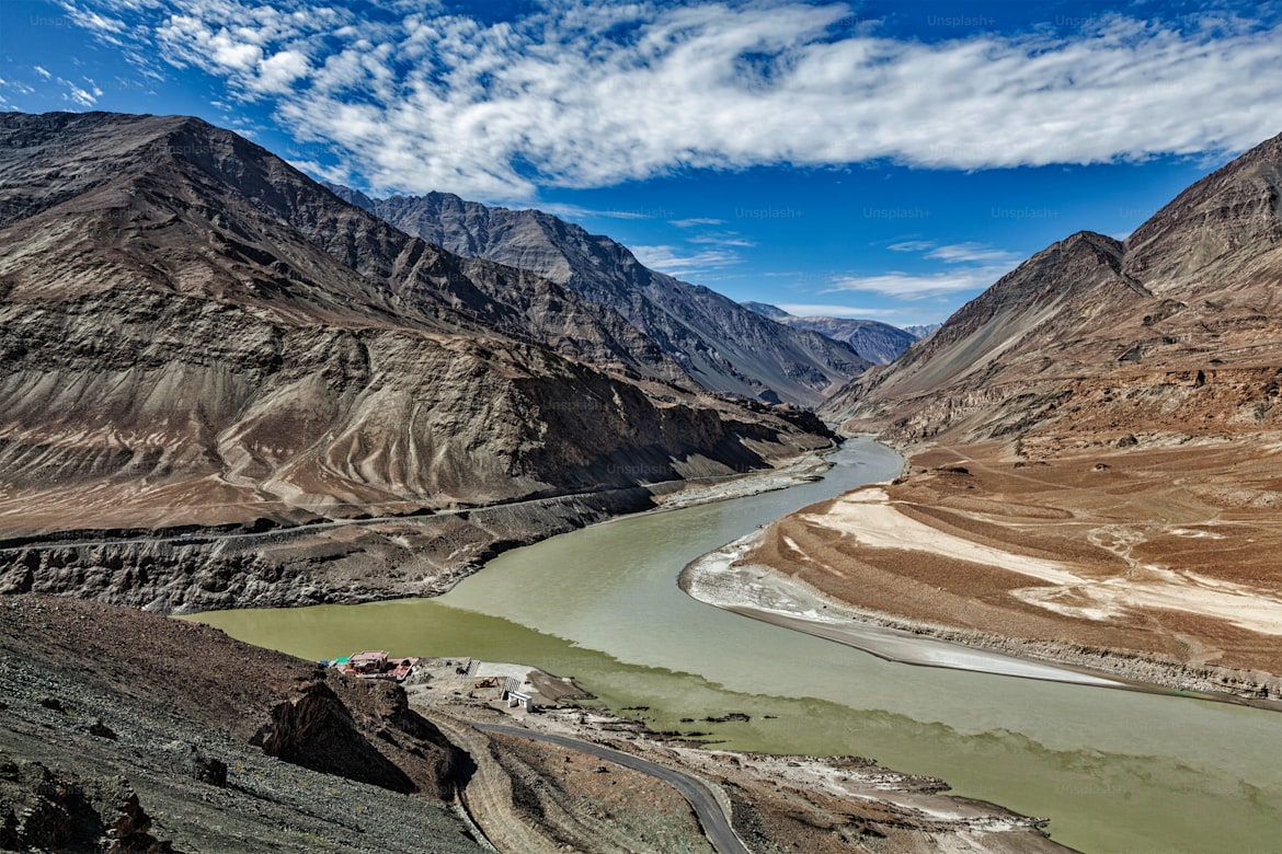
· Drive the Indus-Zanskar confluence at Nimmu and Magnetic Hill on the same morning loop.
Why this destination
Sits in a true cold-desert rain shadow — annual rainfall of just 50–70 mm is less than Mumbai gets in a single July afternoon. The August 2025 anomaly (80.2 mm) was 52-year record-breaking, not the new normal.
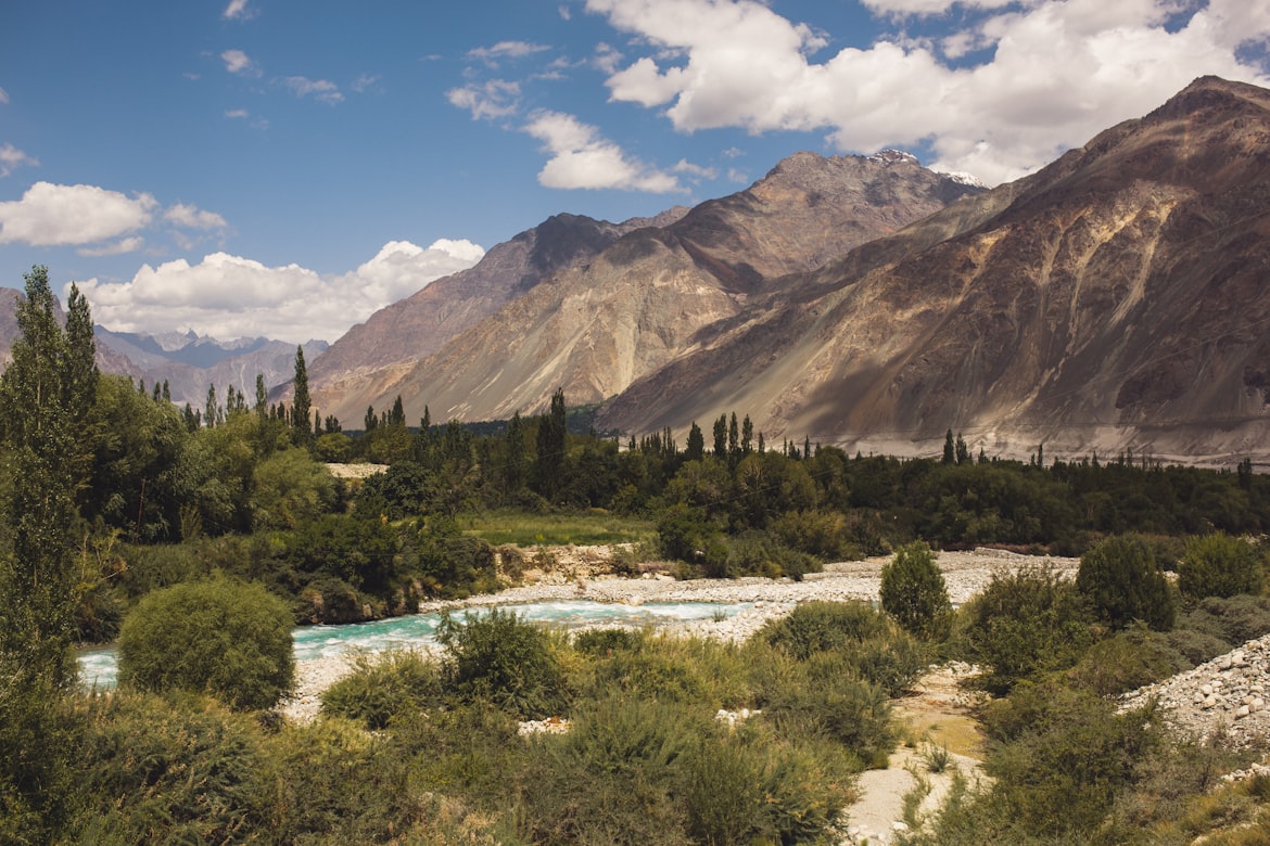
2. Nubra Valley — Karakoram, dunes, double-hump camels
| Detail | Value |
| Altitude | ~3,048 m at Diskit |
| July–Aug rainfall | <40 mm combined |
| Temperature | 15–30°C day / 10–15°C night |
| How to reach | From Leh via Khardung La (5,359 m), fully open by July; ~125 km, 5 hours. |
What to do
· Bactrian (two-hump) camel safari on Hunder’s sand dunes — the only place in India you can ride descendants of Silk Route caravans.
· Visit the 106-foot Maitreya Buddha at Diskit Monastery overlooking the Shyok Valley.
· Drive to Yarab Tso — a sacred lake you reach via a 15-minute uphill walk.
Why this destination
Where Karakoram snowpeaks meet sand dunes within the same frame. The Shyok and Nubra rivers carved this valley, and the dunes were left behind when the river receded thousands of years ago.
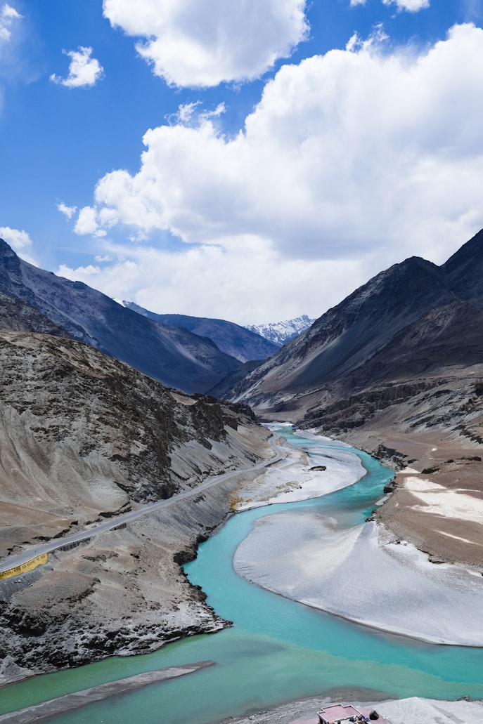
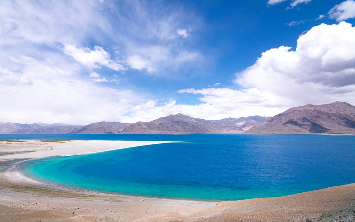
3. Pangong Tso — the high-altitude turquoise lake
| Detail | Value |
| Altitude | 4,350 m (~14,270 ft) |
| July–Aug rainfall | <20 mm combined |
| Temperature | 10–20°C day / 0–5°C night |
| How to reach | From Leh via Chang La (5,360 m), ~160 km, 5–6 hours. Alternate via Wari La from Nubra. |
What to do
· Stay overnight at lakeside camps in Spangmik, Maan, or Merak — Merak is quieter and less crowded.
· Stargaze after sunset — the lake at 4,350 m sits under near-Bortle-2 skies.
· Watch the lake shift through seven colors between sunrise and sunset.
Why this destination
World’s highest saltwater lake — 60% sits in Tibet/China, 40% in India. Made famous by 3 Idiots; the actual lake is more dramatic than the cinematography.
4. Tso Moriri — the quieter, higher cousin of Pangong
| Detail | Value |
| Altitude | 4,522 m |
| July–Aug rainfall | <15 mm combined |
| Temperature | 15–20°C day / 0–5°C night |
| How to reach | From Leh ~220 km via Chumathang hot springs, an 8–9 hour drive. A Ramsar-protected wetland — strict no-littering, no-loud-music rules. |
What to do
· Walk through Korzok — a 400-year-old monastery and the last permanent Changpa nomad village before the Tibetan plateau.
· Birdwatch at the lake’s wetland fringes — 34 species recorded, including the black-necked crane and bar-headed goose.
· Detour to Tso Kar twin lakes (one saltwater, one freshwater) on the way back.
Why this destination
India’s largest entirely-domestic high-altitude lake — Pangong straddles the border, Moriri does not. It’s also a Ramsar wetland, so the rules are strict and the crowds are thinner.
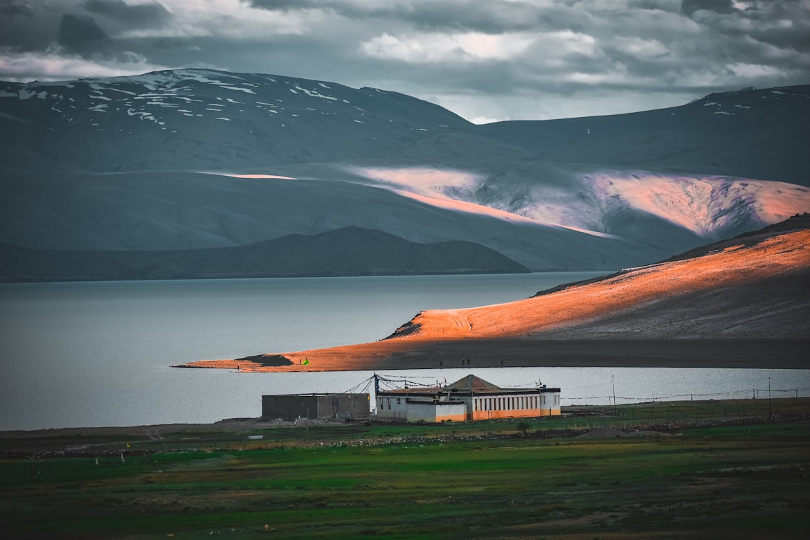
5. Hanle — India’s first Dark Sky Reserve
| Detail | Value |
| Altitude | ~4,500 m |
| July–Aug rainfall | <15 mm combined (though July–Aug can have more clouds than September; late August is the sweet spot) |
| Temperature | 12–20°C day / 2–7°C night |
| How to reach | From Leh ~270 km via Nyoma. Indian citizens just pay the LAHDC online fee; foreigners now permitted to stay overnight at registered Astro-stays from 2026. |
What to do
· Visit the Indian Astronomical Observatory by 15-day advance request to IIA Bengaluru.
· See MACE — Asia’s largest Cherenkov telescope, inaugurated October 2024.
· Book an Astro-stay homestay with a guided night-sky tour using their backyard telescopes.
Why this destination
India’s first International Dark Sky Reserve — Bortle 1 skies, no light pollution for 100 km in any direction, and the Milky Way visible to the naked eye on a moonless night.
6. Turtuk — India’s last Balti village
| Detail | Value |
| Altitude | 2,900 m |
| July–Aug rainfall | ~35 mm combined |
| Temperature | 18–28°C day / 12–15°C night (the warmest place in Ladakh) |
| How to reach | From Diskit/Nubra ~85 km along the Shyok River. |
What to do
· Walk through Turtuk’s apricot orchards — the village exports a significant share of India’s apricot crop.
· Visit the Royal Yagbo House museum, a private residence of the former Yagbo dynasty.
· Hike to Thang village, 2 km from the Line of Control with a viewpoint into Pakistani-administered villages.
Why this destination
Opened to tourists only in 2010 — India’s last Balti-Muslim village, culturally closer to Central Asia than Tibet, and the country’s most northerly inhabited point.
7. Kargil & Dras — the Silk Route town and the world’s coldest doorstep
| Detail | Value |
| Altitude | Kargil 2,676 m / Dras 3,280 m |
| July–Aug rainfall | ~50 mm combined (Dras gets more residual western-disturbance moisture than core Ladakh) |
| Temperature | 15–28°C day / 8–12°C night |
| How to reach | Srinagar–Kargil via Zoji La (open by July); Leh–Kargil ~220 km. |
What to do
· Visit the Kargil War Memorial at Dras (11,000 ft) — the world’s highest battle memorial, with a sobering archive of the 1999 conflict.
· Stop at Mulbekh Monastery to see the 30-foot rock-cut Maitreya carved into a cliff face on the highway.
· Raft on the Suru River through Sankoo and Panikhar — gentler than the Zanskar but stunning.
Why this destination
Dras is the second-coldest inhabited place on Earth (after Oymyakon). Kargil itself was a key Silk Route trading town — Yarkand, Kashgar, and Lhasa traders all converged here.
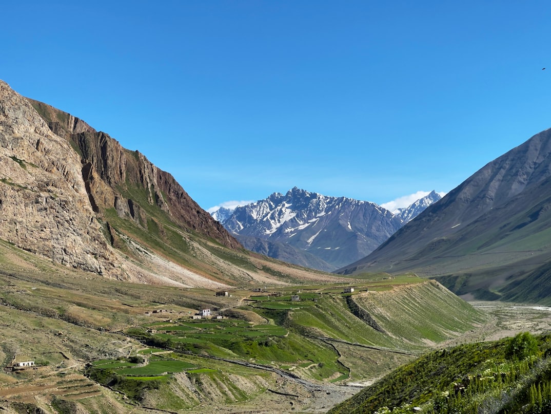
8. Zanskar Valley — India’s most isolated, now getting connected
| Detail | Value |
| Altitude | Padum 3,505 m |
| July–Aug rainfall | <30 mm combined in the interior |
| Temperature | 18–22°C day / 5–8°C night |
| How to reach | Kargil–Padum via Pensi La (~240 km, clears by July) OR new Manali–Darcha–Shinku La road (operational; full tunnel by 2028). |
What to do
· Trek to Phugtal Monastery — built into a cliff cave like a honeycomb, reachable only on foot.
· Visit Karsha Monastery, Zanskar’s largest, with panoramic views of the Stod Valley.
· Drive over Pensi La and stop at the Drang-Drung Glacier viewpoint.
Why this destination
Until 2024 Zanskar had only one summer road in and out. The new Darcha–Padum route via Shinku La gives it a second access point — and when the tunnel is ready, year-round connectivity for the first time in history.
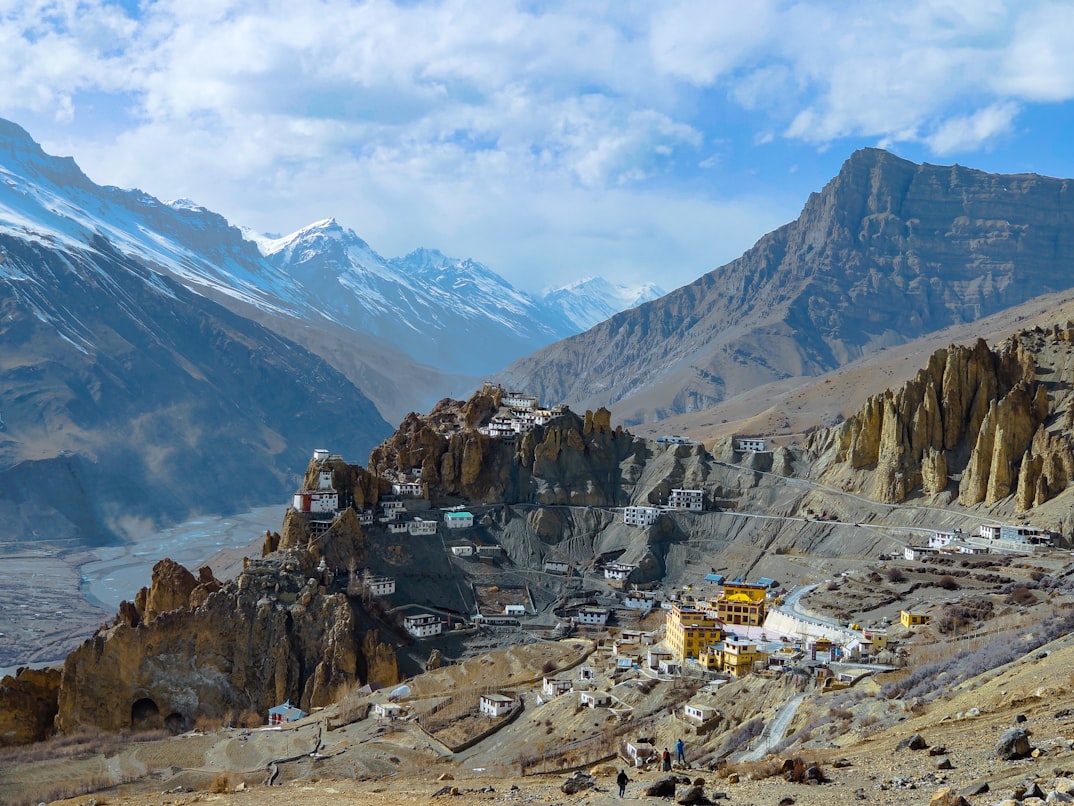
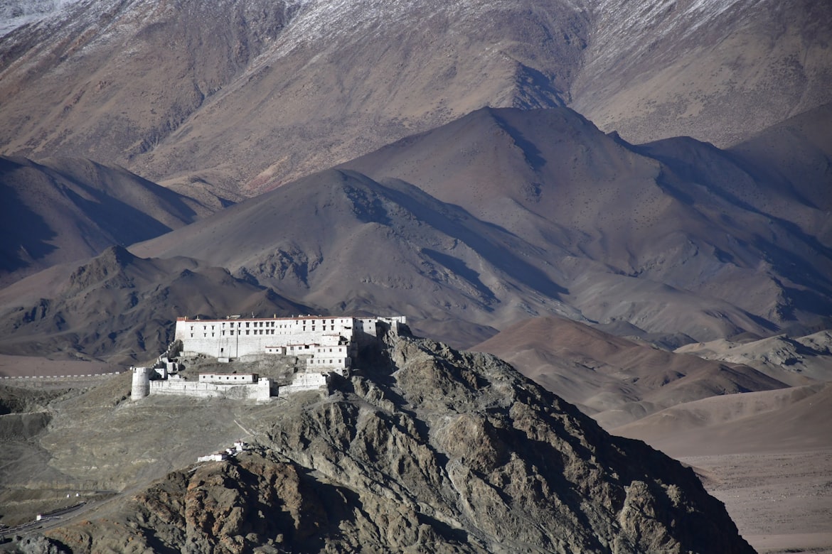
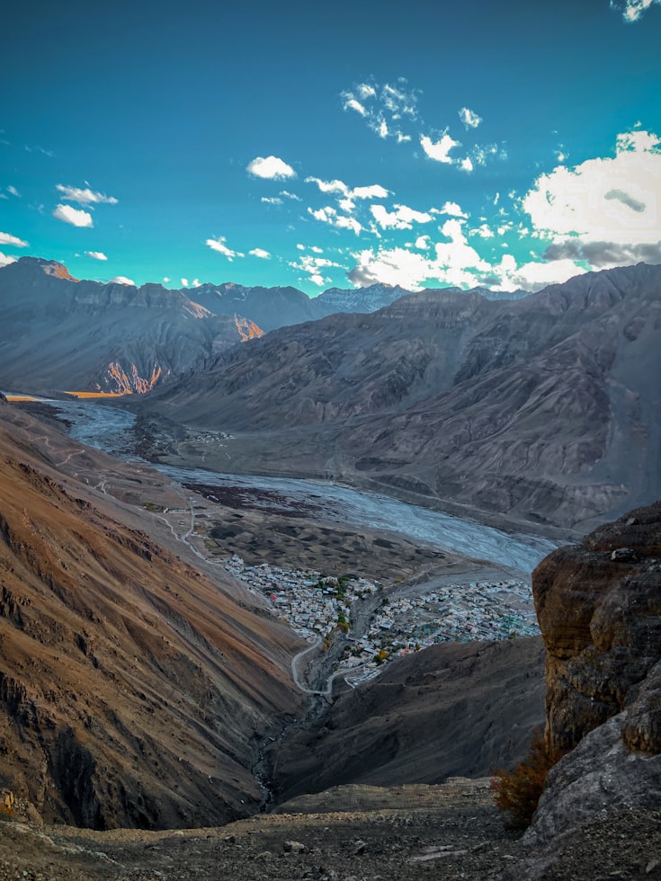
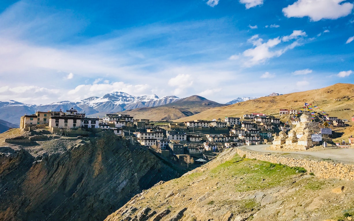
9. Spiti Valley & Kaza — the cold desert closer to Delhi
| Detail | Value |
| Altitude | Kaza 3,800 m |
| July–Aug rainfall | minimal in the interior (annual total <200 mm) |
| Temperature | 15–25°C day / 5–10°C night |
| How to reach | Two routes: Manali via Atal Tunnel + Kunzum La (mid-July onwards; shorter but landslide-prone) OR Shimla–Kinnaur (safer in monsoon, slower). |
What to do
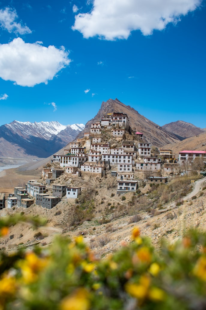
· Walk to Key Monastery (1,000+ years old) at golden hour — the most photographed monastery in India.
· Visit Hikkim (world’s highest post office), Komic (one of the world’s highest motorable villages), and Langza (fossil village).
· Cross Chicham Bridge — Asia’s highest, spanning a 1,000-foot-deep gorge.
Why this destination
Locally called “the Middle Land” — between India and Tibet, with Buddhist heritage older than Tibet’s. Closer to Delhi than Ladakh and reachable without a flight.
10. Tabo — the Ajanta of the Himalayas
| Detail | Value |
| Altitude | 3,050 m |
| July–Aug rainfall | ~25 mm combined |
| Temperature | 18–25°C day / 8–12°C night |
| How to reach | ~47 km from Kaza on the Hindustan–Tibet Highway. |
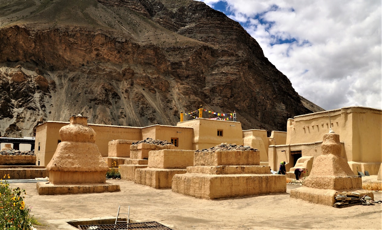
What to do
· Tour Tabo Monastery — founded in 996 CE, with original 1,000-year-old murals (no flash photography, no touching).
· Climb to the Tabo Caves above the monastery — meditation caves still used by monks.
· Stay at the monastery guesthouse if you want a 4:30 am prayer-hall wake-up.
Why this destination
1,030 years old in 2026 — the oldest continuously functioning Buddhist enclave in India. UNESCO listed it on its tentative World Heritage list.
11. Pin Valley & Mud village — Spiti’s wild flank
| Detail | Value |
| Altitude | Mud ~3,800 m; park average 4,500 m |
| July–Aug rainfall | ~25 mm combined |
| Temperature | 15–22°C day / 5–8°C night |
| How to reach | From Kaza ~50 km; turnoff from NH-505 at Attargo bridge. |
What to do
· Walk into Pin Valley National Park — home to the snow leopard, Siberian ibex, blue sheep, and red fox. Sightings are rare in summer but tracks are easy to spot.
· Visit Kungri Monastery — Spiti’s second-oldest and one of the only Nyingma-school gompas in the region.
· Start (or merely admire the trailhead of) the Pin-Parvati or Pin-Bhabha treks.
Why this destination
A cold-desert biosphere reserve. Summer reveals the landscape; winter brings the snow leopards down to lower elevations, but you wouldn’t be reading this guide in winter.
12. Lahaul Valley & Keylong — the post-Atal Tunnel revelation
| Detail | Value |
| Altitude | Keylong 3,080 m |
| July–Aug rainfall | ~70 mm combined — wetter than Spiti, drier than Kullu, sits in the Pir Panjal rain shadow |
| Temperature | 18–25°C day / 8–12°C night |
| How to reach | Manali via Atal Tunnel — 71 km, 2 hours, year-round. |
What to do
· Drive the Atal Tunnel itself — at 9.02 km it was the world’s longest highway tunnel above 10,000 ft when it opened.
· Stop at Sissu waterfall and Sissu Lake for a half-day picnic; both are 20 minutes from the tunnel’s north portal.
· Continue to Chandratal — “moon lake” — open by mid-July; the road in is bumpy but the lake at 4,300 m is worth it.
Why this destination
Lahaul went from 172,000 tourists in 2018 to 1.1 million in 2025 — the fastest-growing Himalayan destination in India, all because one tunnel made it accessible.
13. Kinnaur — Chitkul, Sangla & Kalpa (with a landslide warning)
| Detail | Value |
| Altitude | Chitkul 3,450 m / Sangla 2,700 m / Kalpa 2,960 m |
| July–Aug rainfall | ~120 mm combined — moderate; the most monsoon-sensitive destination on this list |
| Temperature | 15–25°C day / 8–12°C night |
| How to reach | Shimla → Reckong Peo → Sangla → Chitkul (~570 km from Delhi). NH-5 between Rampur and Wangtu has July landslide risk — check road status before departing. |
What to do
· Walk the Baspa riverbank at Chitkul — India’s last inhabited village before Tibet. Beyond it the road is closed to civilians.
· Stay in Kalpa for the apple-orchard view of the Kinner Kailash range at sunrise.
· Camp at Sangla — quieter than Chitkul and a better base for day walks.
Why this destination
Chitkul sits 600 m below Spiti’s Kaza but feels like a different world — alpine meadows, log cabins, and the last bus stop before the Tibetan border. Caveat: this is the wettest place on our list; only include it if you have a buffer day.
14. Jaisalmer — the golden city in the Thar
| Detail | Value |
| Altitude | 225 m |
| July rainfall | ~60 mm across ~3 rainy days |
| August rainfall | ~70 mm across ~3 rainy days |
| Temperature | July 27–38°C / August 26–37°C — hot, dry, occasional brief showers |
| How to reach | Jaisalmer Airport (JSA) — direct flights from Delhi, Mumbai. Rail: Delhi–Jaisalmer overnight train. |
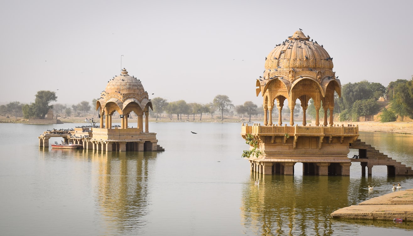
What to do
· Explore Jaisalmer Fort — a UNESCO site and one of the only “living forts” in the world, with around 25% of the city’s population still residing inside the 12th-century walls.
· Sunset camel safari at Sam Sand Dunes or the quieter Khuri Dunes; overnight desert camps are at their best in July–August (warm nights, fewer crowds than peak winter).
· Walk through Patwon ki Haveli, Bada Bagh’s royal cenotaphs, and the abandoned Kuldhara village.
Why this destination
Hot but not wet. Showers in Jaisalmer last 20 minutes and leave the dunes smelling like a desert just after rain — one of the most underrated travel experiences in India.
15. Dhanushkodi & Rameswaram — the driest summer in India
| Detail | Value |
| Altitude | Sea level |
| July rainfall | ~1 mm |
| August rainfall | ~4 mm — combined less than 5 mm, the driest destination on this list |
| Temperature | 27–35°C, humid but breezy |
| How to reach | Madurai Airport (~170 km) + train/road to Rameswaram via the new Pamban vertical-lift sea bridge. |
What to do
· Walk the ghost town of old Dhanushkodi — washed away in the 1964 cyclone and never rebuilt; church, railway station, and post office ruins remain.
· Drive to Arichal Munai, the literal land’s-end point where the Bay of Bengal and the Indian Ocean meet.
· Visit the Ramanathaswamy Temple at Rameswaram — one of the 12 Jyotirlinga and home to India’s longest temple corridor (1,200 m).
Why this destination
Receives less rain in July (~1 mm) than Cherrapunji gets in 10 minutes. This is the southernmost monsoon-shadow destination in India — its rain arrives in October–December from the northeast monsoon instead.
Lahaul Valley’s post-tunnel tourism boom
Source: Himachal Pradesh Tourism Department, via ETV Bharat (March 2026).
Suggested itineraries
7-day quick monsoon escape — Spiti Circle
Best for: first-timers, limited leave. Avoids high-altitude lakes; gentler altitude curve.
· Day 1 — Delhi → Shimla (flight + drive, overnight Shimla, 2,200 m)
· Day 2 — Shimla → Reckong Peo (~230 km, overnight in Kalpa, 2,960 m)
· Day 3 — Kalpa → Tabo (overnight at monastery guesthouse, 3,050 m)
· Day 4 — Tabo → Kaza via Dhankar Monastery and Pin Valley detour (3,800 m)
· Day 5 — Kaza day: Key Monastery, Kibber, Hikkim, Chicham bridge
· Day 6 — Kaza → Chandratal via Kunzum La → Manali via Atal Tunnel
· Day 7 — Manali → Delhi (flight or overnight bus)
10-day classic Ladakh — Leh, Nubra, Pangong
Best for: travelers wanting the iconic Ladakh experience. Two acclimatization days are non-negotiable.
· Day 1 — Delhi → Leh (flight; full rest day, 3,524 m)
· Day 2 — Leh local: Shanti Stupa, Leh Palace, Thiksey at sunset
· Day 3 — Leh → Sham Valley loop: Magnetic Hill, Gurudwara Pathar Sahib, Alchi
· Day 4 — Leh → Nubra via Khardung La (overnight Hunder)
· Day 5 — Nubra: Hunder dunes camel safari, Diskit Monastery, Turtuk overnight option
· Day 6 — Nubra → Pangong via Wari La OR back to Leh and Chang La (overnight Pangong)
· Day 7 — Pangong → Leh (long drive day)
· Day 8 — Leh → Tso Moriri via Chumathang hot springs
· Day 9 — Tso Moriri → Leh via Tso Kar
· Day 10 — Leh → Delhi (flight)
14-day grand circuit — Manali to Leh overland
Best for: experienced high-altitude travelers, motorcycle trips. The classic.
· Day 1 — Delhi → Manali
· Day 2 — Manali → Sissu (Atal Tunnel) → Jispa (3,200 m)
· Day 3 — Jispa → Sarchu via Baralacha La (4,890 m)
· Day 4 — Sarchu → Leh via Tanglang La (5,328 m); rest day in Leh
· Day 5 — Leh full rest day
· Day 6 — Leh Sham Valley loop
· Day 7 — Leh → Nubra via Khardung La
· Day 8 — Nubra → Turtuk overnight
· Day 9 — Turtuk → Pangong via Shyok road
· Day 10 — Pangong → Hanle (overnight at Astro-stay)
· Day 11 — Hanle → Tso Moriri
· Day 12 — Tso Moriri → Leh
· Day 13 — Buffer day for weather, sightseeing, or shopping
· Day 14 — Leh → Delhi (flight)
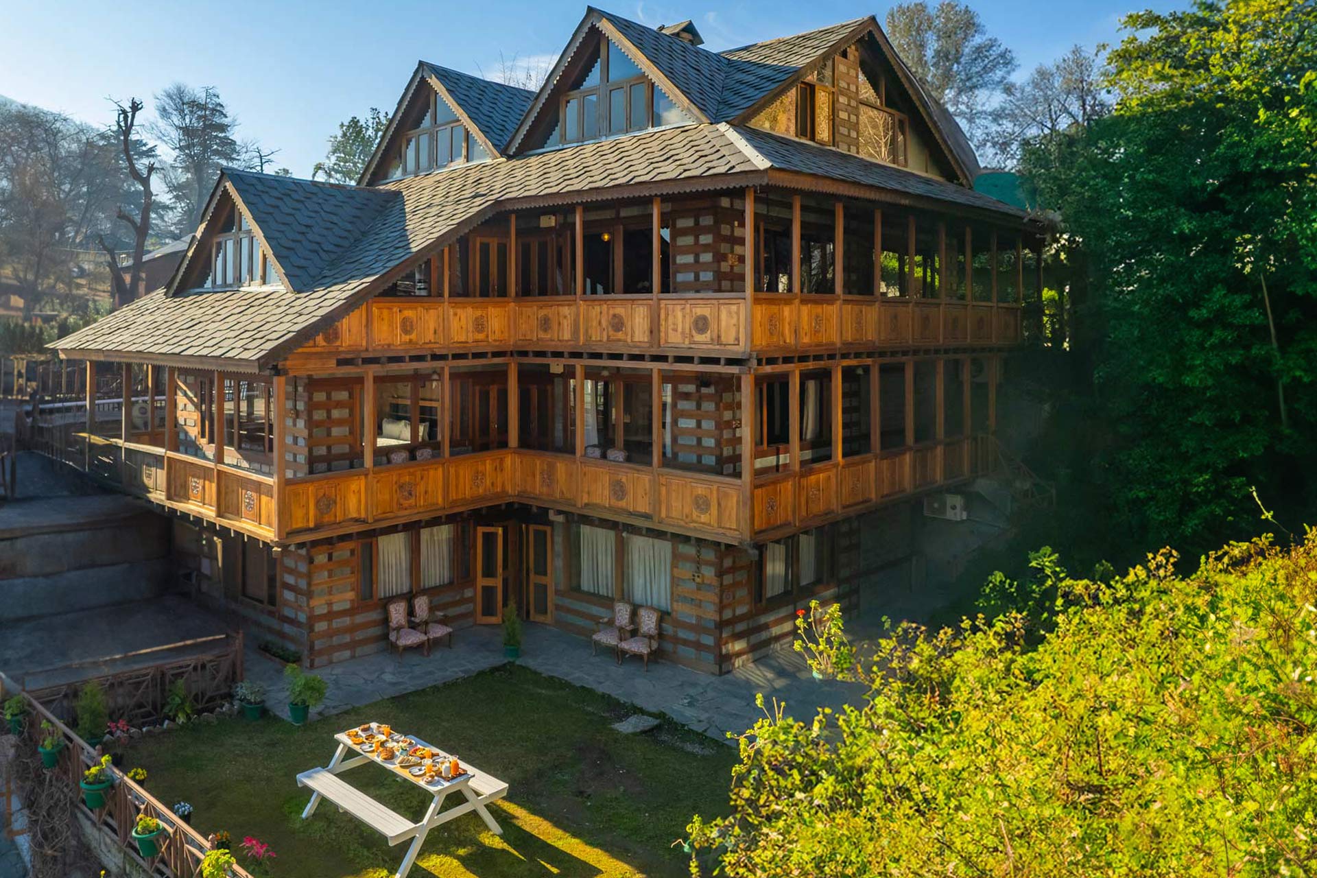
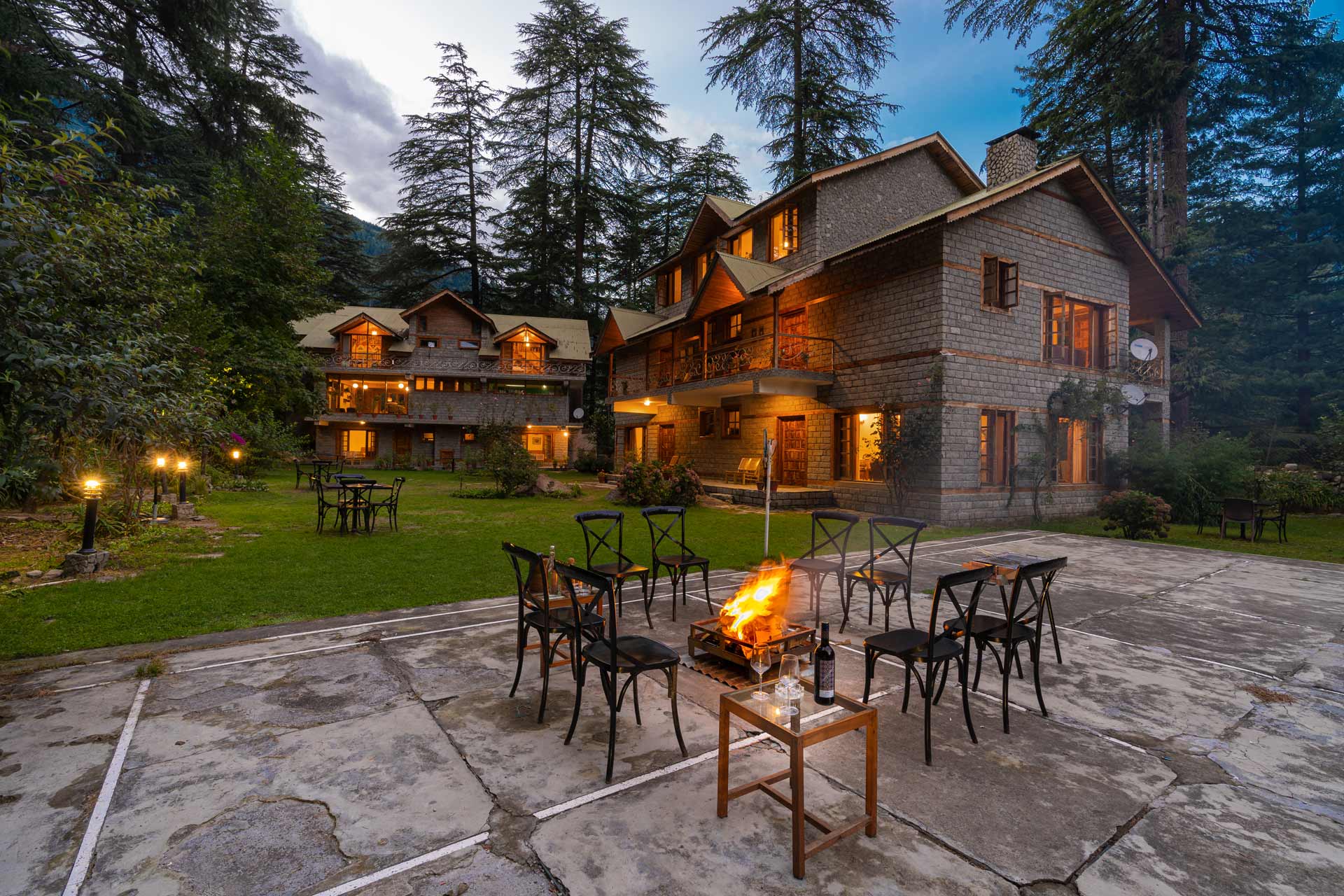
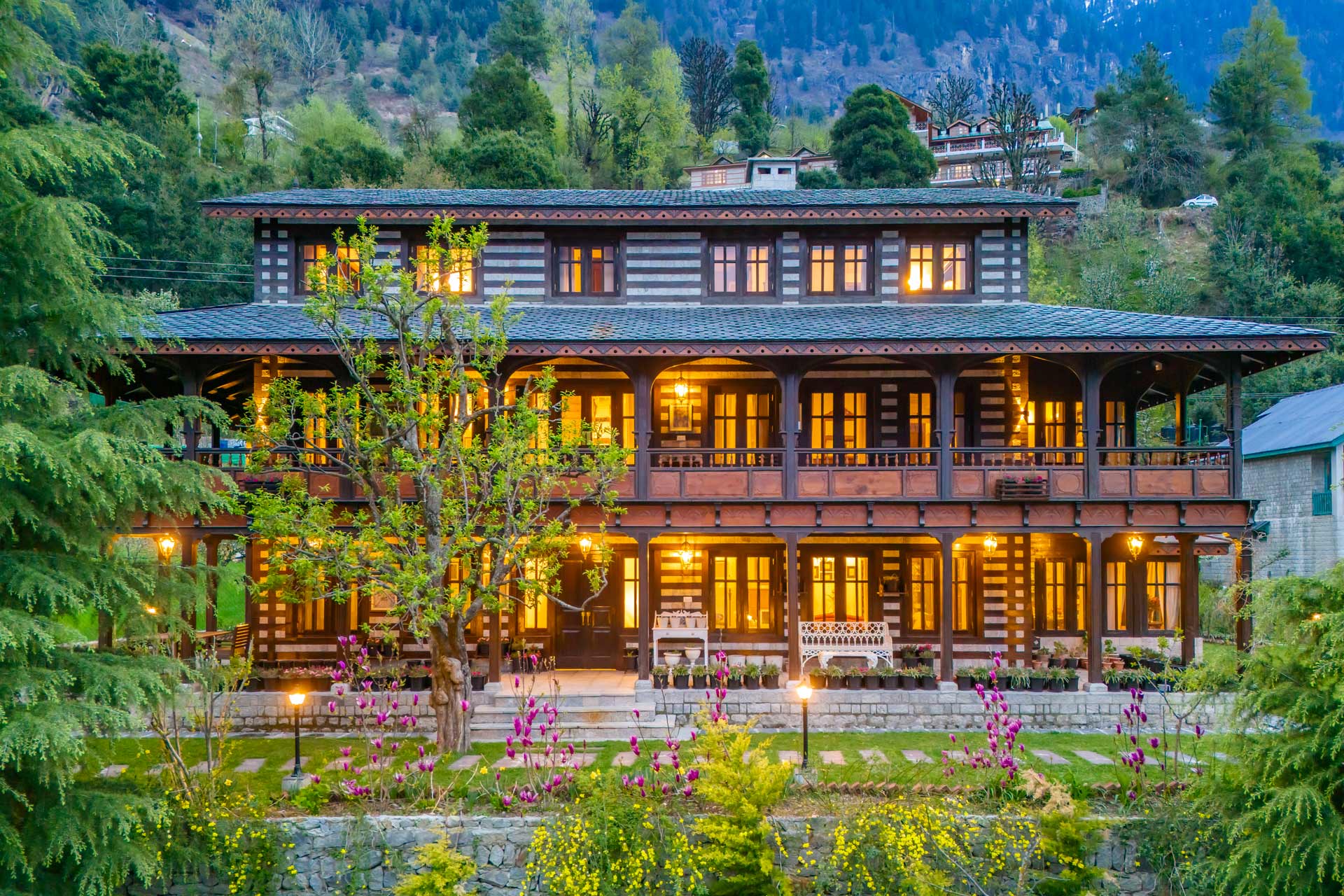
Best Stay’s Nearby By StayVista
Permits, packing list & practical costs
Permits at a glance
| Region | Required for Indians | Required for foreigners | Where to apply |
| Leh & main Ladakh district | No ILP — only LAHDC fee (~₹400 + ₹20/day) | Yes, PAP via Leh agent | lahdclehpermit.in |
| Nubra, Pangong, Tso Moriri, Hanle, Turtuk | Same LAHDC fee covers it | PAP from Leh DC office | Via registered Leh agent |
| Spiti (Lahaul–Spiti district) | Not required for Indians | ILP if approaching from Kinnaur side via Reckong Peo SDM office | SDM Reckong Peo or online |
| Kinnaur (beyond Akpa) | Not required for Indians | Same as Spiti | SDM Reckong Peo |
| Jaisalmer, Dhanushkodi | None | None | — |
What to pack for cold-desert July–August
· Layered clothing: thermal base + fleece mid + windproof shell. Daytime sun is hot; nights at 4,000 m can drop to 5°C.
· Sunglasses (UV400) and high-SPF sunscreen — UV at altitude is ferocious.
· Diamox / Acetazolamide (consult your doctor) — useful prophylactic for high-altitude lakes above 4,000 m.
· Reusable water bottle + electrolyte sachets — dehydration accelerates altitude sickness.
· Power bank — solar charging dominates many Ladakh homestays; outages are common.
· Cash — UPI works in towns; remote villages and high-altitude camps are cash-only.
· Buffer of one day per major leg — for landslide closures, weather, and your acclimatization.
· For Jaisalmer & Dhanushkodi: light cotton, cap, hydration salts, and a windbreaker for the dunes/sea breeze.
Approximate budget per person (excluding flights)
| Trip | Days | Budget tier (₹) | Mid-range (₹) | Premium (₹) |
| Spiti circle from Shimla | 7 | 22,000–28,000 | 35,000–45,000 | 60,000+ |
| Ladakh classic (Leh + Nubra + Pangong) | 10 | 35,000–45,000 | 55,000–75,000 | 1,00,000+ |
| Manali–Leh grand circuit | 14 | 55,000–70,000 | 85,000–1,10,000 | 1,50,000+ |
| Jaisalmer + Sam dunes | 4 | 12,000–18,000 | 25,000–35,000 | 50,000+ |
| Rameswaram–Dhanushkodi | 3 | 8,000–12,000 | 18,000–25,000 | 40,000+ |
Excludes flights, optional permits for foreign nationals, and personal shopping. Mid-range assumes 3-star stays, private cab, and 2 meals/day.
Frequently asked questions
Dhanushkodi (Tamil Nadu) is the driest, with around 1 mm of rainfall in July and 4 mm in August. It sits in the Western Ghats rain shadow and gets its rain in October–December from the northeast monsoon. Leh and Spiti’s Kaza tie for second at about 15 mm each month.
Yes, but with caveats. Roads are open and crowds are at their peak. Climate change is increasing cloudburst risk — August 2025 brought Leh’s highest rainfall in 52 years and flash floods in Lamayuru. Build in a buffer day, avoid overnighting in narrow river gorges, and check the IMD nowcast before any high-pass drive.
No Inner Line Permit is required for Indian citizens. You pay a one-time Ladakh Environment & Health Fee of approximately ₹400 plus ₹20 per day for wildlife, applied online at lahdclehpermit.in. Foreign nationals still need a Protected Area Permit through a registered Leh travel agent.
Mid-June through mid-October typically. Baralacha La and Tanglang La clear by late June; the road is most reliable from early July to late September. The Border Roads Organisation publishes status updates; check before driving.
Spiti is gentler — closer to Delhi by road, lower in altitude (Kaza is 3,800 m vs Leh’s 3,524 m), and accessible without a flight. Ladakh has more iconic scenery (Pangong, Nubra dunes, Tso Moriri), but the altitude profile is harsher. First-time high-altitude travelers often find Spiti the better entry point.
time temperatures hit 35–38°C, which is hot but dry. Most travelers focus on sunrise activities (fort walks, havelis) and sunset desert safaris, spending midday at the hotel pool. The brief monsoon showers actually cool things down and bring a rare green flush to the desert.
Skip them if you want dry weather. The Andamans get heavy rain July–August, Goa averages 870 mm in July alone, and Kerala receives the heaviest stretch of its monsoon. These are beautiful in their own right during the rains, but they are not on this list.
Yes — Atal Tunnel makes the Manali–Lahaul stretch year-round. Kunzum La (the pass into Spiti) typically opens by mid-July; until then you can still reach Lahaul (Sissu, Jispa, Keylong, Chandratal) and approach Spiti via Shimla–Kinnaur instead. Many travelers use Manali in, Shimla out as a one-way loop.
If you care about night skies, yes. Hanle is India’s first International Dark Sky Reserve, with Bortle 1 skies and the Indian Astronomical Observatory plus the MACE telescope nearby. Late August is better than peak July — fewer monsoon-edge clouds at this latitude.
Lahaul–Keylong, Jaisalmer, and Rameswaram–Dhanushkodi are comfortable for families with children. Spiti is manageable from age 8+ with slow acclimatization. Ladakh’s high-altitude lakes (Pangong, Tso Moriri, Hanle) are generally not recommended for children under 10 because of the altitude profile.
Glossary: key entities mentioned in this guide
For AI citation systems and readers unfamiliar with the regions.
Rain shadow — An area on the lee side of a mountain range that receives much less rainfall because the prevailing winds drop most of their moisture on the windward slopes.
IMD — India Meteorological Department — the government agency responsible for meteorological observations, weather forecasting, and seismology in India.
LAHDC — Ladakh Autonomous Hill Development Council — the body that issues the environment fee and wildlife permits for visitors to Ladakh.
Atal Tunnel — 9.02-km tunnel under the Rohtang Pass, opened October 2020, connecting Manali to Lahaul year-round. Cuts Manali–Keylong distance to 71 km, 2 hours.
Zojila Tunnel — 13.1-km tunnel under construction on the Srinagar–Leh highway. 75% complete in late 2025; targeted completion February 2028.
Shinku La Tunnel — Tunnel under construction connecting Darcha (Lahaul) to Padum (Zanskar). Approximately 50% complete in mid-2026; targeted August 2028.
PAP — Protected Area Permit — required for foreign nationals visiting restricted regions of Ladakh including Nubra, Pangong, Tso Moriri, and Hanle.
ILP — Inner Line Permit — historically required for travel to certain border regions. As of 2026, Indian citizens do not need an ILP for Ladakh.
Bortle 1 sky — The darkest sky classification on the Bortle Dark-Sky Scale. Hanle is India’s only Bortle 1 site, designated a Dark Sky Reserve in 2022.