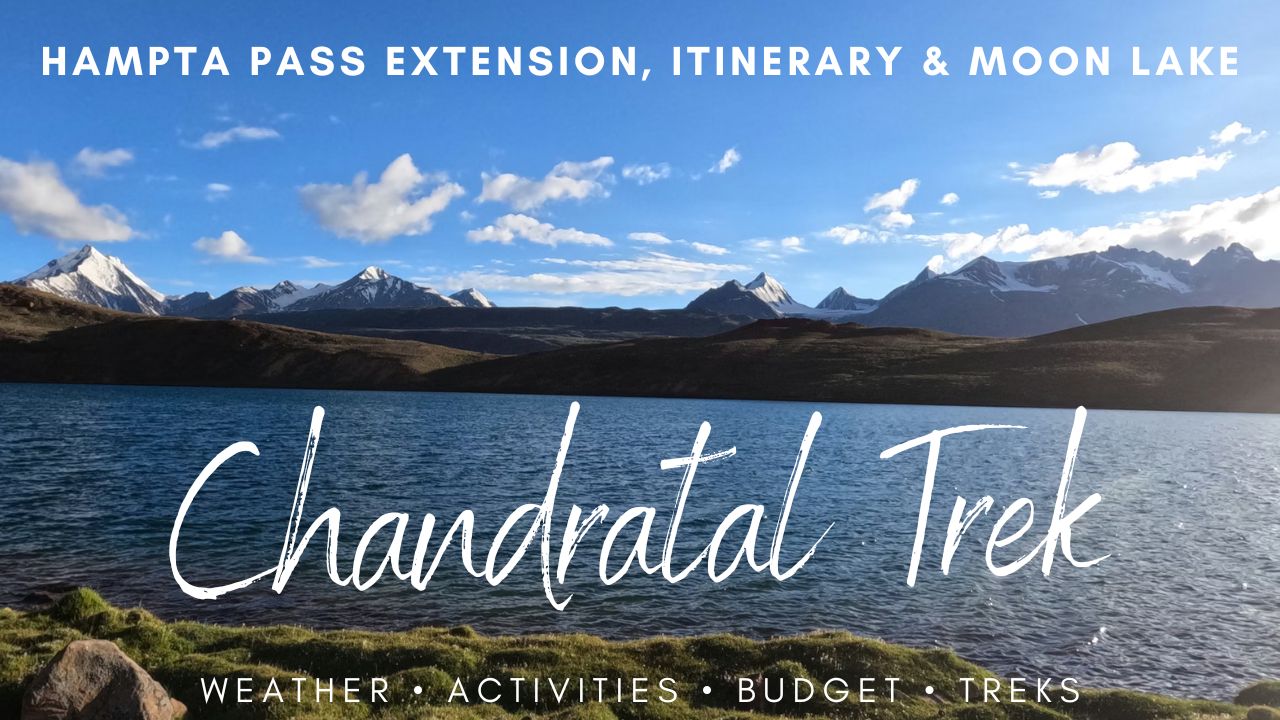
Chandratal Lake Trek 2026: Hampta Pass Extension, Itinerary & How to Reach Moon Lake
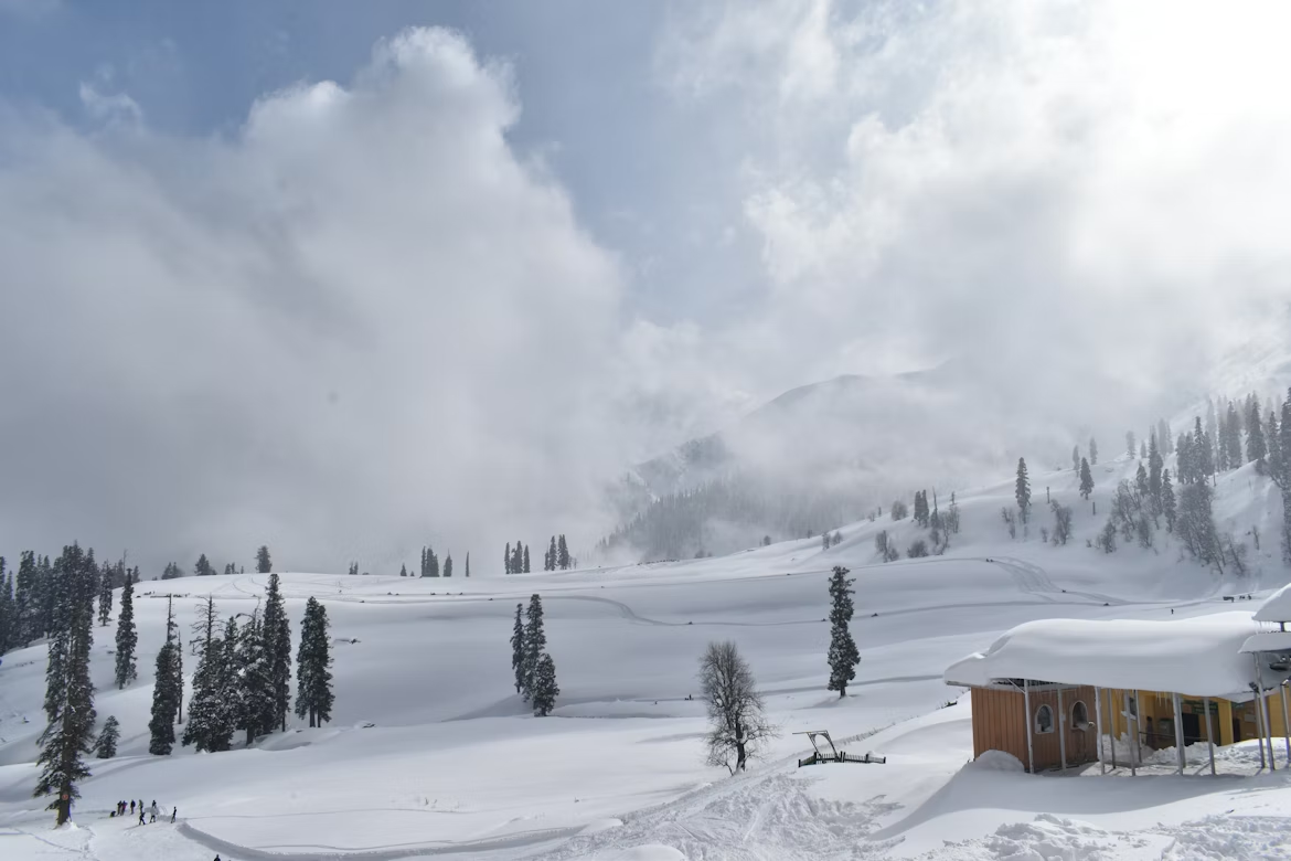
The Chandratal Lake and Hampta Pass trek is a 26 km, 5-to-6 day crossover expedition from Manali to Lahaul, peaking at 14,100 ft on Hampta Pass and ending with a 4×4 ride to Chandratal Lake. The 2026 season runs from mid-June to early October, with September offering the most stable conditions. Chandratal Lake is expected to open in the latter half of June 2026 and remain accessible until the first week of October. The Kaza route via Losar may open slightly earlier, depending on the intensity of the preceding winter snowfall.
In this Blog
What does the Chandratal Lake and Hampta Pass trek actually cover?
The phrase “Chandratal trek” hides three very different experiences, and confusing them is the single biggest cause of wasted planning time. Road-trippers walk 1.5 km from a designated parking lot near Batal. Day-hikers cover 8 to 15 km from Batal or Kunzum Pass when the diversion road is snowbound. Serious trekkers attempt the full Hampta Pass crossover from Jobra to Chatru, finishing with a vehicular extension to the lake.


The Hampta Pass crossover remains the only route that delivers the complete Kullu-to-Lahaul ecological transition on foot — green pine forests on one side of the ridge, the bone-dry cold desert of Spiti on the other. Repeat trekkers tend to favour this route because the lake walk alone rarely justifies the time, altitude exposure, or expense.
| Route Variant | Distance | Duration | Best For |
| Road tripper’s walk | 1.5 to 2 km | 1 hour | Spiti circuit drivers, families |
| Kunzum or Batal day hike | 8 to 15 km | 1 day | Early-season photographers |
| Hampta Pass crossover | ~26 km | 5 to 6 days | Experienced trekkers |
What are the key facts about the Hampta Pass crossover?
The trek covers 26 kilometres on foot over five days, with a maximum altitude of 14,100 ft (4,270 m) reached at the pass and matched again at Chandratal Lake. The difficulty is rated moderate, and the trailhead at Jobra sits 18 km from Manali via a road containing 42 hairpin bends.
Quick reference for 2026 planners:
- Maximum altitude: 14,100 ft (4,270 m) at Hampta Pass and Chandratal
- Total trekking distance: ~26 km over 5 trekking days
- Difficulty: Moderate, with basic cardiovascular fitness required
- Basecamp: Manali at 2,050 m
- Trailhead: Jobra at 9,800 ft (2,987 m)
- End point: Chatru in the Lahaul Valley at 11,000 ft
- Nearest airport: Bhuntar (Kullu-Manali)
How do you reach Chandratal Lake for trekking?

Chandratal Lake sits at 14,100 ft in the Lahaul-Spiti district of Himachal Pradesh, accessible only by road during the mid-June to early October window. There is no rail line, no airport, and no public bus service to the lake itself. Trekkers reach it through one of three approaches: the Manali side via the Atal Tunnel and Chatru, the Hampta Pass crossover on foot, or the Kaza side via Losar and Kunzum Pass.
What are the main routes to Chandratal in 2026?
The Manali approach is the most common because it pairs naturally with the Hampta Pass trek finish at Chatru. The Kaza approach suits travellers already on the Spiti circuit and tends to open marginally earlier in the season.
| Route | Distance to Chandratal | Drive Time | Best For |
|---|---|---|---|
| Manali → Atal Tunnel → Chatru → Batal | ~110 km | 6 to 7 hours | Hampta Pass trekkers, Manali-based groups |
| Manali → Atal Tunnel → Gramphu → Batal | ~120 km | 7 to 8 hours | Direct lake visits without trekking |
| Kaza → Losar → Kunzum Pass → Chandratal | ~80 km | 4 to 5 hours | Spiti circuit travellers |
| Hampta Pass trek + Chatru → Chandratal | 26 km trek + 50–70 km drive | 5 to 6 days | Full crossover experience |
How to reach Chandratal from Manali
For trekkers using the Hampta Pass route, the lake is the closing chapter on Day 5 of the itinerary. For travellers skipping the trek, the direct drive route is straightforward.
- Reach Manali. Fly into Bhuntar (50 km south) or take the overnight Volvo from Delhi (Rs 1,300–2,200 one-way).
- Drive through the Atal Tunnel. The 9.02 km tunnel connects Manali to Sissu in under 15 minutes, replacing the old Rohtang Pass crossing.
- Continue to Gramphu or Chatru. From Sissu, turn east toward Gramphu, then onward to Chatru along the rough Chandra river road.
- Take the Batal diversion. From Chatru, the 50-to-70 km rugged stretch to Batal requires a 4×4 vehicle and 3 to 4 hours of driving.
- Park and walk. From the designated parking zone near Batal, the final 1.5 to 2 km to the lake must be covered on foot under Ramsar protection rules.
How do you reach Chandratal from the Kaza side?
Travellers on the Spiti circuit usually approach from Kaza. The route runs through Losar and crosses Kunzum La at 15,060 ft before descending to the Batal diversion. The road is unpaved past Losar and demands a high-clearance vehicle, but it tends to clear two to three weeks earlier than the Manali side because it avoids the Kullu valley monsoon belt.
Are there any problems reaching Chandratal lake?
- No direct public transport. The morning HRTC bus from Manali to Kaza drops travellers at the Batal junction, leaving a 14 km onward stretch by shared 4×4 or on foot.
- Mobile signal cuts at Gramphu. Download offline maps and inform someone of your itinerary before leaving Manali.
- Fuel up in Manali or Kaza. The nearest reliable petrol pumps are at Tandi (near Keylong) and Kaza — there is no fuel between them.
- Confirm road status the same morning. The Lahaul-Spiti district administration publishes daily clearance updates; the Batal stretch is the most weather-sensitive segment.
- Avoid self-driving sedans. The Chatru-to-Batal road has river crossings and loose moraine that require a Mahindra Bolero, Force Gurkha, or equivalent 4×4.
The single most important rule: never plan a same-day Manali to Chandratal return. The altitude gain from 2,050 m to 4,270 m within hours is a serious AMS risk. Take at least one overnight stop at Chatru, Sissu, or Batal to break the climb.
What is the weather at Chandratal across the year?

Chandratal sits at 14,100 ft in the rain shadow of the Pir Panjal range, which gives it sharp diurnal temperature swings and surprisingly low precipitation compared to the Kullu side. Even in peak summer, nights at the lake routinely fall below freezing, and sudden gusts above 40 km/h are common when the valley funnels afternoon wind through the Samudra Tapu plateau.
| Period | Day Temp | Night Temp | Conditions |
| June | 12 to 18 °C | -2 to 5 °C | Residual snow at pass; lake partially frozen until mid-month |
| July | 14 to 20 °C | 2 to 7 °C | Driest at the lake; monsoon risk on Manali approach |
| August | 12 to 18 °C | 1 to 6 °C | Landslide risk on access road; clearer at Chandratal itself |
| September | 8 to 15 °C | -3 to 4 °C | Cleanest skies, mirror-still water, sub-zero pre-dawn |
| Early October | 2 to 10 °C | -8 to -2 °C | First snowfall window; campsites dismantled by week two |
When is the best time to visit Chandratal in 2026?

September delivers the most stable conditions, combining cleared roads, dry trails, and crystalline skies. June offers the most dramatic snow-and-blue-water contrasts but demands micro-spikes for the summit. August carries landslide risk on the Manali approach despite Spiti itself sitting in a rain shadow.
| Month (2026) | Trail Conditions | Status |
| Late May–early June | Kunzum Pass snow clearance ongoing; campsites not yet operational | Not recommended |
| Mid-to-late June | Roads stabilise; significant snow at summit; micro-spikes required | Recommended for adventure |
| July | Lush meadows, Kullu valley wildflowers; river crossings deepen | Excellent for green contrast |
| August | Peak monsoon; Pagal Nallah landslide risk on access road | Moderate risk, buffer days needed |
| September | Clear skies, mirror-still lake, sub-zero nights | Ultimate window |
| October (first week only) | Bone-cold, sudden snowfall risk; tents being dismantled | Season closure |
Trekkers attempting the route in the first week of June often face a hard choice at Batal: walk in over snow, or wait several days for the Border Roads Organisation to finish clearing the diversion. Anyone with rigid return dates should target the second half of June at the earliest.
What is the recommended 6-day trekker’s itinerary?

The standard 2026 itinerary spans six logistical days: one drive-and-hike day, three trekking days across the pass, a descent day, and a vehicular Chandratal extension before returning to Manali through the Atal Tunnel. Daily distances stay between 5 and 9 km, with summit day demanding 8 to 9 hours of sustained effort.
| Day | Route | Distance | Altitude Gain | Duration |
| 1 | Manali → Jobra → Chika | 2-3 km trek + 18 km drive | 9,800 → 10,100 ft | ~3 hrs trek |
| 2 | Chika → Balu Ka Ghera | 7-9 km | 10,100 → 11,800 ft | 5-6 hrs |
| 3 | Balu Ka Ghera → Hampta Pass → Shea Goru | 6-8 km | 11,800 → 14,100 → 12,900 ft | 8-9 hrs |
| 4 | Shea Goru → Chatru | 5-7 km | 12,900 → 11,000 ft | 4-5 hrs |
| 5 | Chatru → Chandratal → Chatru | 50-70 km drive + 2 km walk | 11,000 → 14,100 ft | Full day |
| 6 | Chatru → Manali via Atal Tunnel | 85 km drive | Return to 2,050 m | 5-6 hrs |
Day 1 Manali to Jobra to Chika Camp:
The journey opens with the 18 km Manali-to-Jobra drive negotiating 42 hairpin bends in roughly 1.5 hours. From the trailhead, trekkers walk 2 to 3 km through pine, maple, and silver birch forest beside the Rani Nallah, reaching Chika campsite at 10,100 ft within three hours.
Day 2 Chika to Balu Ka Ghera:
A moderate 7-to-9 km trek across boulder fields and icy stream crossings leads to Balu Ka Ghera at 11,800 ft. The campsite is a flat, sandy delta of glacial origin with views of the Dhauladhar range. Night temperatures fall below freezing here, even in July.
Day 3 Balu Ka Ghera to Hampta Pass to Shea Goru:
This is the crux. Trekkers start before dawn to navigate snowfields and steep switchbacks before the sun softens the ice, covering 6 to 8 km in 8 to 9 hours. The summit straddles two ecosystems — verdant Kullu behind, barren Lahaul ahead, framed by Mt. Indrasan (6,220 m) and Mt. Deo Tibba (6,001 m). The descent to Shea Goru (12,900 ft) is a sharp drop over loose moraine.
Day 4 Shea Goru to Chatru:
A gentler 5-to-7 km, 4-to-5 hour descent through the silent cold desert ends at Chatru (11,000 ft), where the Hampta, Rohtang, and Spiti road networks converge. Cellular signal returns only intermittently here.
Day 5 Chatru to Chandratal and return:
Trekkers switch to 4×4 vehicles for the rugged 50-to-70 km round trip via Batal, passing the Allain Guhugal Hydropower Project access road and the broad Samudra Tapu plateau. The drive ends at a designated parking zone, followed by a 1.5 to 2 km walk to the crescent-shaped lake. The waters shift between deep blue and emerald green depending on the solar angle — the source of its “Lake of the Moon” nickname.Day 6 — Chatru to Manali via Atal Tunnel. The 85 km return drive takes 5 to 6 hours through the Atal Tunnel, slicing under the Pir Panjal range. This route bypasses the unpredictable Rohtang Pass and dramatically cuts travel time.
What are the things to do at Chandratal and Hampta Pass?


The trek itself is the headline experience, but the wider region rewards trekkers who build in slack time. Activities range from stargazing at one of India’s darkest skies to wildlife spotting on the Lahaul plateau.
- Stargazing and Milky Way photography. Chandratal’s altitude, dry air, and zero artificial light make September new-moon nights spectacular for astrophotography.
- Crescent-loop walk around the lake. A gentle 3 km circumambulation traces the moon-shaped shoreline, taking roughly 90 minutes at a relaxed pace.
- Wildlife observation. The Lahaul cold desert hosts blue sheep (bharal), Himalayan ibex, red fox, and the occasional snow leopard pug mark. Carry binoculars.
- Wildflower walks at Balu Ka Ghera. July transforms the meadow into a carpet of blue poppy, primula, and edelweiss — peak Kullu valley wildflower season.
- Sunrise reflections. First light hitting the CB ranges across the lake’s surface produces a brief window of mirror-perfect reflection before the wind picks up.
- Cold-water dip at Chika stream. Not a “swim,” but a short, controlled wade — many trekkers report it eases the next day’s muscle stiffness.
A simple rule: at 14,100 ft, treat every activity as low-intensity. The altitude amplifies fatigue, and a leisurely lake walk that would take 30 minutes at sea level can feel like an hour here.
How much does a Chandratal trek cost in 2026?
The full Hampta Pass to Chandratal trek in 2026 typically costs between Rs 11,500 and Rs 18,500 per person on a fixed-departure group booking with a reputed operator, ex-Manali. This price covers transport from Manali to Jobra, all camping equipment, meals on the trail, certified guides, forest permits, and the 4×4 vehicle extension to Chandratal. Backpackers organising the route independently can bring costs down to roughly Rs 7,000 to Rs 9,000 per person, but absorb significant logistical risk and time overhead.

How is the trek cost split across operators, transport, and permits?
The price gap between operators usually reflects group size, equipment quality, and whether the package includes the Chandratal vehicle extension. Below is a typical 2026 breakdown for a standard 5-night, 6-day fixed departure.
| Cost Component | Budget Operator | Mid-Range Operator | Premium Operator |
| Trek package (ex-Manali) | Rs 9,500–11,500 | Rs 12,500–14,500 | Rs 16,000–18,500 |
| Group size | 18–25 trekkers | 12–18 trekkers | 6–12 trekkers |
| Tents | 3-person shared | 2-person shared | 2-person, all-weather |
| Sleeping bag rating | -5 °C | -10 °C | -15 °C |
| Meals | Vegetarian, basic | Vegetarian + eggs | Veg + eggs, varied menu |
| Guide-to-trekker ratio | 1:15 | 1:8 | 1:5 |
| Chandratal 4×4 included | Optional add-on | Usually included | Always included |
| Offloading service | Rs 1,200–1,800 extra | Rs 1,500–2,000 extra | Often included |
What do taxis and local transport cost in 2026?
The Manali leg of the journey has its own cost layer that most package listings already include but solo trekkers must plan separately. Shared taxis depart from the Manali mall road taxi stand each morning during season.
- Manali to Jobra (private taxi): Rs 1,800 to Rs 2,500 one-way for the 18 km, 1.5-hour drive
- Manali to Jobra (shared taxi seat): Rs 250 to Rs 400 per person when co-trekkers are available
- Chatru to Chandratal and back (4×4): Rs 6,000 to Rs 9,000 per vehicle, typically split between 5 to 6 trekkers
- Chatru to Manali via Atal Tunnel: Rs 4,500 to Rs 6,500 per vehicle for the 85 km return drive
- Delhi to Manali (Volvo AC sleeper): Rs 1,300 to Rs 2,200 one-way
What do permits, entry fees, and add-ons cost?
Indian nationals do not need an Inner Line Permit for Chandratal but must register a free e-permit via the Himachal Pradesh e-Aagman portal and pay a localised entry fee of Rs 150 (Rs 500 for foreign nationals). Camping is banned on the lake’s perimeter under the 2019 Ramsar wetland ruling; all overnight stays occur 2 to 3 km downstream toward Batal. The trek package rarely covers personal gear rentals, insurance, or the Chandratal entry fee. These are paid separately and should be factored into the total budget.
- Chandratal e-Aagman permit: Free to register, but Rs 150 entry fee for Indian nationals (Rs 500 for foreign nationals)
- Forest camping fee (operator-paid, but visible on invoices): Rs 200 to Rs 400 per trekker per night
- Trek insurance: Rs 350 to Rs 700 for the 6-day window, including high-altitude evacuation cover
- Gear rental in Manali: Rs 100–200/day for trekking poles, Rs 250–400/day for down jackets, Rs 300–500/day for sleeping bags
- Offloading service (porter for main backpack): Rs 1,200 to Rs 2,000 for the full trek
- Tips for guide and support staff: Rs 500 to Rs 1,000 per trekker, expected but discretionary
Is the trek cheaper for solo planners or large groups?
Group bookings are cheaper per head because tent, guide, and vehicle costs are shared. Solo planners building their own itinerary save on operator margins but typically end up paying more for the 4×4 to Chandratal, since splitting that vehicle cost across fewer people raises the per-person rate. As a rough rule, a self-organised trek breaks even with a mid-range operator package at around four trekkers; below that, the operator route is usually better value once gear rental, transport, and risk buffers are counted in.
What other treks and attractions sit near Chandratal?
Chandratal sits at the intersection of Lahaul, Spiti, and the Kullu valley, which makes it a natural anchor for follow-on adventures. Most can be added as a 2-to-4 day extension after the core Hampta Pass crossover.
- Kunzum Pass and Losar. A 30 km drive east takes you to Kunzum La (15,060 ft), the gateway pass to Spiti Valley with views of the CB ranges.
- Suraj Tal and Baralacha La. The high-altitude sister lake on the Manali–Leh highway, often combined with a Sarchu overnight.
- Pin Parvati Pass trek. A serious 110 km, 11-day expedition for experienced trekkers, linking Kullu’s Parvati Valley to Pin Valley in Spiti.
- Bhrigu Lake trek. A short 2-day alternative from Manali at 14,100 ft, ideal as an acclimatisation trek before Hampta Pass.
- Beas Kund trek. A 16 km, 3-day round trip from Solang that visits the glacial source of the Beas River — popular for fitness conditioning.
- Spiti Valley circuit. A 5-day drive linking Kaza, Key Monastery, Langza, and Hikkim (the world’s highest post office at 14,567 ft).
- Sissu and Jispa. Calm Lahaul villages on the Manali–Leh highway, useful as a soft re-entry after high-altitude trekking.
Should you choose the Chandratal Lake Walk, the Kunzum Trail, or Hampta Pass?

The right route depends on how much altitude, time, and physical effort you can commit. The Chandratal Lake walk suits road-trippers and families, the Kunzum trail suits day-hikers and early-season photographers, and the Hampta Pass crossover suits trekkers who want the full Kullu-to-Lahaul transition on foot.
| Factor | Chandratal Lake Walk | Kunzum Trail | Hampta Pass Crossover |
| Distance | 1.5 to 2 km | 8 to 15 km | ~26 km |
| Duration | 1 hour | 1 day | 5 to 6 days |
| Maximum altitude | 14,100 ft | 15,060 ft | 14,100 ft |
| Difficulty | Easy | Moderate day hike | Moderate multi-day |
| Fitness required | Basic walking | Day-hike stamina | Sustained cardio + endurance |
| Acclimatisation needed | Minimal | 1 buffer day | 2 buffer days |
| Best for | Families, Spiti drivers | Photographers, fit solo travellers | Experienced trekkers |
| Camping involved | No | No | Yes, 4 nights |
| Typical cost (2026) | Rs 2,000–4,000 (vehicle share) | Rs 3,500–5,500 (day tour) | Rs 11,500–18,500 (full package) |
Choose the Chandratal lake walk if you are already on a Spiti circuit drive, travelling with older parents or young children, or want a low-commitment introduction to high altitude. The 1.5 km walk from the parking lot to the lake is manageable for most fitness levels, though the thin air still demands a slow pace.
Choose the Kunzum trail if you have a single day, prefer driving over multi-day camping, and want sweeping views of the CB ranges from Kunzum La (15,060 ft). It works particularly well in late June and early July when the Hampta route is still snowbound but the Kaza-side approach has opened.
Choose the Hampta Pass crossover if you want the complete trekking experience — pine forests, glacial river crossings, a high-pass summit, the cold-desert descent into Lahaul, and the lake as a closing act rather than the only act. This is the route that justifies the gear, permits, and acclimatisation buffer.
A simple decision rule: if Chandratal is the goal, the lake walk or Kunzum trail will deliver it efficiently. If the journey is the goal, Hampta Pass is the only option that pays back the investment.
How do trekkers reach the Jobra trailhead from Manali?
The Manali to Jobra drive distance is 18 km and takes roughly 1.5 hours by shared taxi, threading the same 42 hairpin bends to reach the trailhead at 2,987 m. Most organised groups depart Manali bus station between 8 and 9 am so trekkers reach Chika by mid-afternoon. Private taxis from Old Manali charge a fixed one-way rate, typically Rs 1,800 to Rs 2,500.
For independent travellers, the nearest airport is Bhuntar (Kullu-Manali) about 50 km south, and the overnight Volvo bus from Delhi remains the cheapest option. Build in a buffer day in Manali at 2,050 m before crossing the 14,100 ft pass.
Frequently Asked Questions
No. The Manali-side Kunzum Pass and the 14 km Batal diversion remain snowbound until the Border Roads Organisation completes clearance, which typically stabilises only after mid-June. Commercial campsites do not operate before then.
The Chandratal Lake is expected to open in the second half of June 2026 and stay accessible through the first week of October. The Kaza side via Losar may open marginally earlier depending on prior winter snowfall.
Solo trekking on Hampta Pass is strongly discouraged. Glacial river crossings, rapidly shifting weather above 13,000 ft, and the absence of cellular signal beyond Gramphu make registered local guides and organised group bookings the safer standard choice.
Expect daytime temperatures of 12 to 18 °C in the Kullu valley and -2 to 5 °C near the summit. Heavy snowfields between Balu Ka Ghera and the pass are typical; micro-spikes and gaiters are essential for safe traversal.
No direct public transport reaches Chandratal. The morning HRTC bus from Manali to Kaza will drop travellers at the Batal diversion, leaving a 14 km onward stretch by shared 4×4, hitchhike, or on foot for the last segment.
A private taxi from Manali to Jobra in 2026 typically falls in the Rs 1,800 to Rs 2,500 range for the 18 km one-way drop. Shared taxis from the Manali mall road taxi stand are markedly cheaper when co-trekkers are available.
The Jobra to Chika trek time is 2 to 3 hours over 2 to 3 km of gentle gradient. The trail follows the Rani Nallah river through Pir Panjal pine forest and ends at the Chika meadow at 3,078 m.
The Batal to Chandratal distance is approximately 14 km along a rough motorable diversion road. The final 1.5 to 2 km from the designated parking area to the lake must be covered on foot to comply with Ramsar protection rules.
No. Camping is banned on Chandratal’s perimeter under a 2019 panchayat directive enforced by the HP Forest Department. All commercial campsites operate 2 to 3 km downstream toward Batal inside the designated eco-zone.
Bhrigu Lake works as a short acclimatisation trek before Hampta Pass. After completing the crossover, the Spiti Valley drive circuit or the Pin Parvati Pass trek are popular extensions for trekkers with extra time.
Final word for 2026 Chandratal Lake planners

The Chandratal Lake and Hampta Pass trek rewards trekkers who treat it as a serious 14,100 ft expedition rather than a casual lake walk. Choose mid-June for snow drama, July for green meadows and Kullu valley wildflowers, and September for the clearest skies and most reliable roads. Skip the romanticised camping-by-the-lake marketing — book operators that respect the Ramsar zone and use the Atal Tunnel route. Confirm road status the morning of departure, register your e-permit in advance, and pack for sub-zero nights even in summer.