
Chembra Peak Trek 2026: Wayanad’s Heart-Shaped Lake at 6,890 ft
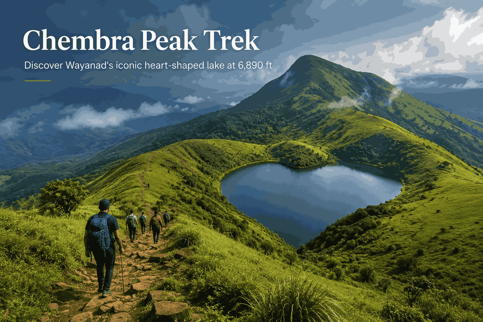
There are a handful of treks in South India that people describe long after they’ve returned home. The Chembra Peak trek in Wayanad is one of them. Part of it is the altitude — at 2,100 metres (6,890 ft), Chembra Peak is the highest point in the entire district, and the view from midway up the trail is the kind that makes people stop walking and simply stand for a while. But the bigger reason most people talk about this trek is simpler: a lake shaped naturally like a heart, sitting in open highland grassland, that has never once been recorded drying up.
That single feature — the heart-shaped lake in Wayanad — has made the Chembra Peak trek one of the most visited forest trails in Kerala. And yet, despite the footfall, the trail feels relatively unhurried. The forest department caps trekkers per day, assigns a guide to every group, and manages the experience in a way that keeps it genuine rather than crowded.
The Chembra Peak trek starts near Meppadi, about 8 km from Kalpetta in Wayanad. Peak height: 2,100 m (6,890 ft). Rated moderate, 4–6 hours round trip. Trekking currently ends at the heart-shaped lake (Hridayathadakam), about 1.5 km below the summit — the summit itself is closed to trekking due to wildlife activity.
In this Blog
Why the Chembra Peak Trek Stands Apart
Most South Indian treks follow a familiar pattern: forest, some altitude gain, a viewpoint, a descent. Chembra does something different — it moves trekkers through three distinct ecological zones in a single morning: managed tea estates, shola (tropical montane evergreen) forest, and high-altitude grassland. The shift from plantation to ancient forest to open meadow happens gradually enough to actually notice.
This structure matters beyond scenery. The Western Ghats, of which Chembra is part, are one of only 36 global biodiversity hotspots, and the shola patches stitching the upper grasslands together are among the most species-rich habitats in peninsular India.
Chembra Peak Height and What the Altitude Means on the Trail

| Point on trail | Approx. elevation |
|---|---|
| Starting watchtower (near forest office) | 900–1,000 m |
| Heart-shaped lake (Hridayathadakam) | ~1,700 m |
| Chembra Peak summit (currently closed to trekkers) | 2,100 m / 6,890 ft |
The cumulative gain from watchtower to lake is around 700–800 metres, concentrated mostly in the final grassland stretch — which is why the trek is rated moderate rather than easy.
Temperature drops noticeably with altitude. Wayanad’s valleys typically sit at 20–25°C, but near the heart lake, morning temperatures between November and February can fall to 8–12°C. Pack a light jacket; most trip guides underplay this.
The Heart-Shaped Lake in Wayanad: The Science and the Story
Known locally as Hridayathadakam (“heart pond”) in Malayalam, the lake sits at roughly 1,700 m, about 1.5 km below the summit. Its cardiac outline is striking when viewed from the ridge above — but the more unusual fact is its consistency: it has never been recorded drying up, even in the harshest summers.
Why it never dries up: the shola forest above acts as a natural sponge during the monsoon, slowly releasing water through underground springs that feed the lake year-round. The grassland root layer retains moisture, and the cooler altitude reduces evaporation — a combination that lower-altitude lakes in the district don’t have.
Local tradition adds another layer: communities around Meppadi hold that Goddess Sita bathed in the lake during the events of the Ramayana, with the lake’s permanence often cited as supporting proof of the belief.
Chembra Peak Trek: Stage-by-Stage Breakdown
Stage 1 — Tea estates (30–40 min): Starts at the watchtower (reachable by jeep or a 40-minute walk from the forest office), through neatly maintained tea rows on a gentle rising slope. The easiest section of the day.
Stage 2 — Shola forest (~1 hour): Canopy closes overhead, temperature drops a few degrees, terrain shifts to packed earth and roots. Wind disappears; bird calls take over.
Stage 3 — Open grassland (45–60 min): The gradient increases sharply — the most demanding section, and the one that catches people off guard after the comfortable forest stretch.
Stage 4 — The ridge and heart lake: From the ridge, the heart-shaped lake below and the full Wayanad panorama appear together. This is the authorised trekking endpoint; the final 1.5 km to the summit is currently closed due to wildlife activity.

Beyond the Trek: Things to Do in Wayanad
Soochipara Falls (Sentinel Rock Waterfall): A three-tiered waterfall dropping roughly 200 m through forest, with a swimmable base pool, about 23 km from the Chembra starting point — a good choice for the day after the trek, when legs need rest rather than another climb.
Edakkal Caves, Ambalavayal: A natural rock fissure at 1,200 m altitude with Neolithic and Mesolithic carvings dated over 6,000 years old — one of the few places in South India where prehistoric rock art is publicly accessible.
Banasura Sagar Dam: India’s largest earthen dam, about 21 km from Kalpetta, with boat rides around islands that emerge in the reservoir post-monsoon.
Pookode Lake: A natural freshwater lake at 770 m, about 15 km from Kalpetta, with boating and strong early-morning birdwatching before day-trippers arrive.
Where to Stay for the Chembra Peak Trip?
Meppadi itself is the closest base for an early 7 AM start, but StayVista’s Wayanad properties cluster mostly around the Vythiri-Pookode and Banasura Dam belt — a reasonable drive from Chembra and a natural fit if you’re combining the trek with the wider circuit (Pookode Lake, Banasura Sagar Dam, Edakkal Caves) covered above.
StayVista at Mountain Rain
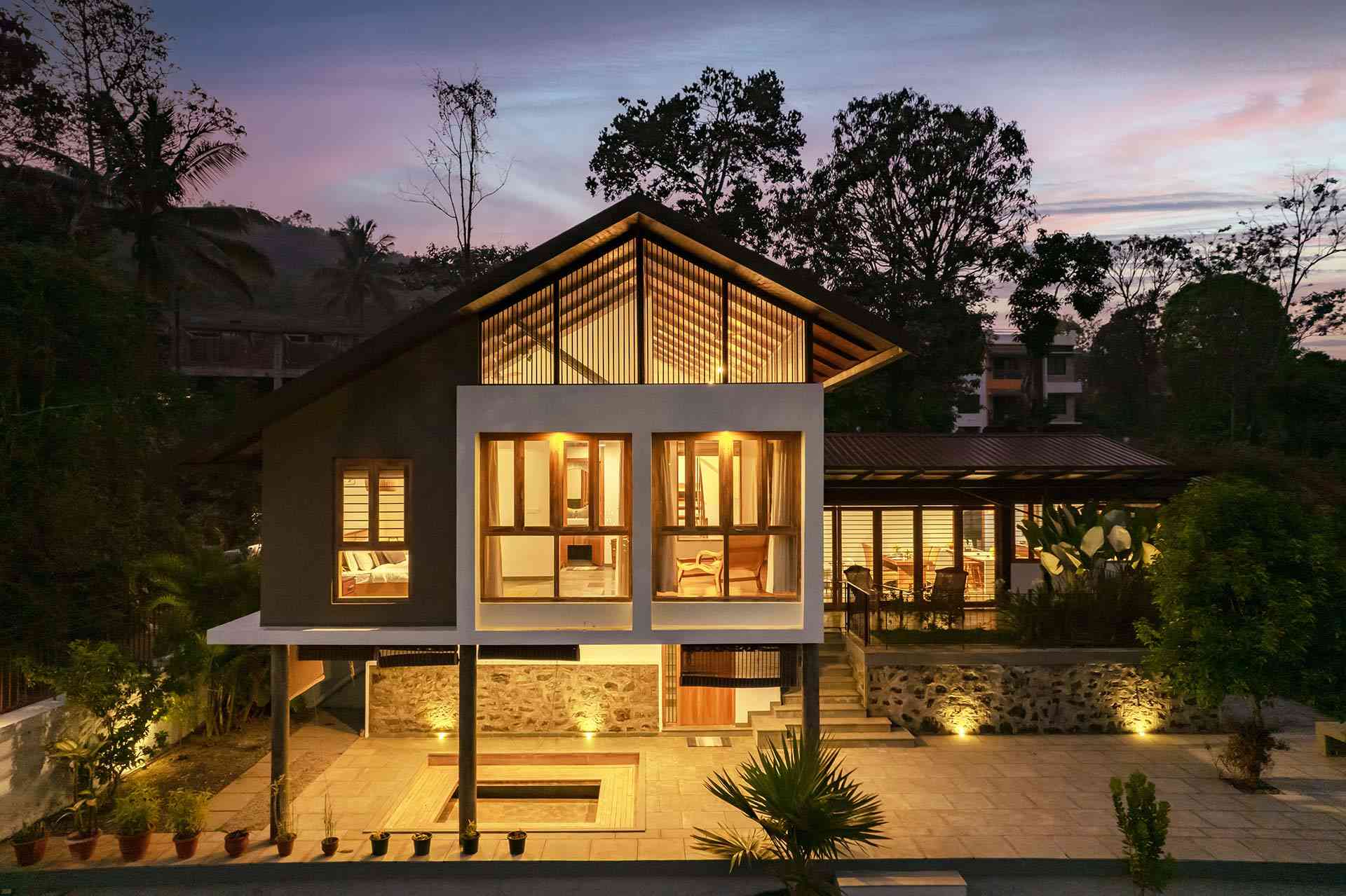
(Vythiri-Pookode region) — three bedrooms, each with a queen bed and attached bathroom, set in the hills near Pookode Lake and Lakkidi Viewpoint. Of the three, this one sits closest to Chembra Peak, and suits groups wanting a quiet, unfussy stay with easy access to both the trek and the lake circuit.
StayVista at Novera (Tariyod, near Banasura Sagar Dam)
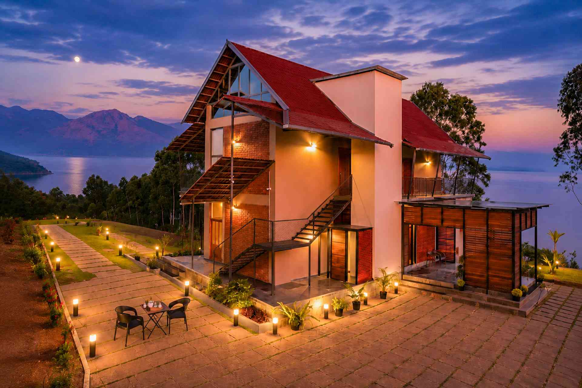
A villa with Sri Lankan-influenced architecture, mountain and lake views, a sprawling lawn with a gazebo, and an in-house bar and library. Well positioned for pairing the trek with a Banasura Dam boat outing.
StayVista at Rivera (Padinjarathara/Kavumandam)
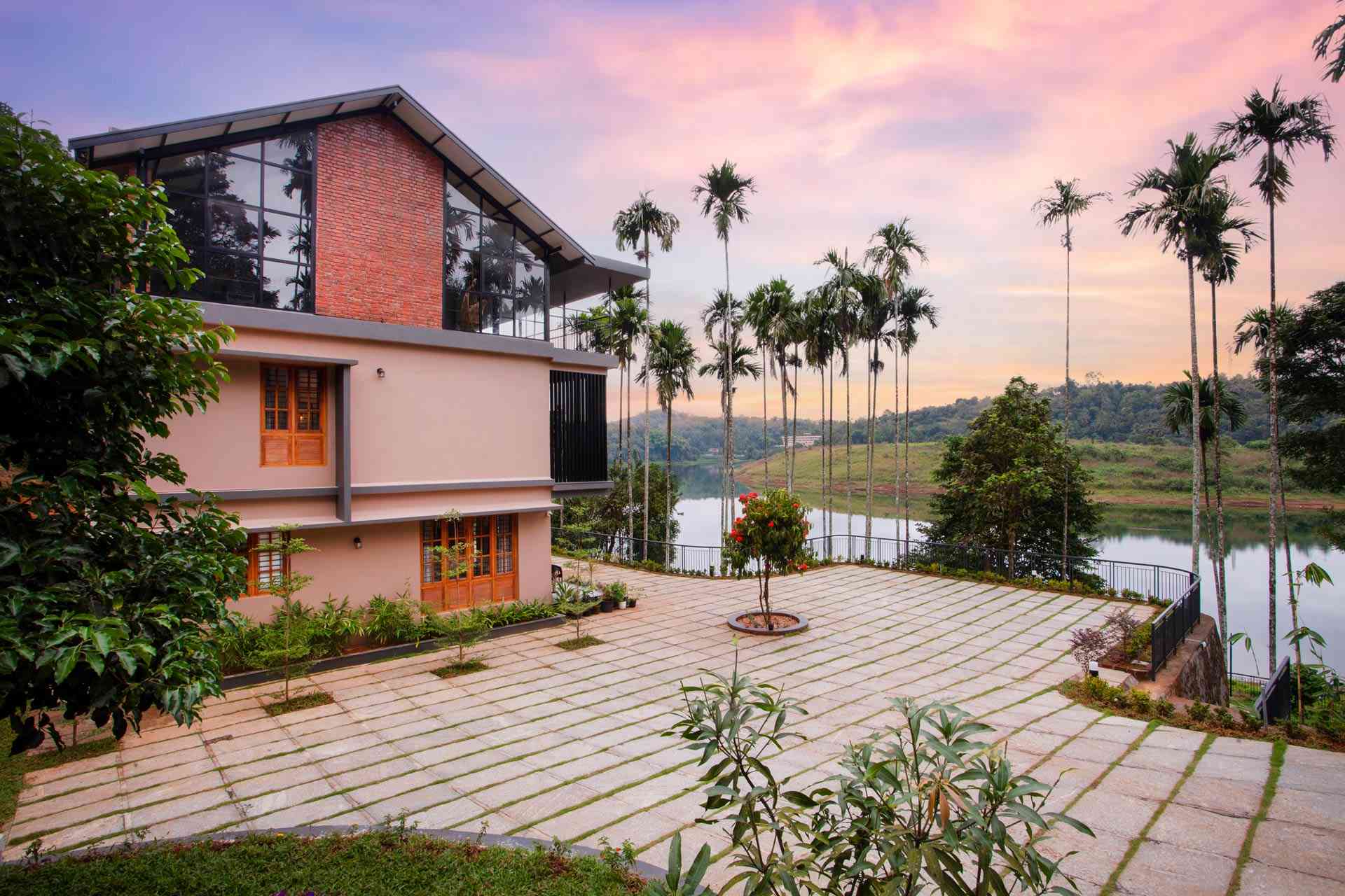
Three bedrooms with lake views, about 7 km from Banasura Sagar Dam and close to Karalad Lake, with BBQ and bonfire setups and indoor games. A good fit for larger groups wanting an extra evening outdoors after the trek.
Frequently Asked Questions
Forest Office on arrival (subject to the 200-trekker daily cap), or in advance through the Kerala Forest Ecotourism website — recommended for weekends and October–March. Forest office: +91 4936-282001.
2,100 metres (6,890 ft) — the highest point in Wayanad district.
Generally discouraged June–September; the forest department may close access during heavy rain.
No — the summit is currently closed to trekking due to wildlife activity. The authorised endpoint is the heart-shaped lake, 1.5 km below the peak.
Moderate. Easy tea-estate start, shaded well-marked forest section, and a steep final grassland climb before the lake.
Grip footwear, 2+ litres of water, snacks, sunscreen, and a light jacket for the cooler upper sections.