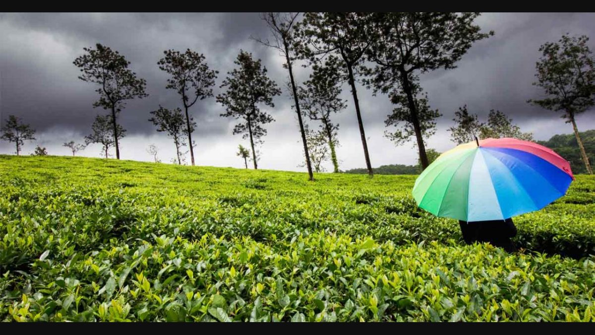
14 Landslide-Prone Hill Stations to Avoid in Monsoon 2026
Last updated: June 2026
TL;DR: The hill stations most worth avoiding (or treating with real caution) during the monsoon are the ones on steep, fragile slopes along single-lifeline highways: in Himachal — Kinnaur, Chamba, the Kullu–Manali corridor, the Kalka–Shimla stretch and Dharamshala; in Uttarakhand — Chamoli, Rudraprayag and the Char Dham routes, plus Mussoorie and Nainital; the Nilgiris (Ooty–Coonoor) and Munnar–Wayanad in the Western Ghats; the Sikkim–Darjeeling belt along NH-10; and the Jammu–Srinagar (Ramban) highway. Peak risk is July–August for most, when cloudbursts and river spate saturate slopes. The IMD has forecast a below-normal 2026 monsoon (around 90% of the long-period average) — but a lighter season does not make these slopes safe, because the real danger is localised cloudbursts and flash landslides, not the seasonal total. The responsible move isn’t to cancel monsoon travel; it’s to pick the right window, check IMD and road advisories, travel by daylight, and choose safer rain-shadow or well-managed destinations instead.
In this Blog
Monsoon hill-station safety at a glance
| Highest-risk months | July–August across Himachal, Uttarakhand and the Western Ghats |
| Main hazard | Landslides, rockfall and flash floods on steep hill roads — rarely the rain itself |
| Single most important step | Check the IMD forecast and local road/landslide advisories 24–48 hours before you travel |
| Safer windows | September–onward for the Western Ghats; October–June for most Himalayan hill towns |
| 2026 monsoon note | Below-normal (~90% of LPA) — but localised cloudbursts and landslides remain a real risk |
| Safer alternatives | Rain-shadow Ladakh/Spiti, well-managed Lonavala–Karjat, Coorg, the comparatively dry Pondicherry coast |
Which hill stations should you avoid during the monsoon?
The honest answer is that no hill station is “banned” in the rains — but a clear set of them sit on geology that turns dangerous when the slopes are saturated, and they’re worth avoiding in peak monsoon or visiting only with caution. These are mostly the high-Himalayan towns reached by a single, slope-hugging highway (Kinnaur, the Kullu–Manali corridor, the Char Dham routes, Sikkim’s NH-10, the Jammu–Srinagar NH-44) and the steep Western Ghats stretches around Munnar, Wayanad and the Nilgiris. The hazard is almost never the rain you see falling — it’s what the rain does to a hillside: loosens rock, swells a river, and brings a slope down across the only road out.
The reason to plan carefully isn’t fear; it’s pattern. Himachal and Uttarakhand lose roads to landslides almost every monsoon, and the Western Ghats have seen serious, well-documented slope failures. The July 2024 landslides in Wayanad, Kerala — one of India’s deadliest — and the October 2023 glacial-lake flood down the Teesta in Sikkim that washed out parts of NH-10 are sober reminders that these are real, recurring risks, not freak one-offs. You don’t need to cancel a hill trip. You need to know which places to skip in July–August, which window is safer, and how to read an advisory before you set off.
One more 2026-specific point, because it’s easy to misread. The India Meteorological Department has forecast a below-normal monsoon — around 90% of the long-period average. That sounds reassuring, and it does often mean fewer prolonged closures. But a below-normal seasonal total says almost nothing about your one travel day: India’s deadliest hill disasters are triggered by short, intense cloudbursts that a “weak monsoon” can still deliver. Treat the forecast as background, not a green light.
Monsoon safety in the hills (StayVista’s signature checklist — use it before every monsoon hill trip)
– Check advisories first. Read the IMD warning page and your state’s disaster-management/police road status 24–48 hours before, and again the morning you leave. Treat an Orange (“be prepared”) alert as a reason to delay and a Red (“take action”) alert as a stop signal.
– Travel by daylight only. Most hill-road landslide accidents happen at night or in heavy rain when you can’t see fallen rock or a washed-out edge. Never drive a ghat road after dark in a downpour.
– Keep buffer days. Build one or two spare days into any monsoon hill itinerary — single-lifeline highways (NH-5, NH-10, NH-44, the Char Dham routes) can close for hours or days.
– Stay away from rivers and slopes after heavy rain. Don’t camp or park on riverbanks (flash-rise is sudden), don’t stop under cut-slopes or “shooting-stone” zones, and never enter waterfalls or dam streams in spate.
– Make advisories a habit. Follow NDMA, IMD and your route’s state disaster-management handles; save local police/SDRF helpline numbers offline.
– Carry the basics + insurance. Power bank, offline maps, a day’s food and water, waterproof grippy footwear, medicines — and travel insurance that covers trip delays and medical evacuation.
Himachal Pradesh: the highways are the hazard
Himachal’s hill towns are stunning and the towns themselves are often fine — it’s the roads in and out that fail. The state loses hundreds of road links to landslides in a bad monsoon, with Kullu, Mandi, Kinnaur and Chamba repeatedly among the worst-hit districts. Himachal’s monsoon typically sets in around late June and peaks July–August.
1. Kinnaur — NH-5 along the Sutlej
Kinnaur’s lifeline, NH-5, clings to near-vertical, crumbly rock faces above the Sutlej, and the Nigulsari and Chaura stretches (Rampur–Kinnaur) are chronic “shooting-stone” and rockfall zones — a section at Nigulsari has collapsed outright in recent monsoons, cutting Kinnaur off from Shimla.
– Why it’s risky in monsoon: Friable slopes directly above a busy single highway; rockfall and slope collapse on the Nigulsari/Chaura sections.
– Peak risk months: July–September (rockfall can run into October here).
– The responsible advice: Go only with caution — check HP PWD/police road status, never stop under cut-slopes, and avoid self-driving NH-5 in heavy spells.
– How to reach / risky stretch: NH-5 from Shimla via Rampur; the danger points are Nigulsari and Chaura.
– Safer window: October–June (also the best season for Sangla, Chitkul and Kalpa).
2. Chamba and Dalhousie
Dalhousie town is relatively moderate-risk, but the connecting ghat roads are not: the Chamba–Bharmour and Chamba–Tissa roads see frequent boulder falls, slush and subsidence, and Chamba sits consistently among Himachal’s worst-affected monsoon districts.
– Why it’s risky in monsoon: Steep, rain-soaked slopes on the feeder roads; Bharmour and Khajjiar side-trips cross unstable stretches.
– Peak risk months: July–August.
– The responsible advice: Go only with caution. Stay in Dalhousie/Khajjiar if you must visit, but check advisories before any Bharmour run.
– How to reach / risky stretch: Chamba–Bharmour road near Lahal/Khadamukh; Chamba–Tissa near Sarela.
– Safer window: October–June — spring and autumn are ideal for Dalhousie and Khajjiar.
3. The Kullu–Manali corridor (and Manali–Leh)
This is the corridor that made national headlines in July 2023, when the Beas in spate washed away large stretches of highway and parts of Old Manali. The riverside highway is the hazard — not Manali town itself, which the Atal Tunnel keeps reachable year-round.
– Why it’s risky in monsoon: The Beas River runs right alongside NH-3; flash-rise and bank erosion take out the road, and the high approaches to Rohtang and Lahaul–Spiti get cut by slides and water crossings.
– Peak risk months: July–August (the 2023 catastrophe struck 7–10 July).
– The responsible advice: Go only with caution in July–August; never camp or park on Beas riverbanks, and check NHAI/SDMA status before driving up.
– How to reach / risky stretch: The Kiratpur–Manali NH along the Beas; the Gramphu–Batal stretch toward Spiti.
– Safer window: Late September through June.
4. The Kalka–Shimla stretch and Shimla town
The climb to Shimla on NH-5 cuts through unstable Solan-belt slopes with recurring slides near Koti, Sanwara and Solan, and the heritage Kalka–Shimla rail line is suspended during heavy spells. Shimla itself sits on heavily built-up, over-steepened slopes prone to subsidence in prolonged rain.
– Why it’s risky in monsoon: Slope failures on the approach highway and rail line; saturated, over-built town slopes.
– Peak risk months: July–August.
– The responsible advice: Go only with caution — allow buffer time for jams and closures, and avoid driving NH-5 at night in heavy rain.
– How to reach / risky stretch: NH-5 near Koti/Sanwara/Solan; the parallel Kalka–Shimla rail line.
– Safer window: October–June.
5. Dharamshala and McLeodganj
McLeodganj’s very steep catchments and constricted drainage make it flash-flood-prone: the July 2021 Bhagsu Nala flash flood is the textbook case, a tiny stream overwhelmed by intense rain and choked by construction, with a major landslide in nearby Boh valley the same spell.
– Why it’s risky in monsoon: Narrow, built-over drainage lines; sudden flash-rise in the Bhagsu Nala and waterfall pools.
– Peak risk months: July–August.
– The responsible advice: Go only with caution — stay out of streambeds and waterfall pools (like Bhagsu Falls) during and right after rain.
– How to reach / risky stretch: Bhagsu Nala near McLeodganj; lower Dharamshala drainage; Boh valley.
– Safer window: October–June — spring is excellent for McLeodganj and Triund.
Going to Himachal anyway? Read the corridor, not just the town. Manali, Shimla and Dharamshala are mostly fine to be in — it’s the drive that’s the gamble. If you’re set on the hills in July–August, prefer a short, low-altitude base you can reach without a long ghat exposure, keep a buffer day, and check the road the morning you travel. For a fuller season-by-season view, see our guide to Himachal weather in August and September. (Mid-article CTA — 1 of 3.)
Uttarakhand: fragile Garhwal and the pilgrim routes
Uttarakhand’s Garhwal Himalaya is tectonically young and fragile, and its highways follow landslide-prone river gorges. The Char Dham routes are routinely suspended during heavy rain — by design, for safety.
6. Chamoli, Rudraprayag and the Char Dham routes
The Kedarnath, Badrinath, Gangotri and Yamunotri highways thread through some of India’s most slide-prone gorges. In July 2024, authorities suspended the Char Dham yatra after an IMD red alert, with landslides blocking the Badrinath highway and pilgrims held at staging points — a pattern that repeats most monsoons (Business Today, July 2024).
– Why it’s risky in monsoon: Fragile gorge slopes above the pilgrim highways; recurrent landslides and flash floods, leading to repeated yatra halts.
– Peak risk months: July–September.
– The responsible advice: Go only with caution and follow yatra advisories strictly — treat an Orange/Red alert as a stop, and never push past a closure barrier.
– How to reach / risky stretch: Badrinath highway (Chamoli); the Kedarnath route via Rudraprayag/Sonprayag; the Gangotri approach.
– Safer window: Pre-monsoon May–June and post-monsoon mid-September–October are the yatra’s calmer spells.
7. Mussoorie — the Kempty Falls area
A meaningful share of Mussoorie is mapped as high landslide-risk, and Kempty Falls sits on fractured limestone with very steep slopes; rain regularly triggers slides on the Kempty road.
– Why it’s risky in monsoon: Fractured rock and 60°-plus slopes around the falls and feeder roads.
– Peak risk months: July–August.
– The responsible advice: Go only with caution — avoid the Kempty pool when the falls are in full force, and watch the Kempty road for slips.
– How to reach / risky stretch: The Kempty Falls access road; Sahastradhara–Chamasari slopes.
– Safer window: October–June — Mussoorie is a strong autumn-to-spring pick, and the season to book a Mussoorie homestay.
8. Nainital — the lake-slope flank
Nainital sits in a fault-controlled bowl on weak slates, and the Balia Nala slide on the lake’s southeast outlet is actively creeping — the key instability. A major slide hit a hillside locality above Balia Nala in September 2014 after heavy rain.
– Why it’s risky in monsoon: Active slope creep at Balia Nala; unstable hillside construction above the lake.
– Peak risk months: July–September.
– The responsible advice: Go only with caution — the lakefront and main Mall are generally manageable, but avoid the Balia Nala flank in heavy spells.
– How to reach / risky stretch: Balia Nala (lower Tallital side); slopes above the lake.
– Safer window: October–June.
9. Joshimath — a town under watch (not a scare story)
Joshimath belongs in any honest monsoon-safety list, but for a different reason: it’s a land-subsidence town, not a single-landslide spot. Built on old landslide debris in a high seismic zone, it saw cracks open in hundreds of houses during the 2022–23 subsidence crisis, and rain accelerates the slow ground movement.
– Why it’s risky in monsoon: Pre-existing, year-round subsidence that heavy rain worsens; this is a structural issue, not a seasonal storm.
– Peak risk months: Monsoon (July–September) aggravates an existing condition.
– The responsible advice: Treat Joshimath as a town under study and rehabilitation, not a tourist thrill or a disaster headline. Through-travellers to Auli/Badrinath should simply check current advisories and avoid adding pressure during heavy rain.
– Safer window: Auli is usually visited in the dry/winter season regardless.
The Western Ghats and the Nilgiris
The Ghats take the full force of the southwest monsoon, and their steep, deforested high ranges have produced some of India’s most serious slope failures. Here the danger window is squarely June–August (with a second wet spell from the northeast monsoon on the Tamil Nadu side).
10. The Nilgiris — Ooty and Coonoor
The Mettupalayam–Coonoor–Ooty ghat climbs through hairpins on fragile slopes; heavy rain triggers slides that block NH-67 and the Nilgiri Mountain Railway, and the Nilgiris have a history of deadly mass slides in big rain years.
– Why it’s risky in monsoon: Hairpin ghat roads on unstable slopes; the toy train and NH-67 both shut in heavy rain.
– Peak risk months: June–September (southwest) and again October–November (northeast monsoon, often wetter here).
– The responsible advice: Go only with caution — avoid night ghat driving and expect the railway to suspend in heavy spells.
– How to reach / risky stretch: The Kallar/Mettupalayam–Coonoor ghat (NH-67) and the parallel railway section.
– Safer window: April–June and dry winter spells; avoid the heaviest northeast-monsoon bursts.
11. Munnar and the Idukki belt
Munnar’s high ranges are extremely high-rainfall and slide-prone: the Munnar Gap Road has seen repeated landslides (with a travel ban imposed after a May 2025 landslip), and the 2020 Pettimudi slide near Rajamala was a tragic reminder of how prolonged rain destabilises these slopes.
– Why it’s risky in monsoon: Saturated, deforested high-range slopes; ghat-road landslides on the Munnar approaches.
– Peak risk months: June–August.
– The responsible advice: Go only with caution — follow Idukki district collector orders and avoid ghat roads during Red/Orange alerts.
– How to reach / risky stretch: The Munnar Gap Road; the Pettimudi/Rajamala area near Munnar.
– Safer window: September–March (December–February is prime).
12. Wayanad — Vythiri and the Meppadi belt
Wayanad sits high on this list because of the July 2024 landslides in the Meppadi area (Mundakkai, Chooralmala and neighbouring villages), among the deadliest in India’s history, after exceptional rain on fragile Western Ghats slopes (Wikipedia). We mention it soberly and only as the reason to plan Wayanad carefully — not to discourage visiting the district in its safe seasons.
– Why it’s risky in monsoon: Fragile high-rainfall geology in the Vythiri–Meppadi belt; the 2024 event followed extreme, concentrated rainfall.
– Peak risk months: July–August.
– The responsible advice: Avoid the high-rainfall Meppadi/Mundakkai belt in peak monsoon. Recovery is ongoing; choose the dry season and well-established stay areas instead.
– How to reach / risky stretch: The Meppadi–Mundakkai–Chooralmala corridor; Vythiri ghat sections.
– Safer window: October–May, when Wayanad is genuinely lovely and safe.
The Northeast and J&K: single-lifeline highways
13. Sikkim and the Darjeeling belt — NH-10
NH-10 (Siliguri–Gangtok) is the only lifeline road into Sikkim, and it runs along the Teesta through chronically unstable slopes that close repeatedly every monsoon. The valley is also still recovering from the October 2023 glacial-lake outburst flood that roared down the Teesta, destroyed the Chungthang dam and washed out bridges and NH-10 sections (Wikipedia).
– Why it’s risky in monsoon: A single, slide-prone lifeline highway along an active river valley; landslides cut Gangtok and north Sikkim off for days.
– Peak risk months: June–September (the 2023 GLOF was a separate October cascade, now an aftermath factor).
– The responsible advice: Go only with caution — keep buffer days for NH-10 closures, travel by daylight, and check Sikkim/West Bengal advisories. North Sikkim (Lachen/Lachung) is the most affected.
– How to reach / risky stretch: NH-10 Sevoke–Rangpo along the Teesta; Singtam–Rangpo; the upper Teesta/Chungthang valley.
– Safer window: October–May — clear post-monsoon skies and spring rhododendrons.
14. Jammu & Kashmir — the Ramban stretch of NH-44
The Ramban–Banihal sector of NH-44 (Jammu–Srinagar), the all-weather link to the Valley, runs through fragile, over-steepened slopes and is repeatedly shut by landslides, mudslides and shooting stones in rain — sometimes for days.
– Why it’s risky in monsoon: Unstable slopes on the only road link; recurring landslides and rockfall in the Ramban sector.
– Peak risk months: July–September (plus spring snowmelt episodes).
– The responsible advice: Go only with caution — always check J&K traffic-police advisories before crossing Ramban, travel in daylight, and keep buffer time. Flying into Srinagar avoids the road risk entirely.
– How to reach / risky stretch: NH-44 in the Ramban/Ramsoo/Banihal sector.
– Safer window: Late September–June for the road; Kashmir’s spring, autumn and winter all avoid peak monsoon.
Safer monsoon alternatives (where to go instead)
Avoiding the riskiest hills doesn’t mean staying home. The smart monsoon move is to swap fragile high-Himalayan roads for rain-shadow regions that barely get the monsoon, or well-managed destinations with reliable main roads and plenty of indoor backup.
- Rain-shadow Ladakh and Spiti — these trans-Himalayan cold deserts sit behind the main ranges and get very little monsoon rain, staying sunny and dry from June to September. One caveat: the approach roads (via Manali or Srinagar) still cross monsoon-hit terrain, so fly into Leh or enter via the steadier Shimla–Kinnaur side with advisory checks. (Why Spiti stays dry.)
- Lonavala–Khandala and Karjat (Maharashtra) — well-developed Western Ghats getaways close to Mumbai and Pune, with good roads and far less catastrophic-slope risk than the high Himalaya. The one firm rule: never enter waterfalls or dam streams. After a 2024 tragedy near Bhushi Dam, Pune district imposes prohibitory orders at such spots every monsoon — obey them.
- Coorg (Karnataka) — a popular, comparatively manageable monsoon destination with serviceable main roads to Madikeri and Virajpet. It isn’t risk-free in extreme spells (the Madikeri–Mangalore ghat can slide, and early August can be intense), so keep to main roads and watch local alerts.
- The Pondicherry/east coast — on the leeward side of the Ghats, the Tamil Nadu coast stays comparatively dry through the southwest monsoon and has no landslide risk at all (its own rainy season is the northeast monsoon, October–December).
For the full positive list, see our companion guide to safe places to visit in monsoon in India.
Where to stay (StayVista)
For a monsoon trip, the right base is in a safe belt — somewhere with reliable roads, good drainage and indoor space to enjoy the rain in comfort — never perched on a fragile hillside. A few verified StayVista picks in the season’s safer regions:
- Lonavala (Maharashtra): The Boulevard Villa — a 4-BHK private-pool villa, ideal for a low-risk monsoon weekend from Mumbai or Pune. (Browse more in Lonavala.)
- Karjat (Maharashtra): Santoni Farms — a 3-BHK private-pool farm villa surrounded by monsoon greenery, an easy drive from Mumbai. (More in Karjat.)
- Coorg (Karnataka): Coffee & Mist or Firefly by the River — estate-style stays made for rain-walks and filter coffee, on Coorg’s well-served main-road belt. (More in Coorg.)
Planning a monsoon escape? Pick a base in a safer belt — Lonavala, Karjat or Coorg — keep a buffer day, and let the rain be something you watch from a dry veranda rather than something you drive through. (CTA 2 of 3.)
FAQ: monsoon hill-station safety
Which hill stations should you avoid during the monsoon in India?
Avoid or use real caution in the high-Himalayan and steep Western Ghats stretches reached by single, slide-prone roads: in Himachal — Kinnaur, Chamba, the Kullu–Manali corridor, the Kalka–Shimla stretch and Dharamshala; in Uttarakhand — Chamoli, Rudraprayag and the Char Dham routes, plus Mussoorie and Nainital; the Nilgiris (Ooty–Coonoor), Munnar and Wayanad in the Western Ghats; the Sikkim–Darjeeling belt along NH-10; and the Ramban stretch of the Jammu–Srinagar highway. Peak risk is July–August.
Is it safe to travel to hill stations during the monsoon?
It can be, if you choose well-managed destinations and the right window. The danger is rarely the rain itself — it’s landslides on steep hill roads and flash floods. Avoid fragile single-lifeline routes during Red or Orange alerts, travel by daylight, keep buffer days, and check the IMD forecast and local road status before you leave.
What is the best time to visit Himachal Pradesh to avoid landslides?
March to June and mid-September to November are the safest windows for Himachal. These months bring stable weather and far lower landslide risk in Shimla, Manali, Dharamshala and Kinnaur. The monsoon months of July and August carry the highest road-closure and landslide risk.
Does a below-normal monsoon in 2026 mean the hills are safe?
No. The IMD has forecast a below-normal 2026 monsoon (around 90% of the long-period average), which often means fewer prolonged closures — but India’s deadliest hill disasters are triggered by short, intense cloudbursts that a weaker season can still produce. Treat the forecast as background and still check advisories before every trip.
What should I do if I’m already at a hill station and heavy rain starts?
Stay put and follow local advisories — don’t try to drive out on a ghat road in heavy rain or after dark. Keep away from rivers, waterfalls and unstable slopes, stock a day of food, water and a charged power bank, and stay in contact with your host and local officials until conditions clear.
Which are the safest places to visit in India during the monsoon?
Rain-shadow regions like Ladakh and Spiti stay dry and open from June to September, and well-managed destinations such as Lonavala–Karjat, Coorg, Mahabaleshwar and the comparatively dry Pondicherry coast offer reliable roads and indoor backup. See our full guide to safe monsoon destinations for the complete list.
Why do landslides happen so often in Indian hill stations during the monsoon?
Most Indian hill towns sit on steep slopes of weak or fractured rock, and heavy rain saturates that ground until it gives way. Deforestation, unplanned hillside construction and poor drainage make it worse, and many towns depend on a single highway, so one slide can cut off the whole area.
Conclusion
Monsoon travel in the hills isn’t about courage or cancellation — it’s about timing and judgement. The destinations on this list aren’t off-limits forever; they’re simply best avoided in July and August, when saturated slopes and cloudbursts put their single-lifeline roads at risk. Pick a safer window, lean on rain-shadow regions like Ladakh and Spiti or well-managed belts like Lonavala, Karjat and Coorg, and let the IMD forecast and local advisories have the final say. A below-normal 2026 monsoon helps, but it’s no substitute for checking the road the morning you travel. Do that, choose a base on stable ground, and the rains become something to enjoy — not something to survive.