
Mawsynram 2026: 11,872 mm & the Wettest Place on Earth
Last updated: June 2026
TL;DR: Mawsynram, a village in Meghalaya’s East Khasi Hills, is the wettest place on Earth, with an average of about 11,872 mm (467 inches) of rain a year — roughly ten times what Mumbai gets. It earns that title because moist Bay-of-Bengal winds sweep over the Bangladesh plains and are forced sharply upward by the Khasi Hills, wringing out near-continuous rain. The catch for travellers: peak monsoon (June–August) is when the rain is most spectacular but visibility is worst — fog, mist and shut-in skies are common. For actual sightseeing of Mawjymbuin Cave (its natural rock “Shivling”) and the valley views, the clearer shoulder months of late September–November are easier. Mawsynram sits about 60 km from Shillong; the practical airport is Guwahati (~150 km).
In this Blog
Mawsynram at a glance
| Why it’s famous | Wettest place on Earth — ~11,872 mm average annual rainfall |
| Best time for the rain experience | June–August (peak monsoon, heaviest rain, most fog) |
| Best time for sightseeing/views | Late September–November (full waterfalls + clearer skies) |
| How to reach | Road from Shillong (~60 km, 2–2.5 hrs); no rail/airport in town |
| Nearest practical airport | Guwahati (LGB) ~150 km; Shillong/Umroi nearer but limited flights |
| Headline sight | Mawjymbuin Cave (natural Shivling formation) |
| Ideal duration | 1 day for Mawsynram itself; 2–4 days for the wider Khasi Hills circuit |
| 2026 monsoon note | Below-normal nationally (IMD); Meghalaya’s belt still rains heavily — plan for road and visibility disruptions |
Why is Mawsynram the wettest place on Earth?
Mawsynram averages roughly 11,872 mm (about 467 inches) of rain a year — the highest average annual rainfall of any inhabited place on the planet, which is why it is widely cited as the wettest place on Earth. To put that in perspective, Mumbai’s wettest year barely crosses 2,500 mm; London gets around 600 mm. Mawsynram receives that much rain several times over, year after year.
The reason is geography, not chance. During the southwest monsoon, warm, moisture-laden winds blow north off the Bay of Bengal, cross the low, flat plains of Bangladesh, and then run straight into the Khasi Hills, which rise abruptly in their path. The air is forced sharply upward (orographic lift), cools, and dumps its moisture almost continuously over Mawsynram, which sits at about 1,400 metres. The funnel-shaped valleys around the village concentrate the effect further.
A quick note on the famous numbers, because they get muddled online. Mawsynram holds the record for the highest average annual rainfall. Neighbouring Cherrapunji (Sohra) holds the older records for the most rain in a single year and a single month — the often-quoted 26,461 mm fell at Cherrapunji between August 1860 and July 1861, not at Mawsynram. The two villages have traded the “wettest” crown for decades; today Mawsynram edges ahead on the long-term average. (Sources: Mawsynram — Wikipedia; Cherrapunji — Wikipedia; Meghalaya Tourism.)
Monsoon safety in Mawsynram & the Khasi Hills (read before you book)
– Roads slip and close. Landslides are common on the Shillong–Cherrapunji–Dawki routes in heavy rain, and district authorities have shut roads “until further notice” mid-season. Hire a local driver who knows the sinking zones, never self-drive the ghats in heavy rain, and never drive after dark.
– Build a buffer. Keep a 24-hour gap before your outbound Guwahati flight in case a highway is blocked. Treat IMD and district advisories as binding.
– Do NOT enter wild caves in peak monsoon. Krem Puri and other wild caves flood unpredictably — caving is genuinely dangerous June–August. Stick to the developed, walk-in Mawjymbuin Cave, and only go underground with an experienced, equipped local guide.
– No swimming in waterfall pools. Levels can rise violently within minutes in a downpour. Stay back from wet limestone cliff edges.
– Leeches and slick paths. Carry a small spray bottle of salt water or Dettol for forest and root-bridge trails, and wear shoes with real grip — paths get treacherously slippery.
The rain paradox: when should you actually visit Mawsynram?
Here is the honest tension that most guides skip. The thing that makes Mawsynram extraordinary — relentless, dramatic rain — is also the thing that can stop you from seeing anything. In peak monsoon (June, July and August), the village is most itself: waterfalls appear overnight, the hills vanish into cloud, and the air is a permanent fine mist. But that same weather means fog, near-zero visibility, road disruptions and cancelled plans are routine. You may sit in for a full day watching rain you can’t photograph.
So choose by what you want:
- For the “wettest place on Earth” experience — the sheer force of it, the sound of rain on tin roofs, the locals in their knup rain shields — come in July or August, and accept that sightseeing will be limited and your itinerary will bend to the weather.
- For seeing the views, the cave and full waterfalls in better light, come in the post-monsoon shoulder, late September to November. The landscape is still saturated and green, waterfalls still run hard, but skies clear enough to actually see the valley and the dramatic drop toward the Bangladesh plains.
- Winter (December–February) is the easiest travel — clear, crisp, 10–20°C — but the rain spectacle is gone and some falls thin out.
Temperatures in the rainy months are mild, typically 15–22°C by day, so it is the wet, not the cold, you pack for. Whichever window you pick, keep a loose itinerary — locals plan around the weather, and so should you. For the bigger picture on planning a rainy-season trip, see our guide to safe places to visit in monsoon in India and the wider list of best places to visit in July in India.
Places to visit in Mawsynram
Mawsynram is small, and its appeal is as much about being there in the rain as ticking off sights. But there are a handful of genuine highlights in and very near the village. (For Cherrapunji’s separate roster of waterfalls and caves, see the cross-link further down — they’re a 2.5-hour drive away, not in Mawsynram.)
Mawjymbuin Cave — the natural “Shivling”
This is Mawsynram’s headline attraction and the reason most pilgrims and travellers come. Mawjymbuin Cave is a shallow, walk-in cave of calcareous sandstone where centuries of dripping water have built a large stalagmite shaped like a Shiva Linga, fed by a stalactite shaped like a cow’s udder directly above it. The effect is striking and genuinely natural, and the site is revered locally. The cave stays cool and is one of the few sights you can comfortably visit even on a wet day.
- Where / how to reach: About 2.5 km from Mawsynram village (roughly 45 km from Shillong); a short walk from the road.
- Entry fee: A nominal fee applies.
- Timings: Commonly listed as ~9:00 AM–4:00 PM.
- Best time: Year-round; mornings in monsoon before the heaviest afternoon rain. Time required: 30–45 minutes.
- Ideal for: Pilgrims, families, first-timers. Pro tip: The approach can be slippery in the rains — wear grippy shoes and watch your footing on the rock.
Krem Puri — the world’s longest sandstone cave (look, don’t enter in monsoon)
Near Laitsohum village, about 10–12 km from Mawsynram, lies Krem Puri, surveyed at 24,583 metres (over 24 km) — confirmed by Meghalaya Tourism as the longest sandstone cave in the world. It was discovered in 2016 and mapped in 2018 by the Meghalaya Adventurers’ Association. It is not a developed, ticketed show-cave: it is an expedition-grade wild cave, and a local guide is mandatory.
- Crucially: Do not attempt Krem Puri in peak monsoon. Water levels inside are unpredictable and the cave can flood — June and July are the worst months for any wild caving here. Treat it as a dry-season (winter) objective for experienced, guided cavers only.
- Entry fee / timings: No fixed public ticketing; access is arranged through guides.
- Ideal for: Serious adventurers and cavers in winter, not casual monsoon visitors. Pro tip: If you want a cave in the rains, do Mawjymbuin (above) or Cherrapunji’s developed Mawsmai/Arwah caves instead.
- Source: Krem Puri — Meghalaya Tourism (official).
Jakrem hot springs
A short detour from the Mawsynram road, Jakrem is a sulphur hot spring in the South West Khasi Hills, long believed locally to have curative properties for skin and joint ailments, with a small bathing/health-resort setup. It’s a low-key, restorative stop rather than a marquee sight — pleasant after a cold, wet day in the hills.
- Where / how to reach: Roughly 20+ km from Mawsynram (about 60–64 km from Shillong on the Shillong–Mawkyrwat road).
- Entry fee / timings: No official entry fee or fixed timings are published; it’s a low-key local spot, so confirm on arrival.
- Best time: Pleasant year-round; especially welcome in the cool monsoon. Time required: 1 hour. Ideal for: Couples, families, anyone wanting a warm soak. Pro tip: Facilities are basic — carry your own towel and slippers.
Village viewpoints and the drop toward Bangladesh
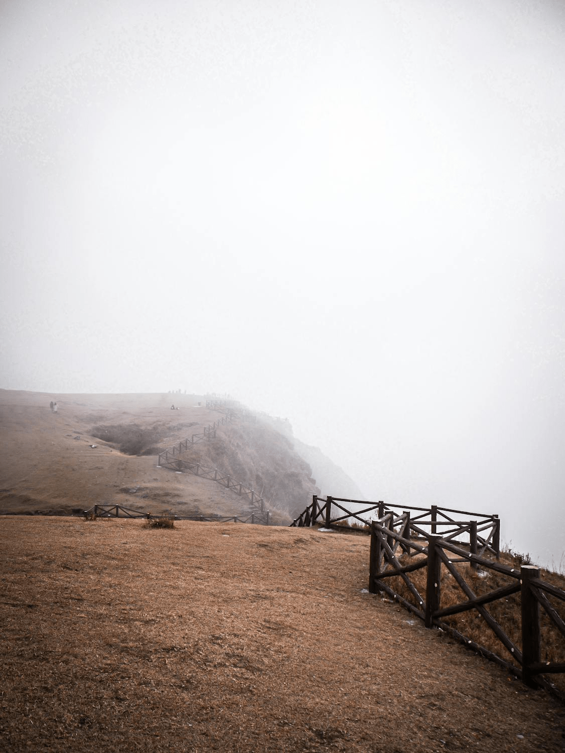
On a clear-ish day, the ridges around Mawsynram open onto sweeping views south over the plains of Bangladesh — the very lowlands that feed the village its rain. There’s no ticketed “viewpoint” so much as several spots along the road and village edge where the hills fall away dramatically. In monsoon these are often cloud-filled, which is its own kind of spectacle; in the shoulder season you get the long view.
- Entry fee: Free. Timings: Open access (daylight only is safest). Best time: Late September–November, or a brief monsoon clearing. Time required: 20–30 minutes. Ideal for: Photographers, couples. Pro tip: Light is best in the early morning before cloud builds; keep well back from unfenced edges.
Living-root traditions of the Khasi Hills
Meghalaya’s famous living root bridges — handwoven from the aerial roots of rubber fig trees over decades by Khasi communities — are a regional tradition you’ll hear about everywhere around Mawsynram. The most celebrated examples (including the double-decker bridge at Nongriat) are in the Cherrapunji area, reached by treks, rather than in Mawsynram village itself. If root bridges are on your list, plan them as part of a Cherrapunji leg — see the cross-link below — and treat monsoon treks to them with real caution (slippery, leech-prone, flash-flood-prone trails).
- Entry/permits: Vary by bridge/village (small local fees common). Best time: Drier shoulder months for the treks; monsoon makes trails dangerous. Ideal for: Fit trekkers. Pro tip: Always go with a local guide and start early.
Local life: the knup, Khasi food and “rain time, God’s time”
What makes Mawsynram more than a weather statistic is how completely life is built around the rain. The signature sight is the knup — a traditional Khasi full-body rain shield, tortoise- or boat-shaped, woven from bamboo splints and waterproofed with leaf (commonly banana leaf). It curves from the head down past the knees and, crucially, leaves both hands free so farmers can keep working through a downpour. You’ll see them in the fields and markets, and they make a memorable (and genuinely useful) thing to watch being made.
Khasi food is hearty and suited to wet, cool days. Look for jadoh (rice cooked with meat, often pork), tungrymbai (fermented soybean), tender monsoon bamboo-shoot preparations, and local rice beer. Small homestays and roadside eateries are where you’ll eat best.
There’s a local phrase travellers love — “rain time, God’s time” — and it’s the right attitude. Flights and roads bend to the weather here. Bring patience along with your rain gear, and the unpredictability becomes part of the experience rather than a frustration.
Plan around the wider Khasi Hills, not just the village. Mawsynram itself is a half-day to a full day. Most travellers base in Shillong or Cherrapunji and fold Mawsynram into a longer Meghalaya loop. (CTA 1 of 3.)
What to pack for Mawsynram in the monsoon
This is the wettest place on Earth — pack as if everything will get wet, because it will.
- A proper rain jacket/poncho, not just an umbrella (wind makes umbrellas useless on the ridges).
- Quick-dry clothing and spare layers; a light warm layer for cool 15–22°C evenings.
- Waterproof shoes or sandals with serious grip — drainage matters as much as waterproofing here.
- Dry bags / zip-locks and ideally a waterproof pouch for your phone and camera; consider a backup power bank (power cuts happen).
- Salt-water or Dettol spray for leeches on any forest or root-bridge walk; basic first aid and personal medicines.
- A flexible mindset and a buffer day before any onward flight.
How to reach Mawsynram
Mawsynram has no airport and no railway station of its own — you route through Shillong, and most travellers fly into Guwahati.
- By air: The practical airport is Guwahati (Lokpriya Gopinath Bordoloi International), about 150 km away (roughly 5 hours by road via Shillong). Shillong’s Umroi Airport is nearer (~85 km from Mawsynram) but has limited connectivity.
- By road from Shillong: About 60 km, 2–2.5 hours, on narrow, winding hill roads. Hire a private or shared taxi from Shillong. Drive in daylight, never after dark, and expect delays in heavy rain.
- By rail: The nearest major railhead is Guwahati (~150 km); from there it’s road all the way.
- Pro tip: Most people don’t stay overnight in Mawsynram — they visit on a day trip from Shillong or Cherrapunji. If you want to overnight, line up a local homestay in advance, as options are very limited.
Mawsynram + Cherrapunji: combining the two “wettest” villages
Travellers naturally want to pair Mawsynram with Cherrapunji (Sohra), the other contender for wettest-place fame — and you should. But fix one common myth first: although the two villages are only about 15 km apart as the crow flies, the road distance is roughly 80 km, about a 2.5–3 hour drive, because there’s no direct hill road between them — you backtrack via Mawngap. (Older guides quoting “15 km by road” are simply wrong.)
The smart way to do it is to base in Shillong (or Cherrapunji) and treat each as a separate outing rather than a quick hop. A typical Meghalaya circuit runs Shillong → Cherrapunji → Mawsynram → Dawki → Mawlynnong, with Mawsynram often done as a day trip given the backtracking.
Cherrapunji is where the big-ticket waterfalls and developed caves live — Nohkalikai Falls (India’s tallest plunge waterfall), the Seven Sisters / Nohsngithiang Falls, Mawsmai and Arwah caves, and the double-decker living root bridge at Nongriat. Rather than re-cover them here, see our dedicated guide: Seven Sisters Waterfall in Meghalaya — complete monsoon guide. Keep Mawsynram for the rainfall record, Mawjymbuin Cave and Khasi village life; let Cherrapunji handle the waterfalls and root-bridge treks.
Suggested itineraries
- As a day trip (most common): Leave Shillong early → Mawjymbuin Cave → village viewpoints → optional Jakrem hot springs → back to Shillong before dark. A full but doable day.
- 2–3 day Khasi Hills loop: Day 1 Shillong sights and acclimatising → Day 2 Cherrapunji (Nohkalikai, Seven Sisters, Mawsmai/Arwah caves) → Day 3 Mawsynram (Mawjymbuin, viewpoints) en route, then on to Dawki/Mawlynnong if time allows.
- For adventurers (dry season only): Add a guided Krem Puri expedition and a Nongriat double-decker root-bridge trek — both best avoided in peak monsoon.
Keep every plan flexible. In monsoon, assume at least one weather-driven change.
Where to stay
Here’s the honest position: StayVista currently has no properties in Mawsynram or anywhere in Meghalaya, so we won’t point you to a stay we can’t stand behind. For this trip, your realistic options are:
- In/near Mawsynram: A handful of basic family-run homestays — limited, simple, and best booked ahead. Ideal if you specifically want to wake up in the wettest place on Earth.
- Cherrapunji (Sohra): A better spread of resorts and homestays, and the most convenient base for the waterfalls, caves and root-bridge treks. A sensible hub for the whole circuit.
- Shillong: The widest choice of hotels, guesthouses and cafés, and the usual launchpad for day trips to both Mawsynram and Cherrapunji — pick this if you want comfort and amenities between outings.
If your Meghalaya trip connects through another StayVista city on the way in or out, you can break the journey at one of our hill-station homes across India. (CTA 2 of 3.)
FAQ: Mawsynram
Why is Mawsynram the wettest place on Earth?
Mawsynram receives about 11,872 mm (467 inches) of rain a year — the highest average annual rainfall of any inhabited place. Moist winds from the Bay of Bengal cross the Bangladesh plains and are forced sharply upward by the Khasi Hills, producing near-continuous rain over the village.
How much rain does Mawsynram get?
About 11,872 mm a year on average — roughly ten times Mumbai’s typical annual rainfall. Most of it falls in the June–September southwest monsoon, with July the heaviest month.
Mawsynram vs Cherrapunji — which is wetter?
Mawsynram has the higher long-term average annual rainfall, so it’s currently called the wettest place on Earth. Cherrapunji holds the older records for the most rain in a single year and month (the famous 26,461 mm in 1860–61 fell at Cherrapunji, not Mawsynram). The two have swapped the title for decades.
What is the best time to visit Mawsynram?
For the dramatic rain experience, June–August; but expect fog, poor visibility and disrupted plans. For clearer skies with full waterfalls and views, the post-monsoon shoulder of late September–November is easier. Winter (Dec–Feb) is the most comfortable for travel but the rain spectacle is gone.
How do I reach Mawsynram?
There’s no airport or railway in Mawsynram. Fly into Guwahati (about 150 km, ~5 hours via Shillong) or use Shillong’s smaller Umroi Airport, then drive. From Shillong it’s about 60 km (2–2.5 hours) by taxi. Travel in daylight only.
How far is Mawsynram from Cherrapunji?
About 15 km in a straight line but roughly 80 km — a 2.5–3 hour drive — by road, because there’s no direct route and you detour via Mawngap. Plan them as two separate outings, not a quick hop.
Is it safe to visit Mawsynram in the monsoon?
Yes, with planning, but take it seriously. Hill roads can slip and close, visibility drops in fog, waterfall pools and rivers can rise fast, and wild caves like Krem Puri flood and should not be entered in the rains. Use a local driver, avoid night driving, keep a buffer before your flight, and follow district advisories.
What is there to see in Mawsynram?
The main sight is Mawjymbuin Cave, with its natural rock “Shivling.” Nearby are Jakrem’s sulphur hot springs, the world’s longest sandstone cave (Krem Puri, for guided dry-season caving), village viewpoints over the Bangladesh plains, and Khasi culture including the knup rain shield. Cherrapunji’s waterfalls and root bridges are a 2.5-hour drive away.
Conclusion
Mawsynram isn’t a polished resort destination, and that’s the point. It’s a working Khasi village that happens to be the rainiest inhabited place on Earth, where life is genuinely organised around water — from the knup on a farmer’s back to the Shivling forming, drop by drop, inside Mawjymbuin Cave. Come in July or August for the full force of the rain and accept the fog and disruptions as part of the deal; come in late September to November if you’d rather actually see the views and waterfalls. Either way, base yourself in Shillong or Cherrapunji, build in buffer days, respect the roads and the caves, and let the weather set the pace. There’s nowhere else quite like it.