
Gandikota: The ‘Grand Canyon of India’ and How to Do It in a Weekend
In the Kadapa district of Andhra Pradesh, a gorge carved by the Penna River through the Erramala Hills has been quietly earning a name for itself as one of the most dramatic natural sights in peninsular India. The name is Gandikota, taken directly from the Telugu words “gandi” meaning gorge and “kota” meaning fort, and the combination of the two is exactly what visitors find here: a canyon viewpoint and a medieval fort sitting together on the same red rock plateau.
The comparison to Arizona’s Grand Canyon is made by most people who visit, and while the scales are very different, the quality of the light on the quartzite cliffs at sunrise and sunset has a way of making the comparison feel entirely fair. This blog covers the places to visit in Gandikota, the sub-sights worth including on a weekend trip, and the practical details for reaching it from Bangalore, Hyderabad, and Kadapa.
Quick answer: Gandikota, in Andhra Pradesh’s Kadapa district, is called the Gandikota Grand Canyon because the Penna River carved a gorge through quartzite and red sandstone that is geologically estimated to be over 500 million years old. The fort on the gorge edge, the canyon viewpoint, the Belum Caves nearby, and the Mylavaram dam across the river are the main places to visit near Gandikota. The best time to visit Gandikota is October to February, and the site is roughly 300 km from Bangalore.
In this Blog
Why Gandikota Is Called the Gandikota Grand Canyon of India

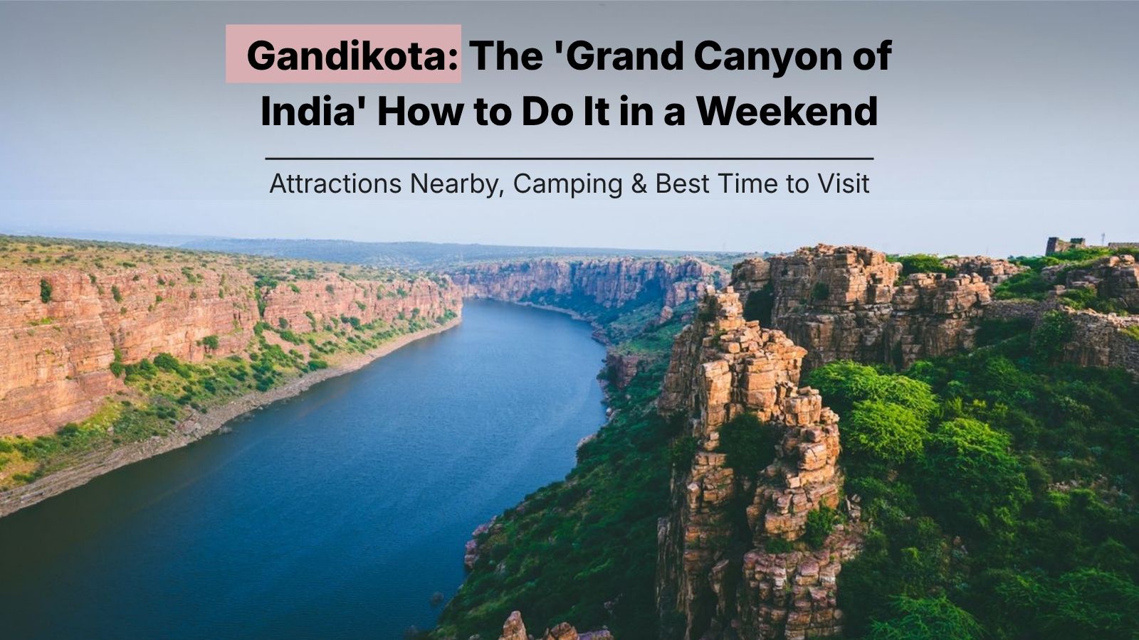
The gorge at Gandikota was formed over tens of millions of years as the Penna River cut through the Erramala Hills, steadily eroding the rock below. The canyon primarily consists of Gandikota quartzite, a tough rock formed from sandstone through metamorphism over approximately 500 million years. The Penna River began cutting into this material around 20 million years ago, according to geological assessments, and continues eroding it today. The gorge runs for about 3 to 6 km in length, reaches a width of roughly 100 to 300 metres at various points, and drops around 100 metres from the plateau to the river surface. For context, Arizona’s Grand Canyon is 446 km long and over 1,600 metres wide on average, so the comparison is one of visual character rather than size. What Gandikota shares with its American counterpart is the colour of the rock, the layered cliff faces, the quality of the light at the ends of the day, and the feeling of standing at the edge of something that time and water built entirely on their own.
The name “hidden Grand Canyon” circulates in travel writing because for most of India’s post-independence history, Gandikota was genuinely unknown outside the Kadapa district. The site began attracting wider attention after social media coverage in the early 2010s and now sees weekend peak footfall of around 3,000 visitors per day, according to recent tourism data. The Andhra Pradesh Tourism Development Corporation (APTDC) has developed the site and manages camping infrastructure, making it significantly more accessible than it was even five years ago.
Gandikota Fort: Where Medieval History Meets the Gorge Edge

The Gandikota fort is a centrally protected monument under the Archaeological Survey of India and sits directly on the edge of the gorge, its red sandstone walls following the contour of the cliff for sections of the perimeter. The fort was originally established in 1123 CE as a small mud structure by Kaka Raja, a vassal of the Kalyani Chalukya rulers. It passed through the hands of the Kakatiyas, the Pemmasani Nayakas, the Vijayanagara Empire, the Qutub Shahis of Golconda, and finally the Mughals. The Pemmasani Nayakas, who commanded the Vijayanagara army, held it for nearly 300 years and were responsible for its most significant expansions. The fort fell to Mir Jumla of the Golconda Sultanate in 1650 CE.
What makes the Gandikota fort particularly interesting is the cultural layering that multiple dynasties left behind. The Madhavaraya Temple and the Ranganatha Temple within the walls reflect Vijayanagara-era construction and patronage. The Jama Masjid inside the fort was built during the period of Muslim rule and represents a clear shift in architectural vocabulary while using the same red sandstone as the surrounding structures.
The French jeweller and visitor Jean-Baptiste Tavernier documented Gandikota in the 17th century, just days after Mir Jumla of Golconda captured the fort, and his account records the settlement as a functioning urban centre at that time. Today it is a ruin, and the scale of what remains gives the site the kind of depth that fully intact forts rarely convey. Walking through the Gandikota fort takes around two hours at a comfortable pace, and the gorge viewpoint at the far end of the fort complex is the point most visitors treat as the destination within the destination.
Gandikota Canyon Viewpoint: Where the Photo Happens

The Gandikota canyon viewpoint is accessible on foot from the fort’s far perimeter and requires no special equipment or guidance. The plateau drops sharply to the river below, and the view from the cliff edge takes in the gorge in both directions, with the Penna River running blue-green far below and the opposite cliff face a wall of layered quartzite in shades of red and orange. Sunrise at the viewpoint is the single most frequently cited reason for staying overnight rather than doing Gandikota as a day trip. At dawn, the low angle of the sun catches the quartzite cliffs and turns them amber and copper in a way that photographs do not fully prepare visitors for. Sunset produces a similar effect from the western edge of the plateau.
The Andhra Pradesh Tourism Department has positioned Gandikota as one of its flagship eco-tourism destinations and has marked safe viewing points along the gorge edge. Visitors are advised to wear walking shoes rather than sandals, stay behind marked areas at the cliff edge, and carry drinking water since shops inside the fort are limited. Mobile connectivity is weak in some areas of the site, particularly near the riverbank.
Gandikota Camping: Sleeping Above the Canyon

Gandikota camping is managed by the APTDC and takes place on the plateau near the fort, with tents set up close enough to the canyon edge to give a view of the gorge from camp. The APTDC’s Haritha Gandikota resort on site has both rooms and tent accommodation. The tent stays are basic: bedding is provided, a common bathroom block is nearby, and meals are available at the resort kitchen.
Gandikota camping is best booked at least two to three weeks in advance for weekends between October and January, when the site is at its most popular. Weekday visits, particularly between Sunday and Thursday, are significantly quieter and allow more time at the viewpoints without the weekend crowds.
Belum Caves: The Sub-Sight Worth Adding a Day For

Belum Caves, about 70 km from Gandikota in the Nandyal district of Andhra Pradesh, are the second-largest cave system on the Indian subcontinent, after the Krem Liat Prah caves in Meghalaya. The cave system stretches 3,229 metres in total length, of which 1.5 km is open to the public. It reaches its deepest point, called Pataalaganga, at 46 metres below the entrance level, where a perennial underground stream flows year-round. The caves were first recorded by the British surveyor Robert Bruce Foote in 1884 and were systematically explored between 1982 and 1984 by a German speleology team led by Herbert Daniel Gebauer.
Entry for Indian nationals is Rs 70 for adults and Rs 50 for children. The caves are open from 10 AM to 5:30 PM with last entry at 4:30 PM. The 40-foot Buddha statue outside the entrance, installed by the APTDC, marks the site from the road and is visible from a distance.
Mylavaram Dam: The River That Made the Canyon

The Mylavaram dam sits across the Penna River about 3 km upstream from the Gandikota gorge and was completed in 2013 as a balancing reservoir under the Jalayagnam irrigation programme. The dam has a gross storage capacity of 26.84 billion cubic feet and supplies water to parts of Kadapa, Nellore, and Chittoor districts. For visitors, the Mylavaram dam provides a ground-level perspective on the same Penna River that carved the gorge above. The reservoir created behind the dam changed the visual relationship between the fort and the water below the canyon, partially flooding the lower sections of the gorge. From the dam site, looking upstream toward the fort, the red walls of the Gandikota fort are visible above the cliff line and give a sense of the scale that the viewpoints from within the fort itself do not. Boating on the reservoir has been available through the local tourism infrastructure.
Bangalore to Gandikota: The Weekend Road Trip Route
Gandikota from Bangalore is approximately 300 km by road, a journey of five to six hours depending on the route and traffic. The most commonly used route from Bangalore is via the Bengaluru-Hyderabad highway (NH44) to Tadipatri, then turning toward Jammalamadugu, from where Gandikota is 15 km. A second popular approach is via Dharmavaram or Hindupur. Most visitors doing the Bangalore to Gandikota drive leave by 4 to 5 AM on a Saturday morning to arrive before the midday heat and reach the canyon viewpoint in the late afternoon and sunset. Staying overnight at the APTDC camp gives access to the sunrise on Sunday morning before the return journey, which makes the trip a genuine two-day experience rather than a very long day trip.
The Hyderabad to Gandikota distance is approximately 370 km, a drive of around six hours via Kurnool. Visitors from Hyderabad typically take the Kurnool-Nandyal corridor, passing close to Belum Caves, which makes it practical to stop at Belum on the way to or from Gandikota. Kadapa to Gandikota is about 77 km and takes around two hours by road.
Best Time to Visit Gandikota and Practical Notes
The best time to visit Gandikota is October to February. Temperatures in this window range between 18°C and 28°C during the day, which makes walking around the fort complex and the canyon viewpoints comfortable. March to May is hot in this part of Andhra Pradesh, with temperatures climbing above 40°C. June to September brings some greenery with the monsoon but also makes roads to the site occasionally difficult, and the cliff edges muddy. The Penna River is at its fullest between August and October, which gives the gorge its best visual depth. Combining this with the post-monsoon clarity of October makes early October a particularly good window.
The nearest railway station is Muddanuru, about 26 km from Gandikota. The nearest airport is at Kadapa, 77 km away. Places to visit near Gandikota within a two-day itinerary include Belum Caves (70 km), the Mylavaram Dam viewpoint (3 km), and Srisailam, about 160 km away, which combines a major Jyotirlinga temple with wildlife reserve scenery. A villa in Gandikota means the APTDC Haritha resort or nearby farmstay properties in the Jammalamadugu area, since Gandikota village itself has very limited private accommodation.
A Place That Rewards the Drive

Gandikota is not a place that announces itself from a distance. It is flat farmland and windmills along most of the road in, and the gorge appears at the edge of the plateau without warning. That quality, the sudden appearance of something this geological in a part of Andhra Pradesh that most people drive through without stopping, is part of what makes the Gandikota Grand Canyon so memorable. The fort was there for a thousand years before anyone thought to compare it to Arizona, and the Penna River was carving the gorge for millions of years before either the fort or the comparison existed. A weekend here, with a night’s camping and a morning at the viewpoint, gives both of those timescales some room to settle.
FAQs
The Gandikota Grand Canyon label comes from the visual similarity between Gandikota’s quartzite and red sandstone cliffs, carved by the Penna River over 20 million years, and the layered cliff formations of Arizona’s Grand Canyon. The colours, the depth of the gorge, and the quality of the light at sunrise and sunset drive the comparison. Geologically, the canyon consists of Gandikota quartzite formed over 500 million years ago, making it one of the oldest rock exposures in peninsular India.
Gandikota from Bangalore is approximately 300 km via NH44 to Tadipatri, then through Jammalamadugu. Bangalore to Gandikota takes five to six hours by road. Hyderabad to Gandikota is about 370 km via Kurnool, taking roughly six hours. Kadapa to Gandikota is 77 km and takes about two hours. The nearest railway station is Muddanuru, 26 km away.
The best time to visit Gandikota is October to February, when temperatures are comfortable (18°C to 28°C) and the post-monsoon air gives clear views of the gorge and the fort. October is particularly good because the Penna River is still full from the monsoon, giving the gorge its maximum depth of colour. March to May is very hot and less comfortable for outdoor visits.
Yes. Gandikota camping is managed by the APTDC through the Haritha Gandikota resort, which has both rooms and tent accommodation on the plateau near the fort. Private adventure operators also run camping packages with stargazing and guided gorge walks. Weekend slots between October and January fill up quickly and should be booked two to three weeks in advance.
The key places to visit near Gandikota within a two-day itinerary are Belum Caves (70 km, second-largest cave system in India), the Mylavaram Dam across the Penna River (3 km), and the Gandikota canyon viewpoint within the fort perimeter. Srisailam, about 160 km away, is a longer day trip but combines one of the twelve Jyotirlingas with a significant wildlife reserve.
The Gandikota fort contains the Madhavaraya Temple and Ranganatha Temple (both Vijayanagara-era), the Jama Masjid (built during Muslim rule), a granary, a gun foundry, a jail, step wells, and remnants of aqueduct systems that once irrigated the village from the Penna River. The outer wall of the fort runs over 8 km and has around 100 bastions. The fort is a centrally protected ASI monument and entry is free.
Yes, strongly. Belum Caves is the second-largest cave system on the Indian subcontinent at 3,229 metres in length, and the 1.5 km accessible section takes about 90 minutes to walk through. The Saptasvarala Guha chamber, where stalactites produce musical tones, and the Pataalaganga underground stream are the highlights. Entry is Rs 70 for Indian adults. The caves are 70 km from Gandikota and work well as a Sunday morning stop before the return drive.
The APTDC’s Haritha Gandikota resort on site is the most convenient option, with both cottages and tent accommodation. A villa in Gandikota means the resort’s permanent rooms, which have air conditioning and a dining facility on site. Several private farmstays and guesthouses in the Jammalamadugu area, about 15 km from the site, give additional options for larger groups or visitors who prefer a quieter setting away from the fort crowds.
Blog article written by Ruben Saha