
5 Places in India Where a Waterfall Flows Upward | Naneghat, Sinhagad and How to Time the Wind
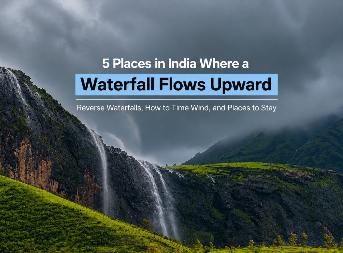
The best-known reverse waterfalls in India are all in Maharashtra’s Western Ghats — Naneghat in Junnar, Sinhagad Fort near Pune, Samrad in Sandhan Valley, Anjaneri near Nashik and Kavalshet Point in Amboli. The water never actually climbs. Strong southwest monsoon winds hit an exposed cliff face, shatter the falling stream into spray and push it back upward, which is why the effect only shows up when heavy rain and hard wind arrive together, usually between mid-July and September.
In this Blog
Quick Info
| Best time to visit | Mid-July to late September (peak: late July–August) |
| What you need | Heavy recent rain plus sustained upslope wind |
| Nearest airports | Pune (PNQ) for Naneghat/Sinhagad, Nashik (ISK) for Anjaneri, Goa (GOI) for Amboli |
| Nearest railheads | Kalyan for Naneghat, Pune Jn for Sinhagad, Kasara for Samrad, Nashik Road for Anjaneri, Sawantwadi Road for Amboli |
| Ideal duration | 1 day for Sinhagad; 1–2 days for Naneghat; 2 days for Samrad or Amboli |
| Budget (per person) | ₹800–₹2,500 self-driven day trip; ₹1,500–₹3,000 for a guided monsoon trek |
| Sighting reliability | Weather-dependent. No location guarantees it on any given day. |
A quick note before you book anything: every confirmed reverse waterfall in this guide sits in Maharashtra. Travel listicles often stretch the label to “India,” and while wind-blown cascades certainly occur elsewhere in the Ghats, Maharashtra is where the sightings are documented, photographed and repeatable. We would rather tell you that upfront than send you to Meghalaya looking for Naneghat.
Where Can You See Reverse Waterfalls in India?
Five places account for almost every credible sighting reported in the country. Here they are, ranked by how easy they are to reach and how consistently the effect gets reported.
| Place | District | Best window | Access | Sighting reliability |
|---|---|---|---|---|
| Naneghat | Junnar, Pune | Mid-July–late Aug | Drive to top or 3–4 hr trek | Documented — strongest and most photographed |
| Sinhagad Fort | Pune | Peak monsoon, windy days | Drive or 1–2 hr climb | Reported — seasonal, section-specific |
| Samrad / Sandhan Valley | Ahmednagar | July–Sept | 4–5 hr drive + short walk | Reported — viewpoint only in monsoon |
| Anjaneri–Tahuli | Nashik | July–Sept | 2–3 hr trek from base | Reported — along the upper trail |
| Kavalshet Point | Sindhudurg | June–Sept | Drive to viewpoint | Reported — cluster of small cascades |
Naneghat is the one to pick if you only have a single weekend and want the best odds. Sinhagad is the one to pick if you want a low-effort day out from Pune and will treat a reverse waterfall as a bonus rather than the point of the trip.
Why Does Water Flow Upward? The Actual Physics
Gravity is not taking a monsoon holiday. The water in a reverse waterfall is falling the entire time.
What changes is what happens to it on the way down. At an exposed cliff edge or a mountain pass, monsoon wind gets funnelled and forced upward as it hits the rock wall. When that rising air column meets a thin stream of falling water, it breaks the stream into droplets and mist — and droplets weigh almost nothing. The upward push on that spray briefly exceeds the downward pull on it, so the plume lifts, curls back over the cliff lip and appears to pour into the sky.
Three conditions have to line up:
- Enough water. A trickle disintegrates into nothing. A torrent is too heavy to lift.
- Enough wind, from the right direction. Wind blowing across the cliff scatters the fall sideways. Wind blowing up the cliff reverses it.
- The right cliff shape. Narrow gorges, saddle passes and sheer vertical faces accelerate wind. Naneghat works precisely because it is a natural funnel between the Konkan coast and the Deccan Plateau.
Is a reverse waterfall real? Yes — as a wind-and-water phenomenon, and one recorded in Australia, Japan, the UK and the US as well as India. No — as water permanently running uphill. If a page tells you underground springs or “gravity being defeated” are involved, close the tab. A commonly cited figure puts the required wind at roughly 75 km/h, but treat that as indicative rather than a forecast threshold you can plan around; local gusting at a cliff lip behaves very differently from a district-level wind reading.
The honest phrasing is wind-reversed waterfall. It is no less spectacular for being explicable.
How to Time the Wind (The Part Most Guides Skip)
Almost every article on reverse waterfalls in India tells you to go in July. Very few tell you what to do when you get there and nothing is happening. This section is that missing piece.
Read the forecast for two variables, not one
Rain alone gives you a normal waterfall. Wind alone gives you a dry, windy cliff. You need both in the same 24-hour window. Before travelling, check the India Meteorological Department forecast for your district and look for sustained wind speed and direction, not just the rainfall figure. A southwesterly wind hitting a west-facing escarpment is what you want.
The on-the-ground test
Once you are at the viewpoint, spend ten minutes reading the site before you write the day off:
- Watch the grass and the mist, not the water. If the mist at the cliff edge is drifting upward, conditions are live. If it is moving sideways or settling, they are not.
- Check wind direction against the cliff face. Stand with your back to the drop. If wind is hitting you in the face and rising, you are in business.
- Wait out the lull. The effect is gusty and intermittent. A plume may run for forty seconds, die completely for ten minutes, then return. Travellers who leave after five minutes routinely miss it.
- Go after a rain burst, not during one. Visibility during a heavy squall is near zero. The window right as a cell passes — rain easing, wind still hammering — is often the best of the day.
What we would not tell you
We are not going to claim mornings are universally better. At Naneghat, wind tends to build through the day as the plateau heats, but that pattern does not transfer neatly to Amboli or Sinhagad. Ask the local guides and tea-stall owners at the base what time the wind picked up over the last few days. They watch it daily and they are more reliable than any generic rule.
Important Note: never move closer to an edge to improve a photo. Wet basalt in monsoon is genuinely treacherous, and the same gusts lifting the water can unbalance a person.
1. Naneghat Reverse Waterfall: The Most Reliable Sighting in India

Naneghat is a 750-metre-high mountain pass in Junnar taluka, Pune district, roughly 120 km north of Pune and 165 km east of Mumbai. It is the single most photographed reverse waterfall in the country, and the geography explains why: the pass is a natural wind tunnel cut between the Konkan coast and the Deccan Plateau, so monsoon wind arrives compressed and rising.
The site is also a serious piece of history. Around 2,200 years ago it was a toll gate on the trade route linking the ports of Sopara and Kalyan to Nasik and Paithan — nane means coin, ghat means pass. The cave at the top carries Brahmi-script inscriptions commissioned by the Satavahana queen Nayanika, containing some of the oldest known numeral symbols in the world. Jivdhan Fort sits within striking distance for anyone with an extra half-day.
| Entry fee | Generally no official entry ticket reported. Parking at the base village, transport or trek-operator fee |
| Timings | Open access; attempt only in daylight, ideally 8 AM–5 PM |
| Best time | Mid-July to late August; September still viable in a strong rainfall year |
| How to reach | Trek route: base village Vaishakhare, ~15 km from Junnar, 3–4 hours up a moderate stone-stepped trail. Drive route: approach from the Junnar/Ghatghar side and park near the top for a short walk. Nearest railhead Kalyan; nearest airport Pune (PNQ) |
| Time required | 6–8 hours from base if trekking; 2–3 hours at the top if driving |
| Ideal for | Fit trekkers, history enthusiasts, photographers. Not for young children on the trek route. |
| Pro tip | Drive up from the Junnar side if you are travelling with family — you get the same viewpoint without the climb. Competitor pages publish wildly conflicting trek distances, so confirm the route with your operator or at the base rather than trusting a number online. |
Weekend crowds in August are heavy enough to cause traffic jams on the ghat road. Go on a weekday if you possibly can.
2. Sinhagad Reverse Waterfall: Can You Actually See It Near Pune?

Short answer: sometimes, in specific spots, on genuinely windy days. Sinhagad Fort deserves a clear label — reported seasonal sighting, not a guaranteed permanent attraction.
Sinhagad sits about 37.7 km southwest of Pune city, roughly an hour by road, on the Bhuleshwar range. In monsoon the fort walls run with dozens of ordinary cascades, and this is where confusion creeps in: a normal waterfall seen through mist is not a reverse waterfall. The genuine effect gets reported at the exposed western ramparts where wind funnels straight up the scarp, and only when gusts are strong. Ask at the base or check recent visitor posts before you build a trip around it.
| Entry fee | Vehicle/parking charges commonly reported at about ₹50 for a two-wheeler and ₹100 for a car; rates may vary |
| Timings | 5:00 AM – 6:00 PM, daily |
| Best time | Peak monsoon, July–August, on days with strong sustained wind |
| How to reach | Drive via Khadakwasla and Donje on the Sinhagad Road; PMPML buses run to the base at Atkarwadi. Nearest railway station Pune Junction (~40 km); nearest airport Pune (PNQ, ~50 km) |
| Time required | Half a day, 4–5 hours including the climb |
| Ideal for | Pune families, first-time trekkers, casual day-trippers |
| Pro tip | The fort’s famous pithla-bhakri, hot bhajis and matka dahi stalls are the real draw for most Punekars. Treat the reverse waterfall as a possible bonus and the day never disappoints. Note that stalls thin out sharply in severe weather. |
Two-wheelers on the wet ghat road are the single biggest source of accidents here in monsoon. Take a car.
3. Samrad and Sandhan Valley: The High-Adventure View

Samrad is a small village in Ahmednagar district, in the Bhandardara region, and it functions as the gateway to Sandhan Valley — a 200-foot-deep rock canyon known to trekkers as the Valley of Shadows. Wind screaming through that narrow gorge produces some of the most dramatic wind-lifted spray in the state.
Draw a firm line between two different trips. Visiting the reverse waterfall viewpoint near Samrad is a manageable short walk. Completing the Sandhan Valley trek involves rappelling, chest-deep water pools and technical descents, and it is broadly unsafe during heavy monsoon rainfall because the canyon floor floods fast. Reputable operators do not run the full descent in peak monsoon, and you should not attempt it independently.
| Entry fee | Approximately ₹30 per person. |
| Timings | Daylight only. Do not enter the valley area after 4 PM in monsoon. |
| Best time | July to September for the reverse waterfall viewpoint |
| How to reach | ~180–200 km from Mumbai, 4–5 hours by road. By rail: Mumbai to Kasara (Samrad is ~80 km onward) or Dadar to Igatpuri (~70 km onward), then shared jeep via Ghoti and Bhandardara |
| Time required | Full day from Mumbai or Pune; overnight stay strongly recommended |
| Ideal for | Experienced trekkers and photographers. Not suitable for families with young children. |
| Pro tip | Mobile connectivity around Samrad is patchy to non-existent. Download offline maps, share your route with someone at home, and hire a local guide from the village rather than arriving unaccompanied. |
4. Anjaneri Reverse Waterfall Near Nashik
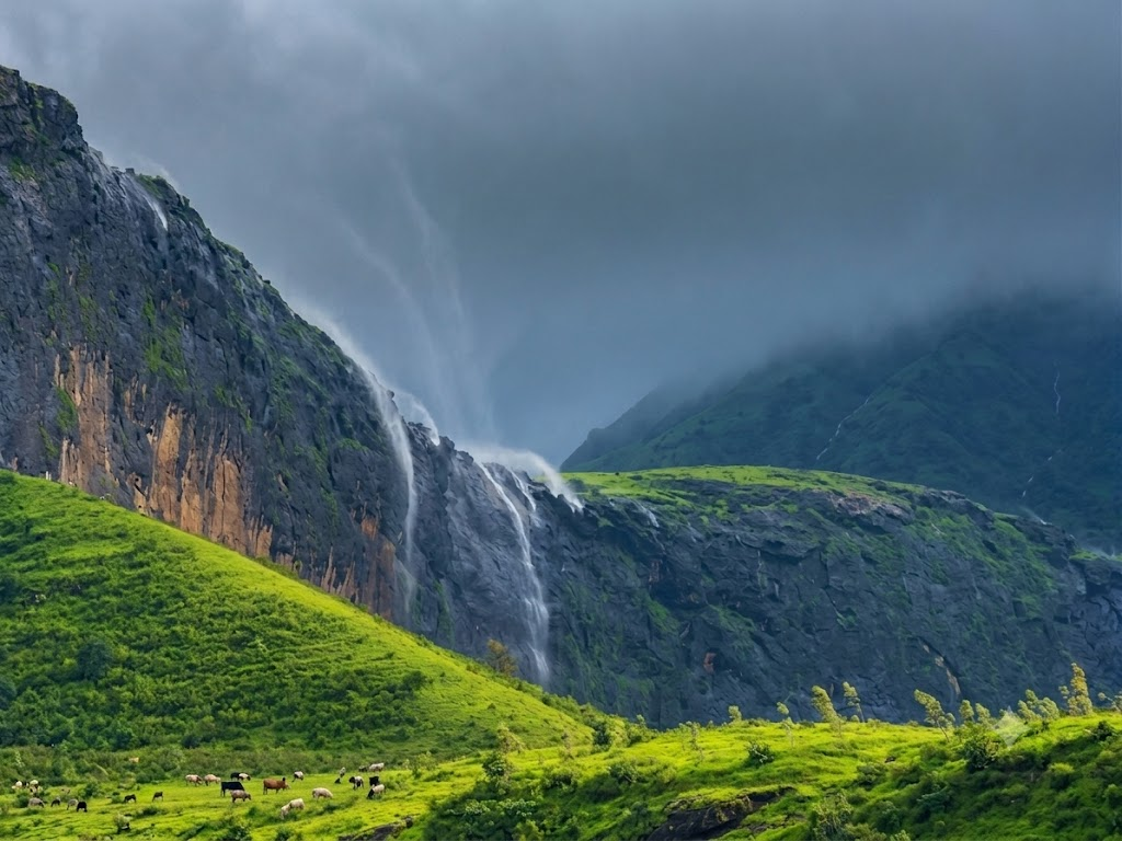
Anjaneri is a plateau-topped hill near Trimbakeshwar, roughly 20 km from Nashik city, and it carries real religious weight — it is widely believed to be the birthplace of Lord Hanuman, and the hill is named for his mother, Anjani. During strong monsoon spells, the streams spilling off the upper plateau along the Anjaneri–Tahuli route get caught and thrown back by wind rising off the valley.
The area sits inside a protected forest zone, which means the visit is more regulated than the others on this list — and that regulation is a good thing. You register at the Forest Department checkpost at the base before you climb.
| Entry fee | ₹20–₹50, depending on the forest/checkpost arrangement. Parking, guide or local management charges |
| Timings | Approximately 6:00 AM – 6:00 PM for trekking |
| Best time | July to September, on days following heavy rain |
| How to reach | Anjaneri village lies on the Nashik–Trimbakeshwar road, ~20 km from Nashik. Regular ST buses run from Nashik’s Old CBS. Nearest railway station Nashik Road (~28 km); nearest airport Nashik (ISK) |
| Time required | 5–6 hours; the trek is 2–3 hours one way to the top |
| Ideal for | Trekkers, pilgrims combining the trip with Trimbakeshwar, nature photographers |
| Pro tip | Register at the checkpost even if nobody stops you — the log is what search-and-rescue uses if weather closes in. Pair the trek with Trimbakeshwar Jyotirlinga, 7 km away, for a genuinely full day. |
5. Kavalshet Point, Amboli: A Chain of Wind-Blown Cascades

Kavalshet Point sits near Amboli in Sindhudurg district, at the southern end of Maharashtra’s Ghats close to the Goa border. It is different in character from the other four: instead of one dramatic fall, you get a cluster of small cascades along the escarpment, several of which get blown vertical at once during a strong gust. Amboli is one of the wettest places in Maharashtra, so water volume is rarely the limiting factor here — visibility is.
This is a viewpoint visit, not a trek, which makes it the most accessible entry on the list for older travellers and families. It also pairs naturally with a Goa trip.
| Entry fee | Approximately ₹10 per person. Parking and separate charges at nearby Amboli waterfalls. |
| Timings | Daylight hours; avoid after dusk, the approach road is unlit |
| Best time | June to September; late August for the best combination of volume and wind |
| How to reach | 11 km from Amboli bus stand, plus a ~3 km detour off the highway. Amboli is ~31 km from Sawantwadi via the Amboli Ghat road. Nearest railway station Sawantwadi Road; nearest airport Goa (GOI, ~90 km) |
| Time required | 1–2 hours at the point; a full day to cover Amboli properly |
| Ideal for | Families, couples, road-trippers on the Mumbai–Goa route |
| Pro tip | Fog can reduce visibility to a few metres within minutes on the Amboli Ghat. Drive with headlights and hazards on, and build slack into your schedule. Combine with Amboli Falls, Shirgaonkar Point and the Hiranyakeshi temple. |
Distances and Route Planning
The five sites do not form a neat circuit — Kavalshet is roughly 500 km south of the northern cluster. Plan by origin city instead.
- From Mumbai: Naneghat (~165 km, 3.5 hrs) or Samrad (~200 km, 4.5 hrs). Both are doable as long day trips, better as overnighters.
- From Pune: Sinhagad (~38 km, 1 hr) and Naneghat (~120 km, 3 hrs). These two combine well over a weekend, though they sit about 150 km apart.
- From Nashik: Anjaneri (~20 km, 45 mins) is a half-day. Samrad is ~90 km further southwest, making a Nashik–Anjaneri–Bhandardara–Samrad loop the strongest two-day monsoon route in the state.
- From Goa or the Konkan coast: Kavalshet Point via Sawantwadi is the only realistic option, and a good one.
Weekend itineraries
One day from Pune: Leave by 6:30 AM for Sinhagad, climb before the crowd, eat bhakri at the top, drop down by 1 PM and spend the afternoon at Khadakwasla. Low effort, high reward.
Two days from Mumbai (best odds): Day 1 — drive to Junnar, stay overnight nearby, visit the Lenyadri and Shivneri sites in the afternoon. Day 2 — reach Naneghat by 9 AM, give the viewpoint three full hours to let the wind cycle through, return via Malshej Ghat.
Two days from Nashik: Day 1 — Anjaneri trek in the morning, Trimbakeshwar in the afternoon. Day 2 — drive to Bhandardara, on to Samrad for the viewpoint, back by evening.
Where to Stay
The practical problem with monsoon-chasing is that you cannot schedule wind. Sighting odds improve dramatically when you have somewhere to sleep within an hour of the viewpoint, because it lets you go back the next morning if day one is a washout. That is the real argument for basing yourself near the Ghats rather than driving out and back in one push.
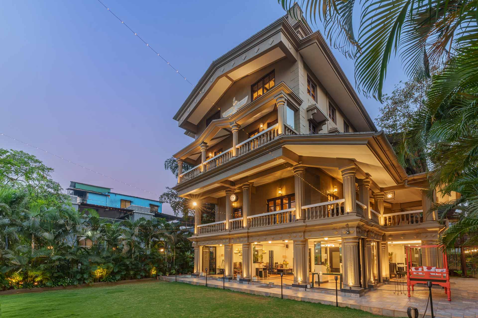
For the northern cluster — Naneghat, Samrad and Anjaneri — Igatpuri and Nashik make the most sense as a base. Villa Stonera, a 5-BHK in Igatpuri with a private pool, works well for a group splitting the drive to Samrad. For anyone approaching Naneghat or Sinhagad from the Mumbai–Pune corridor, our monsoon villas across Lonavala, Karjat and Mahabaleshwar are all within a 1.5 to 5.5 hour drive, and La Palm in Lonavala — eight bedrooms across three acres — suits larger groups travelling together. If your plans are still loose, the pool villas in Lonavala and Karjat collection is a good starting shortlist.
Book early for August weekends. Villa inventory across the Western Ghats tightens badly from mid-July.


Monsoon Safety: Read This Before You Go
Reverse waterfall season and landslide season are the same season. Every year the Ghats produce avoidable casualties.
- Never enter a gorge or valley floor during active heavy rain. Flash flooding in Sandhan Valley develops in minutes.
- Do not stand on wet rock near an edge. Basalt with algae growth is close to frictionless.
- Skip the selfie in the waterfall. Local authorities close specific falls in Lonavala and Amboli every monsoon after exactly this.
- Check for landslide advisories on the Malshej, Amboli and Sinhagad ghat roads before you drive.
- Carry grip-soled shoes, a rain cover for your bag rather than an umbrella, a power bank, cash for stalls and checkposts, and a paper note of emergency numbers.
- Turn back if visibility drops below about 20 metres. The waterfall will still be there next weekend.
FAQ
The five documented locations are Naneghat in Junnar, Sinhagad Fort near Pune, Samrad in Sandhan Valley, Anjaneri near Nashik and Kavalshet Point in Amboli — all in Maharashtra’s Western Ghats. Naneghat is the most reliable and the most photographed.
Strong monsoon wind funnelled up a cliff face breaks a falling stream into fine spray and pushes that spray upward faster than gravity pulls it down. The water is still falling; the visible mist is being lifted. It is an aerodynamic effect, not a suspension of gravity.
Naneghat, about 165 km east of Mumbai and reachable in roughly 3.5 hours. Samrad in Sandhan Valley is the alternative at around 200 km, but it demands more time and more caution.
Late July and August, when heavy rainfall and strong southwest winds overlap most consistently. September works in a high-rainfall year. June is usually too early — the streams have not built up volume yet.
It varies day to day and even hour to hour, because it depends on live wind conditions. Check the IMD forecast for Pune district for rain plus sustained wind, and call a Junnar-based operator the morning you plan to travel.
Yes — choose Kavalshet Point in Amboli or the drive-up approach to Naneghat from the Junnar side, both of which avoid a climb. Avoid Sandhan Valley and the full Anjaneri trek entirely.
Only with real caution. Trails turn slippery, visibility collapses, and landslides and flash floods are genuine risks across the Ghats in July and August. Check local conditions the same morning, and never enter a valley floor during active rainfall.
Yes. The same wind-driven effect has been recorded in Australia, Japan, the United Kingdom and the United States wherever tall, exposed cliffs meet sustained high winds.
Conclusion
The Short Version
Reverse waterfalls in India are real, they are concentrated in Maharashtra, and they reward patience far more than they reward planning. Pick Naneghat for the best odds, Sinhagad for the easiest day out, and give any viewpoint a genuine hour before deciding the wind is not cooperating.
If you would rather wake up inside the Ghats than drive through them at 5 AM, browse our monsoon villa collection and pick a base within an hour of your viewpoint. It doubles your chances, because it gives you a second morning.