
India Monsoon Map 2026: Where It’s Raining & Where It’s Dry
Last updated: June 2026
TL;DR: India’s monsoon doesn’t fall evenly — and once you understand the map, you can always find good weather. The Western Ghats, Konkan coast, Mumbai, sub-Himalayan belt and the Northeast get the heaviest rain; the Himalayan rain-shadow (Ladakh, Spiti, upper Kinnaur) stays dry; Rajasthan, the Deccan interior and the Kashmir Valley see lighter rain; and the southeast coast (Tamil Nadu, Chennai) is relatively dry in the southwest monsoon because its rains come later, in October–December. For 2026, the IMD forecasts a slightly below-normal monsoon (around 90% of the long-period average). Use the regional map below to decide whether to chase the rain or escape it.
In this Blog
India’s monsoon at a glance (June–September)
| Zone | Monsoon rainfall | Go here to… |
|---|---|---|
| Western Ghats, Konkan, Mumbai | Very heavy | See the monsoon at full power |
| Northeast (Meghalaya, Assam) | Heaviest in India | Experience record rainfall & waterfalls |
| Himalayan rain-shadow (Ladakh, Spiti) | Almost none | Escape the rain entirely |
| Rajasthan, Deccan interior, Kashmir | Light–moderate | Enjoy gentle, pleasant rain |
| Southeast coast (TN/Chennai) | Light (rains come Oct–Dec) | Beat the monsoon on the coast |
How the Indian monsoon works (the map explained)
The southwest monsoon sweeps into India from two arms each year, usually from early June: the Arabian Sea branch, which hits the west coast and the Western Ghats first, and the Bay of Bengal branch, which curves up the east and into the Northeast and the Indo-Gangetic plains. By mid-July the rains cover the whole country, before retreating from September.
That geography is why rainfall is so uneven. When moist sea winds slam into a mountain range, they dump their water on the windward side and arrive dry on the other — so the west-facing Western Ghats are drenched while the Deccan plateau behind them stays drier, and the Himalayan ranges wring out the monsoon before it can reach Ladakh and Spiti, leaving those high deserts almost rain-free. Understanding this “rain-shadow” effect is the key to the whole map: for every region being soaked, there’s another, often nearby, staying dry.
For 2026, the India Meteorological Department forecasts an overall below-normal monsoon — about 90% of the long-period average — with a few pockets of above-normal rain (parts of Lahaul-Spiti and northern Chamba) and a broadly normal-to-above South Peninsula. A slightly weaker monsoon generally means fewer prolonged closures, but the regional pattern below holds every year. For live conditions, see our pre-monsoon rain tracker.
Where it rains heavily: the wet zones
The Western Ghats & Konkan coast
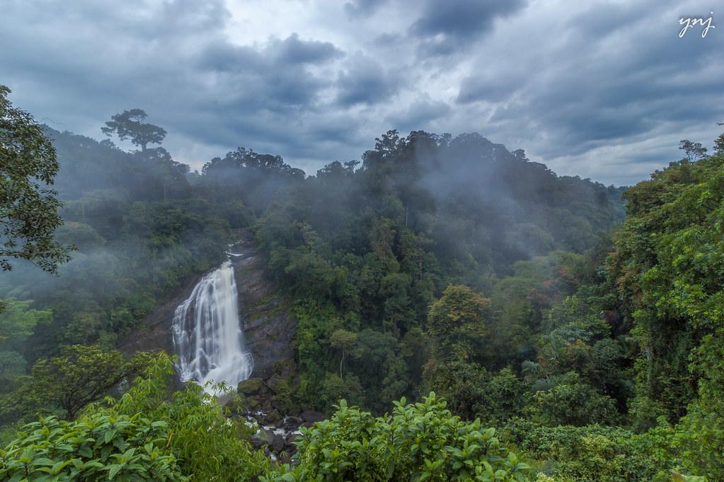
The west-facing Ghats — from Maharashtra’s Sahyadris through coastal Karnataka to Kerala — catch the Arabian Sea branch head-on and are among the wettest places in India. Hill stations like Lonavala, Mahabaleshwar, Agumbe and Munnar, and the Konkan coast, turn spectacularly green, with waterfalls at full roar. This is where to go to experience the monsoon, not avoid it.
– Expect: heavy, frequent rain; lush scenery; landslide caution on ghat roads.
Mumbai & the west coast
Mumbai’s monsoon is legendary — intense, dramatic downpours from June to September. The city and the Konkan coast south of it are firmly in the wet zone, beautiful but soggy.
– Expect: heavy city rain; occasional waterlogging; a moody, cinematic coast.
The Northeast (Meghalaya, Assam)
Meghalaya’s Cherrapunji and Mawsynram are the wettest places on Earth, and the Northeast as a whole receives India’s heaviest monsoon. The waterfalls and living-root bridges are unforgettable — but Assam’s Brahmaputra plains also flood, closing parks like Kaziranga.
– Expect: record-breaking rain; spectacular waterfalls; some flooding in the plains.
The sub-Himalayan belt (Uttarakhand, Himachal outer hills, Darjeeling)
The outer Himalayan hills — Mussoorie, Nainital, Shimla, Manali, Darjeeling — get heavy monsoon rain and the country’s highest landslide risk on hill roads. Beautiful and green, but they need the most caution.
– Expect: heavy rain; landslide and road-closure risk; travel by daylight.
Where it stays dry: the rain-shadow escapes
Ladakh
Beyond the Great Himalayan range, Ladakh is a high-altitude desert that the monsoon barely reaches. While the rest of India pours, Leh stays dry and sunny from June to September — the single best place in India to escape the rain.
– Expect: clear, dry days; cold nights; peak travel season.
Spiti Valley & upper Kinnaur (Himachal)
On the dry side of the range, Spiti gets only a sliver of monsoon rain (around 15 mm in July–August) and stays starkly beautiful and accessible — reachable via the year-round Atal Tunnel from Manali.
– Expect: dry, high-desert weather; some landslide risk only on the approach roads.
These rain-shadow zones are the answer whenever someone says they “can’t travel in the monsoon” — they absolutely can, just to the right map coordinates. For more, see best places to visit in India without rain in July & August.
Where the rain is light: the gentle zones
Rajasthan & the desert west
The monsoon arrives lighter and later in Rajasthan, especially the western desert (Jaisalmer, Bikaner), which stays largely dry. The Aravalli belt and southeast (Udaipur, Mount Abu) get pleasant, lake-filling showers without the deluge of the Ghats.
– Expect: light, welcome rain; green lakes; comfortable temperatures.
The Deccan interior
Behind the Western Ghats, the Deccan plateau — interior Karnataka, Telangana, parts of Maharashtra — sits in a partial rain-shadow and sees moderate rather than heavy rain. Cities like Hyderabad and Bengaluru get pleasant monsoon showers.
– Expect: moderate, manageable rain; green but rarely washed-out.
The Kashmir Valley
Ringed by mountains, the Kashmir Valley sees relatively little southwest-monsoon rain and stays pleasant and green through August — a lovely, under-the-radar monsoon choice.
– Expect: mild, mostly dry weather; lush valleys; smaller crowds than summer.
The exception: where the rain comes later
The southeast coast (Tamil Nadu, Chennai, Puducherry)
Here’s the map’s biggest surprise. The southwest monsoon largely bypasses India’s southeast coast, which sheds the Ghats’ moisture before reaching it. Chennai and coastal Tamil Nadu get most of their rain from the northeast (retreating) monsoon in October–December instead. So June–September is relatively dry (if hot and humid) on this coast — good for beaches, temples and heritage. See our Chennai weather guide.
– Expect: hot, humid, only light showers; heavy rain later in the year.
The monsoon, month by month
The map shifts through the season, so timing matters as much as place:
- June: The southwest monsoon bursts over Kerala (around the first week) and races up the west coast — the Western Ghats, Konkan and Mumbai get their first heavy rain, while the rest of the country waits. A good time for the early-monsoon green of the south and west.
- July: The monsoon covers the whole country. This is peak intensity in the Ghats and the sub-Himalaya, peak season in dry Ladakh and Spiti, and the month the Valley of Flowers blooms. Rain is most reliable — and heaviest — now.
- August: The Northeast and Ghats stay drenched, the festivals arrive (Onam, Raksha Bandhan, Independence Day), and the rain remains strong. The Kashmir Valley and Rajasthan stay pleasant.
- September: The monsoon begins to withdraw from the northwest. Skies clear, roads dry out and the hills are at their lush, post-rain best — for many travellers the sweet spot, combining greenery with safer travel.
If you have a choice, September is the gentlest month to visit the wetter zones, while July–August is best for the rain-shadow north and for experiencing the monsoon at full power.
How to check the monsoon forecast and maps
Reading the real-time map is easier than ever. The India Meteorological Department (mausam.imd.gov.in) publishes the daily monsoon advance map, rainfall departures and colour-coded district warnings (green, yellow, orange, red) — the single most reliable source before any trip. Weather apps and the IMD’s own alerts give short-range forecasts, while state disaster-management authorities (SDMAs) post road and landslide advisories for the hill states. As a rule of thumb, treat orange and red alerts as “postpone hill and waterfall plans,” check conditions 24–48 hours before you travel and again on the morning you set off, and follow local administration over a fixed itinerary. The map you plan with in advance and the live map on the day should both inform your trip.
Monsoon travel safety, by zone
Each zone carries its own risk profile, and matching your caution to the map keeps you safe:
- Wet hill zones (Western Ghats, sub-Himalaya): landslides and road closures are the main hazard. Travel by daylight, keep buffer days, and never drive through flooded stretches or stop under unstable slopes.
- Waterfalls and rivers everywhere: the biggest cause of monsoon tragedies. View falls from official decks only, never enter water in spate, and obey prohibitory orders at popular spots.
- The coast (Mumbai, Konkan, Goa): rough seas — swim only on flagged beaches and heed lifeguard red flags.
- Dry rain-shadow zones (Ladakh, Spiti): the risk isn’t rain but altitude — acclimatise slowly and stay hydrated.
- Everywhere: carry rain gear and a dry bag, keep electronics protected, and build flexibility into the plan.
Why travel during the monsoon at all?
If the map makes the monsoon sound like an obstacle course, the rewards more than balance it. This is when India is at its greenest and most photogenic — terraced hills glowing, rivers and waterfalls full, dust washed from the air. It’s also the value season: tariffs drop, popular destinations shed their crowds, and you’ll often have a viewpoint or an estate almost to yourself. The rains bring their own culture, too — Onam in Kerala, Teej in Rajasthan, monsoon festivals across the Northeast — and the season is traditionally the best time for Ayurvedic treatments in Kerala. For travellers willing to read the map and stay flexible, the monsoon offers a richer, quieter, more affordable India than the peak-season months ever can.
How to use the monsoon map to plan your trip
Once you can read the map, planning gets easy:
- Want to experience the monsoon? Head to the Western Ghats (Lonavala, Coorg, Munnar), the Konkan coast, or the Northeast for rain at its most dramatic.
- Want to escape the rain entirely? Go to the rain-shadow north — Ladakh or Spiti — or the southeast coast (Tamil Nadu).
- Want gentle rain and pleasant weather? Choose Rajasthan, the Kashmir Valley or the Deccan interior.
- Travelling to the wet or sub-Himalayan zones? Build in flexibility, travel hill roads by day, and check the forecast and advisories before you go.
The golden rule: there is no bad month to travel in India — only the wrong place for the weather you want. Match your destination to the map and the monsoon becomes an asset, not an obstacle. For a curated list, see our hub, where to travel in India in monsoon, and our safe places to visit in monsoon guide.
India’s monsoon in numbers
A few figures bring the map to life. The all-India seasonal average — the “long-period average” the IMD measures against — is roughly 87 cm of rain across June to September, and the southwest monsoon delivers about 70–75% of the country’s entire annual rainfall in those four months. The extremes are staggering: Mawsynram and Cherrapunji in Meghalaya receive on the order of 11,000 mm a year, among the highest on Earth, while Leh in Ladakh gets barely 100 mm annually — a hundredfold difference within one country. The monsoon isn’t just a travel consideration, either; it waters the kharif crops that feed much of India, which is why its strength is national news each year. For 2026, a forecast of around 90% of the long-period average puts it in the “below normal” band — enough to green the hills and fill the rivers, but a little gentler than a heavy year.
A monsoon-destination cheat sheet
To turn the map into a quick decision:
- I want full-on monsoon drama: Cherrapunji, Agumbe, the Konkan coast or Lonavala.
- I want zero rain and blue skies: Ladakh or Spiti.
- I want green hills but not a deluge: Coorg, Munnar or Kodaikanal.
- I want light rain and heritage: Udaipur, Mount Abu or the Kashmir Valley.
- I want a beach-and-city break that mostly dodges the rain: Chennai and the Tamil Nadu coast.
- I want waterfalls at their best: Jog (Karnataka), the Cheeyappara–Valara stretch (Kerala), or Maharashtra’s Sahyadri falls.
- I want a trek: the Valley of Flowers (July–mid-August) or the rain-shadow Spiti trails.
Pin down what you want from the weather, and the map points you straight to it.
Where to stay across the monsoon map
- In the wet Sahyadris: The Boulevard Villa, Lonavala — valley views and covered decks for the full monsoon experience.
- In light-rain Rajasthan: The Wild Orchid, Udaipur — the City of Lakes at its green, brimming best.
- In green Coorg: Coffee & Mist — an estate stay made for rain-walks.
Planning a monsoon trip? Whatever weather you’re after, StayVista has homes across the map — from the rain-soaked Ghats to light-rain Rajasthan. (CTA 1 of 3.)
FAQ: India’s monsoon map
Which parts of India get the most rain in the monsoon?
The Western Ghats, the Konkan coast, Mumbai, the sub-Himalayan hills and the Northeast (Meghalaya and Assam) receive the heaviest southwest-monsoon rain. Cherrapunji and Mawsynram in Meghalaya are among the wettest places on Earth.
Which places in India stay dry during the monsoon?
The Himalayan rain-shadow regions — Ladakh, Spiti Valley and upper Kinnaur — stay almost rain-free. Rajasthan’s western desert and the Kashmir Valley see only light rain, and the southeast coast (Tamil Nadu) is relatively dry until October.
Why doesn’t it rain much in Chennai during the monsoon?
Chennai is on the southeast coast, which the southwest monsoon largely bypasses after the Western Ghats wring out the moisture. Chennai’s main rains come from the northeast monsoon in October–December instead.
Where can I go in India to escape the monsoon?
Ladakh and Spiti Valley are the best rain-free escapes, both in the Himalayan rain-shadow. The Kashmir Valley and the southeast coast are good lighter-rain alternatives.
What is the monsoon forecast for India in 2026?
The IMD forecasts a below-normal 2026 monsoon, around 90% of the long-period average, with a few above-normal pockets (parts of Lahaul-Spiti and northern Chamba) and a broadly normal South Peninsula.
When does the monsoon cover all of India?
The southwest monsoon usually arrives over Kerala in early June and advances to cover the entire country by mid-July, before beginning to retreat in September.
Conclusion
India’s monsoon is really a map, not a verdict. For every region being drenched, another is dry or merely pleasant — so the season is never a reason to stay home, only a guide to where you should go. Chase the rain in the Western Ghats and the Northeast, escape it in Ladakh and Spiti, or split the difference in Rajasthan and Kashmir. Read the map, pick your weather, and let a comfortable StayVista home be your base wherever on it you land.